


 165 / 280

[
] 165
active fires since the early 1980s, although with limited
capability until the implementation of the GOES-8
Imager in 1994. With the launch of the European
Meteosat-8 Spinning Enhanced Visible and Infrared
Imager (SEVIRI), the Chinese FY-2C stretched Visible
and Infrared Spin Scan Radiometer (S-VISSR), and the
Japanese Advanced Meteorological Imager (JAMI) on
the Multifunctional Transport Satellite (MTSAT-1R),
almost global geostationary fire monitoring is possible.
9
Although these geostationary sensors have a reduced
spatial resolution (4-5 km in the IR) compared to polar
orbiters, they offer enhanced temporal resolution (full
disk every 15 minutes with Meteosat-9), providing valu-
able diurnal information that is complementary to polar
orbiting fire products. Over the past ten years, the use
of geostationary satellite-derived fire products has grown
appreciably with applications in hazards monitoring,
fire weather forecasting, climate change, emissions
monitoring, aerosol and trace gas transport modelling,
air quality and land-use and land-cover change detec-
tion. The user community includes government
agencies, resource and emergency managers, fire
managers, educational institutions and the general
public.
A specific goal of the GOFC-GOLD-Fire programme
is to develop and foster the implementation of a near
real-time operational global geostationary fire monitor-
ing network using current (GOES, MSG, MTSAT, FY-2C)
and future geostationary platforms (Indian INSAT-3D,
Russian GOMS Elektro L MSU-GS, Korean COMS). This
effort also supports GEOSS activities and the GEO 2006
work plan, which calls for the initiation of ‘a globally
coordinated warning system for fire and monitoring for
forest conversion, including the development of
improved information products and risk assessment
models (DI-06-13)’ and the expansion of ‘the use of
meteorological geostationary satellites for the manage-
ment of non-weather related hazards (DI-06-09).’
NPP/NPOESS Visible Infrared Imagery Radiometer Suite (VIIRS) and
sensors on Global Monitoring for Environment and Security (GMES)
Sentinel satellites.
To maximize the societal benefit of these systems to support
natural resource management and decision-making, there needs to
be a continued emphasis on ensuring that the data are converted to
usable information and made available in a timely fashion. This
process is becoming easier with advances in web technology and
improved access to broadband Internet. Recent advances in infor-
mation technology make it easier to integrate remote sensing
products and GIS data within web-based GIS systems to provide
resource managers with information that is timely, accurate, and
delivered in a readily accessible format. Technologies already exist to
create interactive web maps that incorporate data from a wide range
of servers in different locations; a key obstacle to improving these
maps for active fire managers is finding suitable data that are up-to-
date, accurate, readily available and consistent across regions.
An example of web-based fire information systems is the Fire
Information for Resource Management System (FIRMS),
8
developed
at the University of Maryland with funding from NASA. FIRMS uses
data transmitted from the MODIS instrument on board NASA’s Terra
and Aqua satellites. These data are processed to produce images and
text files pertaining to active fire locations. These are ingested into a
geo-database and disseminated to users using web mapping services
(known as Web Fire Mapper), e-mail alert and SMS/Text messages,
and downloadable files that allow users to access the latest fire loca-
tions using GIS software, Google Earth or NASA World Wind. FIRMS
works with regional networks to customize the web mapping services;
in this way users are able to integrate fire information with local
geospatial information (such as park boundaries and roads), enabling
them to place MODIS active fires in their geographic context. FIRMS
currently provides MODIS active fire data to natural resource
managers, scientists and policy makers working in 58 countries.
Geostationary systems
The NOAA series of Geostationary Operational Environmental
Satellites (GOES) have had the necessary spectral bands to monitor
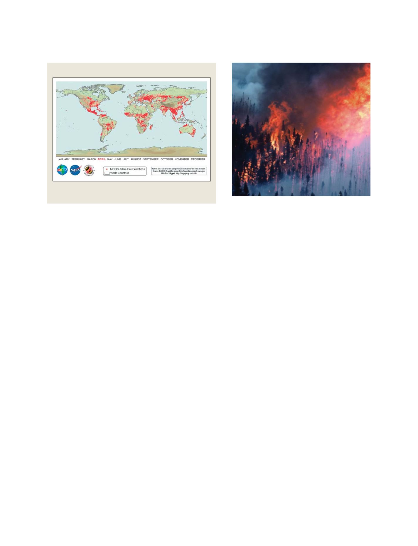
MODIS rapid response fire detections for 2005
Global distribution of MODIS active fire detections for
April 2005 from the FIRMS system
Source: The Fire Information for Resource Management System (FIRMS)
Northern boreal forest fire
Photo: Canadian Forest Service, Natural Resources Canada
S
OCIETAL
B
ENEFIT
A
REAS
– D
ISASTERS