


 170 / 280

[
] 170
Disaster monitoring using ASTER
and PALSAR data
Dr Hiroji Tsu, Managing Director, Earth Remote Sensing Data Analysis Center (ERSDAC), Japan
E
arth observation from space is a powerful tool for detect-
ing and monitoring the effects of natural disasters such
as earthquakes, tsunami, volcanic eruptions, flooding and
landslides, as well as manmade effects, such as pollution and
land subsidence caused by drawing excessive groundwater or
underground mining. As a consequence, information from Earth
observation systems has the potential to greatly assist decision
makers managing the appropriate disaster response.
ERSDAC is responsible for the scheduling, collection, processing,
archiving, distribution and application science of Earth Observation
data, including that from the space-borne Advanced Spaceborne
Thermal Emission and Reflection Radiometer (ASTER) and Phased
Array type L-band Synthetic Aperture Radar (PALSAR) imaging
sensors. Both of these space-borne sensors were funded by the
Ministry of Economy, Trade and Industry (METI) of Japan.
ASTER data applications
The ASTER instrument provides 14 spectral bands in the visible to
thermal infrared spectral regions for a 60 kilometre wide area, at a
pixel spatial resolution of 15-90 m, depending on wave-
length region. ASTER also has a downward and
backward pointing band suitable for generating digital
elevation models.
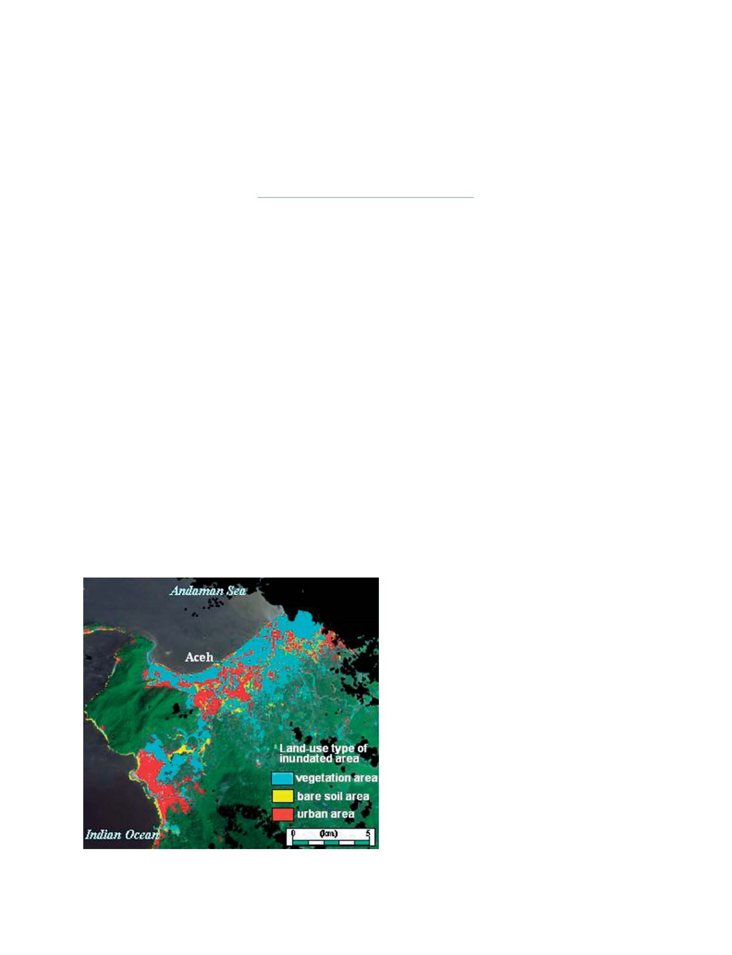
ERSDAC examined the images ASTER collected prior
to and after the devastating magnitude 9.0 earthquake,
which centered in the Indian Ocean, west of Aceh in
west Sumatra on 26 December 2004. ASTER produced
data that showed the land use type prior to the impact
of the Tsunami. Such information is valuable for restora-
tion planning.
The infrared bands of ASTER can provide informa-
tion about surface temperature suitable for applications
like volcano monitoring, especially lava and pyroclastic
flows, as well as forest fires and the thermal discharge
from power plants. In this way the eruption of the
Merapi volcano in the Central Java, 2006 was monitored.
At shorter ASTER wavelength bands (VNIR: Visible and
Near Infrared) clouds of ash and water vapor clearly
were caught, but the related lava and/or pyroclastic flows
were not evident. In contrast, the longer wavelength
ASTER bands (SWIR: Short Wave Infrared) see through
the clouds to detect the high temperatures associated
with the flows/vent.
Analysis of the time series of ASTER images revealed
that the volcanic crater was filled with lava on 14 May
and that the lava overflowed in two directions, namely
to the southwest and south-southeast, on 30 May. On 6
June, the lava changed flow direction again and
proceeded down in a southwest direction, thus extend-
ing its area.
The shape of the land surface is one of the most funda-
mental geophysical measurements of the Earth, and is
dominant controlling factor in virtually all natural
process that occur on the land surface. Topography of
the land surface also significantly influences processes
within the overlaying atmosphere, as well as reflecting
the processes in the underlying lithosphere.
Consequently topographic information is important
across the full spectrum of Earth Sciences.
ASTER has acquired nearly 1.5 million stereoscopic
image pairs since its launch, including an ASTER
derived digital elevation model of the Mount Fuji region.
ERSDAC and NASA are currently collaborating on a
project to use this archive of stereoscopic data to gener-
Tsunami affected area and its land-use type in and around Aceh,
North Sumatra
Photo: METI/NASA retain ownership of ASTER data. Processed by ERSDAC
S
OCIETAL
B
ENEFIT
A
REAS
– D
ISASTERS