


 225 / 280

[
] 225
• How is surface soil moisture dynamics linked with
that in the subsurface profile?
• Are Land Surface Models (LSMs) accurate enough
and unbiased enough to be used in data assimila-
tion?
Enhancing global in situ and satellite soil moisture
observations involves different types of problems. Some
specific considerations for improved in situ observations
include: taking advantage of existing infrastructure;
opportunity-based expansion strategy; striving for
consistency and standardization; linking long records
of points to short records of spatial description; exploit-
ing temporal stability; a single point or even a cluster at
a station will not necessarily provide the data needed
for satellite product validation of data assimilation; and
including but not being limited to five cm measurement
depth to link to satellite observations.
During the last few years, tremendous progress has
been made in understanding the necessity of a global
soil moisture observing system. The contributions of
international organizations such as GEWEX, IWGCO
and GEO, with the support of Space Agencies and with
the efforts of numerous individual scientists, has enabled
this progress in the realization of a global in situ soil
moisture network as part of a global soil moisture
observing system.
this global network of in situ soil moisture measurements and that
the space agencies will commit to the development of a quasi-oper-
ational soil moisture data product.
Coordination of these efforts is done through the International
Soil Moisture Working Group and is based upon the following guide-
lines:
A coordinated plan for soil moisture networks should be devel-
oped at both the national and international levels. A supersite
programme with high density measurements is required to provide
the comprehensive data sets needed for satellite sensor evaluation
and calibration, and to provide a basis for developing soil wetness
algorithms for satellite measurements and the evaluation of climate
model outputs.
Capabilities to measure soil moisture from space have been demon-
strated, but committed missions are needed to perfect these
measurements and to determine the utility of soil moisture measure-
ments derived from space at different spatial and temporal scales.
Vegetation cover can obscure the radiatiances arising from warm wet
soils. Research is needed to find better ways of removing the vege-
tation effect from the signal that is being used to derive soil moisture.
Finally, the relationship between surface soil wetness and deep soil
moisture profiles needs to be quantified or at least understood. The
measurements within the in situ network will need to measure soil
moisture at several depths to establish a soil moisture profile.
In situ networks will occupy a key position in integrated water
cycle understanding and quantitative prediction. Beside their role in
validating satellite retrieval algorithms, data from in situ sensors can
help address the following fundamental science questions about soil
moisture, the key variable state of the land branch of the water cycle:
• What is the soil moisture memory? How does it depend on
climate variability, climate persistence and soil hydraulic prop-
erties? How do vegetation characteristics affect this memory?
• How does soil moisture at the surface and below the surface
respond to precipitation events and restore during drydowns?
• What are the functional relationships between soil moisture and
evaporation? How does it depend on vegetation, soil type and
structure?
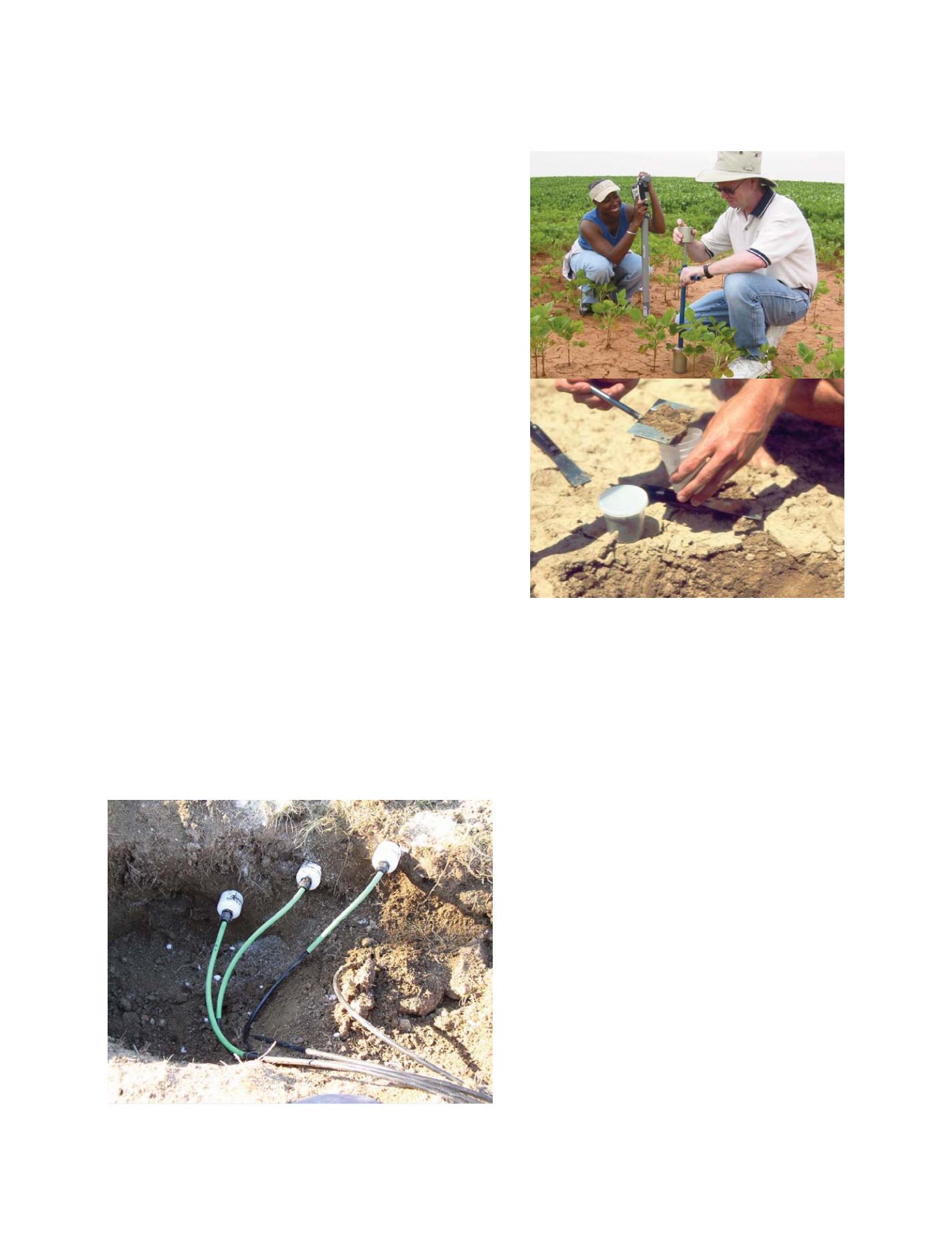
Photo: Tom Jackson & Gary Schaeffer
The pit in which the soil moisture probes have been installed to measure soil
moisture over three different depths
Photo: Tom Jackson & Gary Schaeffer
The measurement of soil moisture using the gravimetric method,
which is considered to be the standard measurement method for
soil moisture
S
OCIETAL
B
ENEFIT
A
REAS
– W
ATER