


 223 / 280

[
] 223
lation systems will make it possible to meet the information needs
of the hydrometeorological and agricultural communities.
Water quality
– The quality of water in lakes, rivers and reser-
voirs is affected by increasing industrialization, including many
areas where environmental standards are neither developed nor
enforced. Water quality monitoring programmes exist in many
developed countries, usually relying on in situ sampling and labo-
ratory analyses. Efforts are underway to assess the potential of
satellites to provide a partial alternative to the monitoring of ambient
water quality.
Evaporation
– Evaporation is not measured directly, with the
exception of surface flux measurements taken at flux towers and
by buoys on the ocean. Remote sensing techniques can be used to
indirectly estimate evapotranspiration (ET) and carbon uptake by
plants from the energy balance equation.
8
As the GEWEX
SEAFLUX project has shown,
9
evaporation over the ocean can be
derived from in situ and satellite measurements.
Groundwater
– While many in situ groundwater measurements
exist, groundwater observations and data processing methods have
not been standardized internationally. Progress is being made in
the estimation of groundwater from time variant
space-based measurements of the gravimetric anom-
alies, such as the National Aeronautics and Space
Administration (NASA) Gravity Recovery and Climate
Experiment (GRACE) mission.
10
Summary and conclusions
There are many applications of Earth observations in
the water sector that bring large benefits to society.
These already aid in a number of societal benefit areas,
but improvements to these observational systems
would greatly enhance many of the benefits.
International programmes such as GEWEX and IGOS-
P have played an important role in structuring our
approach to water cycle measurements. The GEO
initiative has the potential to support the next
quantum advance in water cycle observations if it can
mobilize the resources needed to fully address the gaps
and opportunities present in the water cycle observing
system.
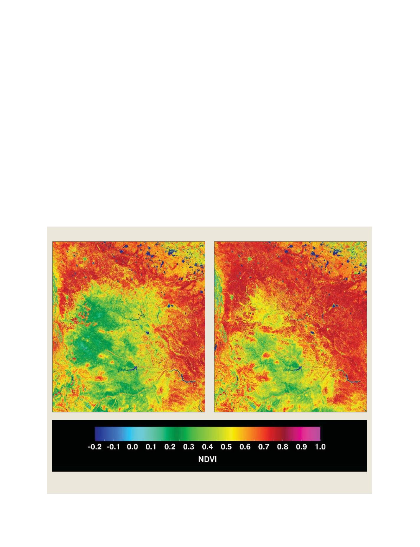
Vegetation indices provide information on water stress and drought severity
Left-hand image: July 10-21, 2001 - A dry year; Right-hand image: July 10-21, 2005 - A wet year
Source: Alexander Trishchenko, Canada Centre for Remote Sensing, Government of Canada
S
OCIETAL
B
ENEFIT
A
REAS
– W
ATER