


 218 / 280

[
] 218
phenomena and characteristics of interest for regional
and local water quality monitoring and management. A
key concern among users is ensuring the continuity of
the data both from satellite systems and in situ networks.
There is also a compelling need for new and improved
observations that can help address water quality needs in
these regions, recognizing that tradeoffs will be necessary
in order to accommodate the diverse and challenging user
requirements.
Calibration and validation requirements
– Calibration
and validation (cal/val) are key components required for
satellite remote sensing of properties that contribute to
or impact water quality. Satellite remote sensing of ocean
colour in particular entails very stringent requirements
on the sensor’s radiometric calibration in the visible spec-
tral region due to the significantly low (<10%)
contribution from the ocean (versus atmosphere). A
robust collaborative validation system for the interna-
tional aquatic science community is crucial. The
validation programme serves functions for product quality
assurance, algorithm performance validation, and the
development and refinement of algorithms (especially for
optically complex waters). This also ensures that satel-
lite-derived products meet scientific requirements for both
research and applications.
Data acquisition and distribution
– The impact of satel-
lite sensors (research or operational) for inland or coastal
water studies is dependent on the ability of users to access
appropriate quality data in a straightforward, timely
fashion. Routine water quality management issues (e.g.
beach closures) frequently require the most rapid access
to data to enable an accurate decision to be made in a
timely manner. Key issues to address include the neces-
sary processing level of the data, its quality, how quickly
it is needed, and in what format and by what means.
Others issues include establishing initial access and
resolving limitations on use or redistribution.
Data processing and product development
– A number
of fundamental issues are related to the use of optical
remote sensing data in coastal and inland waters. These
must be addressed to enable applications to make use of
the full potential of these datasets. In many cases these
issues are common to optical remote sensing over any
water body (including the open ocean), but are often
amplified in the coastal and inland waters by their specific
morphological and dynamic characteristics. These issues
include the need for standardized, community-based
open-source radiative transfer (atmospheric and water)
models, the need for standardized algorithmic methods to
be well documented and user-adaptable, and the need for
interoperable data formats, taking into consideration not
only the preferences/ideals of the remote sensing special-
ist but also those of potential end users.
Developing countries
– Developing countries play an
important role as key shareholders of large tracks of coast-
line, large estuarine areas and vital inland ecosystems.
There is, therefore, a need to address issues and needs for
monitoring and management of inland and near-coastal
water quality, which are particular to developing nations,
biogeochemical and ecological parameters such as chlorophyll
concentrations, turbidity/suspended solids, clarity, macrophyte
surveys, and slick and spill detection, and underlying geophysical
parameters such as surface temperature, winds, currents and waves,
bathymetry and flood area. The broad suite of ocean colour para-
meters (e.g. chlorophyll), as well as temperature, currently
represent primary areas of user interest and also research and devel-
opment activities.
GEO workshop brings experts together
The first GEO Inland and Nearshore Coastal Water Quality Remote
Sensing Workshop was held in Geneva, Switzerland on 27-29 March
2007. This seminal gathering of 55 experts from 26 countries was
hosted by the GEO Secretariat as a part of GEO’s activities on water
resources. The goal was to bring together remote sensing data providers
and expert users to improve their ability and capacity to remotely
assess and monitor inland and nearshore coastal water quality. This
was viewed as a forum for a diverse group, from data providers to end
users, to collaboratively chart a course for the future of this emerging
science.
The final report covered six major issues and aspects addressed in
the workshop. For each major issue, the report identified gaps and
issues, and gave recommendations to data providers and GEO
members and participating organizations on short-term priorities for
improving remote sensing capacity and utilization for water quality
assessment and monitoring. In addition, it formulated short and long-
term strategies to identify, enable and implement enhanced capabilities.
The following briefly summarizes the six major issues.
Satellite sensors
– Underlying efforts to generate products and infor-
mation for managers and decision-makers of nearshore coastal and
inland waters are the data streams generated by a suite or virtual
constellation of international satellite sensors, providing different types
of information at different spatial and temporal resolutions. Users
require timely and accurate data at regular intervals over sustained
periods for their particular region that adequately resolve the processes,
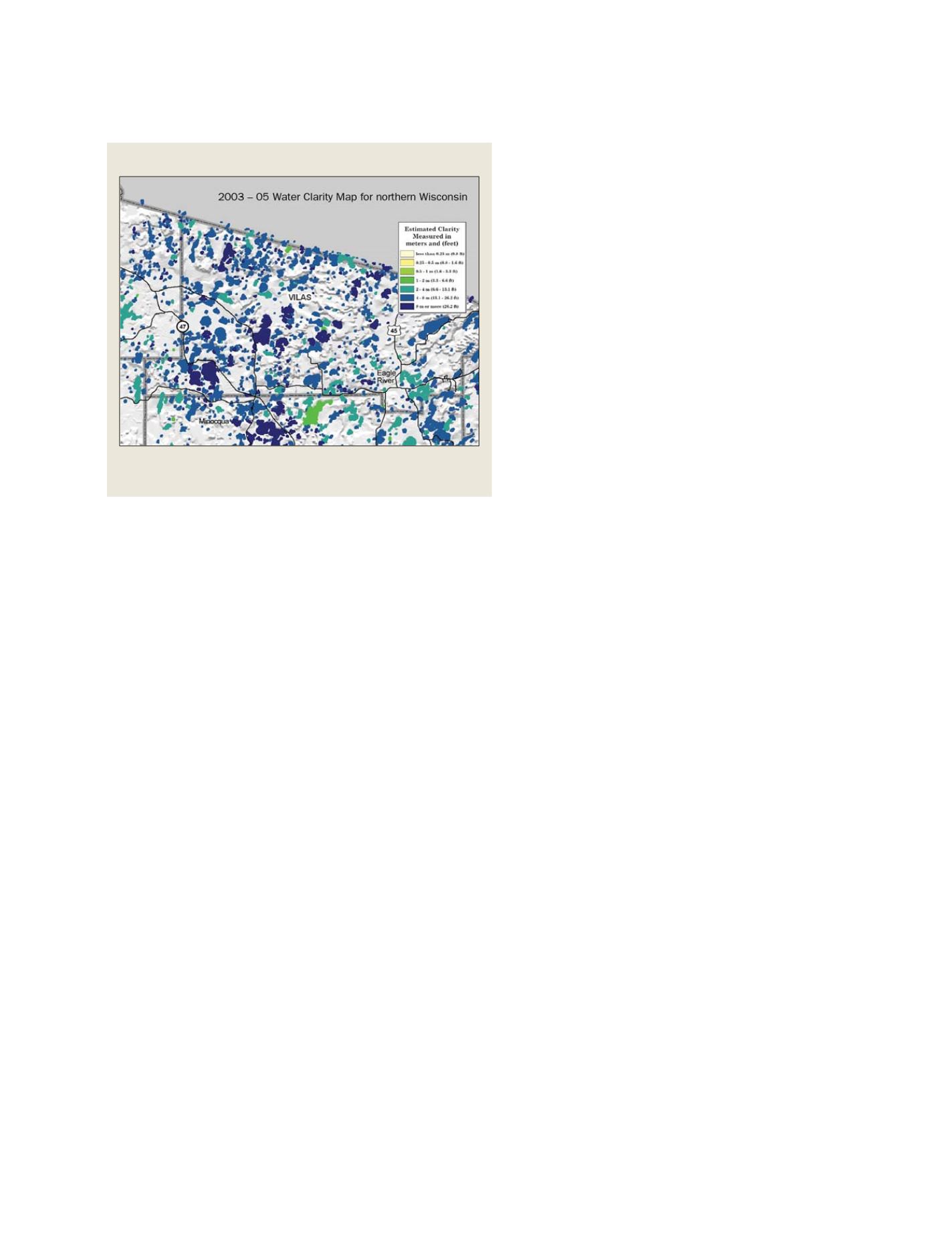
Water clarity
A map of water clarity generated from a Landsat image. The area is in the
northern lakes region of Wisconsin, USA
Source: Steven Greb, WDNR
S
OCIETAL
B
ENEFIT
A
REAS
– W
ATER