


 219 / 280

[
] 219
in order to better articulate their role and participation in this field
and in the GEO process in general.
What can vs. what should be delivered
– Inland water quality remote
sensing is generally viewed as a local or regional concern.
Consequently, the inland water remote sensing community has never
been able to organize itself compared to the ocean remote sensing
community. Therefore it does not enjoy some of the technological
advances and resources – for instance it has a lack of suitable sensors
for complex inland waters. Because coordination is lacking and no
standard approaches exist, the use of results by managers is limited.
Coastal remote sensing has made gains recently with some national
programmes and increasingly international programmes such as in
the European Union (e.g. MarCoast). Satellite sensors such as MERIS,
MODIS and SeaWiFS are more suitable (but not necessarily ideal) for
coastal remote sensing than for inland water remote sensing.
Selected workshop recommendations
The following recommendations are made to the GEOmember nations
and participating (or related) organizations, including the Committee
on Earth Observation Satellites (CEOS).
New high resolution local aquatic imaging missions(s) are required
in low Earth orbit, with a goal of 10m or better ground resolution and
a constellation of imagers and/or pointing capabilities utilized to
provide more frequent looks (weekly or better) than
currently available through existing sensors such as
Landsat or ASTER. Potential partnership opportunities
exist with the terrestrial observing community.
A constellation of regional geostationary ocean color
imagers is needed to provide regional high frequency
temporal revisits (goal of one hour or better for revisit-
ing dynamic events), moderate (~ 100-300 m) spatial
resolution and good offshore coverage of coastal regions
globally. Potential partnership opportunities could exist
with the atmospheric/regional air pollution communities.
Hyperspectral sensors are desired for the mission types
identified above, but minimally twenty (or greater)
narrow (~5-10 nm) spectral bands providing broad spec-
tral coverage, extending from the ultraviolet (UV)
(0.35 m) through the near-infrared (NIR) (1.1 m), with
shortwave infrared (SWIR) bands desired to support
improved atmospheric corrections (thermal bands also
generally desirable). A high signal-to-noise ratio is
needed to support aquatic (versus land) applications.
The water quality community should become active in
future mission concept studies and scoping studies, with
guidance and advice to be provided by the water quality
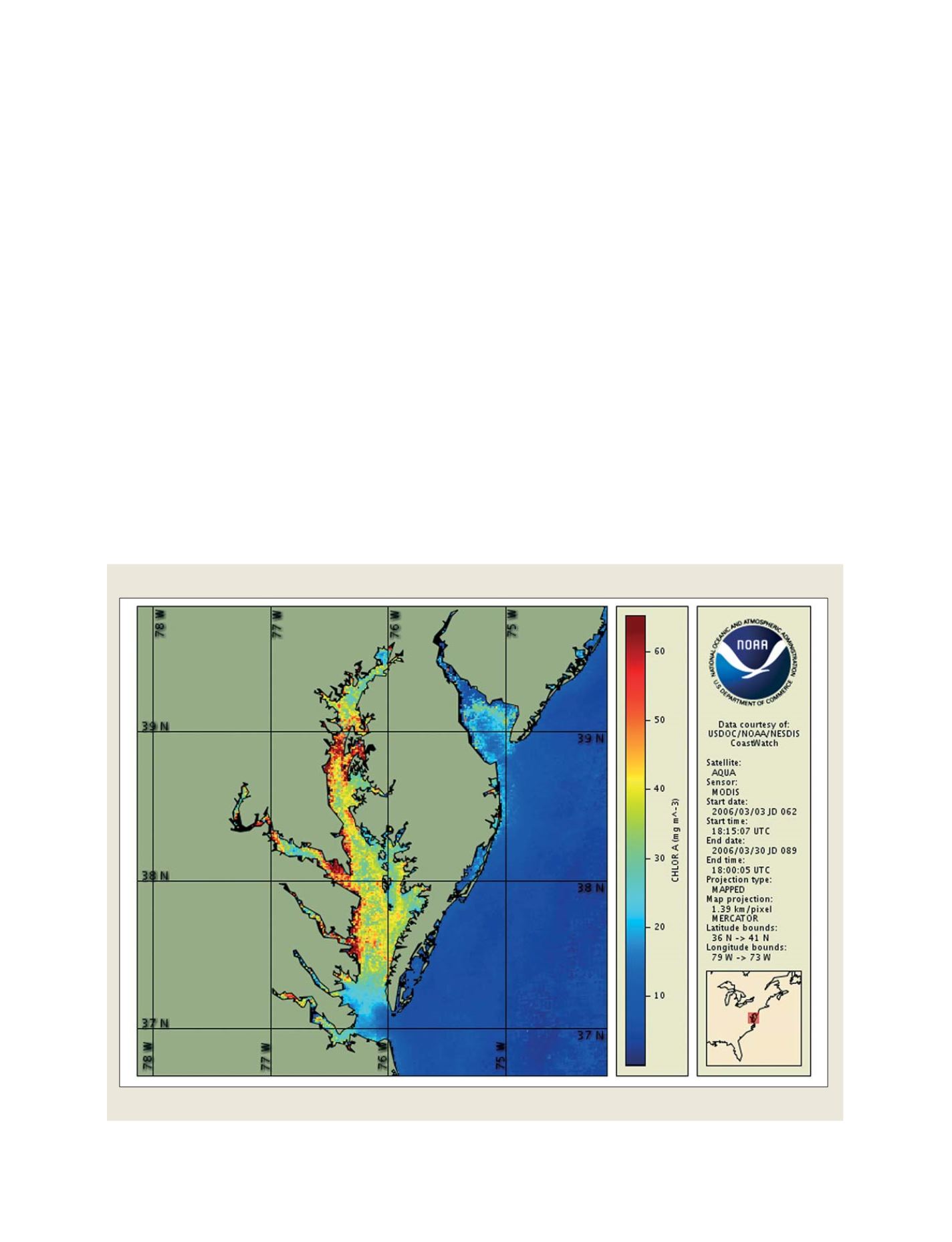
Chlorophyll-a monthly composite image of Chesapeake Bay (USA) from NASA's MODIS (Aqua) sensor
Source: NOAA CoastWatch Program
Phytoplankton biomass
S
OCIETAL
B
ENEFIT
A
REAS
– W
ATER