


 220 / 280

[
] 220
Initiatives should be launched in the capacity building
and educational area in developing countries, such as
specialized graduate programmes, the development of e-
learning and distance learning using freeware and open
source domain software tools. Awareness and interest in
water quality at secondary school level must be initiated,
and support given for ICT initiatives to promote Earth
observation – derived water quality maps in e.g. Google
Earth or similar web-based global services.
Awareness of inland and coastal remote sensing capa-
bilities should be increased through a number of
coordinated programmatic activities including: creating
a global remote sensing of inland and coastal waters
community of practice (CP) or joining a related CP (e.g.,
the Coastal Zone Community of Practice), or forming a
new organization similar to the ocean colour coordinat-
ing group. An ultimate goal could be to establish a global
freshwater and coastal ‘water watch’ programme.
Demonstration projects should be established in each
hemisphere of the world, involving water quality manage-
ment staff that want or need to embrace what remote
sensing technology can offer.
Value-added products should be provided, which utilize
time series statistics to establish baselines, seasonality,
trends and extreme events. Ultimately, watershed remote
sensing and data assimilation should be fully integrated
with receiving river, estuarine, coastal and ocean data and
models. Long-term datasets of water characteristics
should be analysed to provide an informational clearing-
house for disputes of water diversions and fate, and what
quality was evident.
Conclusion
Having and maintaining suitable water quality is critical
to sustaining life on our planet. Monitoring of water
quality using remote sensing, in conjunction with strate-
gic in situ sampling, can play a crucial role in determining
the current status of water quality conditions and helps
anticipate, mitigate and even avoid future water cata-
strophes. The GEO workshop discussed here helped
identify issues, gaps, solutions and recommendations to
expand our capability to utilize this technology. Key
recommendations focused on continuity of existing satel-
lites, development of new and improved sensor/platform
technology, algorithm development and cal/val activities,
improvements in data accessibility, education and capac-
ity building through new demonstration project
initiatives, and the formation of a scientific group dedi-
cated to inland and coastal water quality remote sensing.
Acknowledgements
We thank the participants of the 1st GEO Inland and
Nearshore Coastal Water Quality Remote Sensing
Workshop and their sponsors, as well as the GEO
Secretariat for their support of this effort.
The manuscript contents are solely the opinions of
the authors and do not constitute a statement of policy,
decision, or position on behalf of WMO, NOAA or the
U.S. Government.
remote sensing working group (or community of practice), to be
formed as a result of this workshop.
The water quality community should send letters to various agen-
cies to encourage continued support for cal/val activities and in situ
monitoring. There is a need to promote and organize international
field measurement campaigns (also as capacity building segments)
in developing countries and support developing countries for instru-
mentation needed for in situ cal/val operations and Earth observation
data acquisition.
In cooperation with other organizations, e.g. the International Ocean
Colour Coordinating Group (IOCCG), international partnerships
should be built within GEO member countries for cal/val activities
and to discuss issues like instrument calibration and data processing,
accuracy, sharing, protocols etc.
Raw data should be released within minutes of reception and
processed products within one to two hours. Near-real time (NRT)
metadata should provide information on accuracy (or errors), and faster
access to ancillary data is needed to improve accuracy of NRT data.
Use of GEONETCast and ESA DDS should be encouraged, to
improve data distribution particularly for developing countries. Server-
side options could be implemented, such as spectral or spatial
sub-setting on demand to reduce data transmission size.
Data should be provided in agreed formats, and data networks should
be more interoperable. Open formats should be required and open
source software encouraged for multiple platforms. A consensus build-
ing exercise led by the space agencies is needed to standardize data and
metadata formats that are compatible with end user requirements.
An international activity/entity is needed to ensure that coastal and
inland water algorithmic requirements (e.g. SWIR wavelength atmos-
pheric correction, adjacency effects, optical parameter assignment in
semi-analytical models) are taken into consideration for present and
future missions. A working group (possibly through IOCCG) should
explore methods for regional algorithms implementation.
Harmonization of quality control and accessibility of in situ data
(atmospheric and in-water) for algorithm parameterization purposes
should be improved, and extended to include inland waters.
Needs for water quality products should be defined in relation to
developing countries, with points of contact established in GEO
member countries in relation to the water quality theme (e.g. start
from UNEP GEMS focal points).
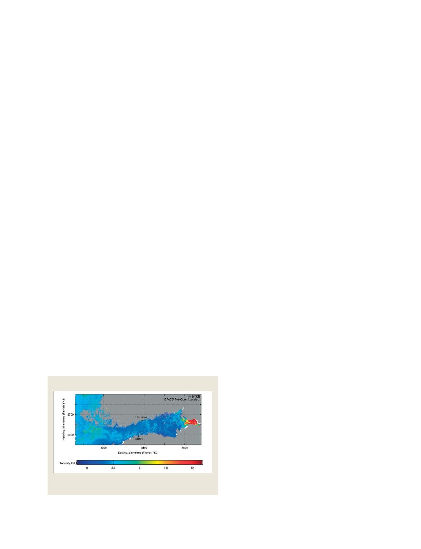
GMES MarCoast Product
GMES MarCoast product showing distribution of turbidity in the Gulf of
Finland, Baltic Sea
Source: © SYKE
S
OCIETAL
B
ENEFIT
A
REAS
– W
ATER