


 33 / 280

[
] 33
Development
The World Summit on Sustainable Development in 2001
recognized the use of satellite data for sustainable devel-
opment and an urgent need for action in Africa.
Several European activities concentrate on natural
resources monitoring and food security, with
programmes like the African Monitoring of the
Environment for Sustainable Development (AMESD),
to be implemented and coordinated by the African
Union. AMESD is a first step in increasing the use of
Earth observation data in natural resource manage-
ment and in moving toward a continental approach to
cross-border issues. Support to the African Union
Council’s department responsible for environment is
foreseen in the area of environment integration as a
component of the larger programme to develop
African capacity.
Whilst addressing all African, Caribbean and Pacific
(ACP) countries, the focus will be on the African conti-
nent in the initial phase. The ACP Observatory will
support three main domains: sustainable management of
natural resources, food security, and crisis response/moni-
toring for security. A thematic and geographical
coordination mechanism will be put in place between the
different actions.
The European Development Consensus emphasizes
the importance of the integration of development objec-
tives into its research and development and innovation
policies. The EU will continue to assist developing coun-
tries in enhancing their domestic capacities in the areas
of science and technology. The EU should ensure that
its principles, and values such as convergence and
harmonization, effective participation and ownership by
developing countries and predominant focus on user
needs, are effectively implemented within GEOSS.
Furthermore, international endeavours such as the
Global Knowledge Partnership emphasize the urgent
need to stimulate conservation and use of indigenous
and local knowledge in a world with increasing exoge-
nous information overload. A central aspect of these
efforts will be the development of local capabilities to
generate reliable information on the location, condition
and evolution of environmental resources, food avail-
ability and crisis situations.
Conclusion
The European Commission is actively contributing to the
implementation of the GEOSS through major initiatives
like GMES, the FP of Community Research, INSPIRE and
capacity building activities (AMESD and PUMA).
GEOSS represents a major international cooperation
framework for solving global problems affecting our
planet. It provides a unique platform for the exchange of
and access to strategic observations needed to better
understand the Earth system and its functioning. The
understanding of the physical and biochemical mecha-
nisms affecting the environment as well as the monitoring
of the impact of policies is a cornerstone of the sustain-
able economic development promoted by Europe.
• Conditions of access to data required for good governance should
not impede their extensive use
• Retrieval of data, evaluation of its relevance and its conditions of
use for a specific purpose should be easy.
The
GEOSS 10-year Implementation Plan
advocates the use of existing
spatial data infrastructure components as institutional and technical
precedents in areas such as geodetic reference frames, common
geographic data, standard protocols and interoperable system interfaces.
INSPIRE contributes to the crosscutting initiatives, technologies and
systems of GEOSS through the provision of standard protocols improv-
ing data access and sharing, interoperable system interfaces, mechanisms
for allocation, transfer and use of data and detailed specifications and
standards. It demonstrates the value of an underlying architecture based
upon a system-of-systems approach through the infrastructures operated
by member states.
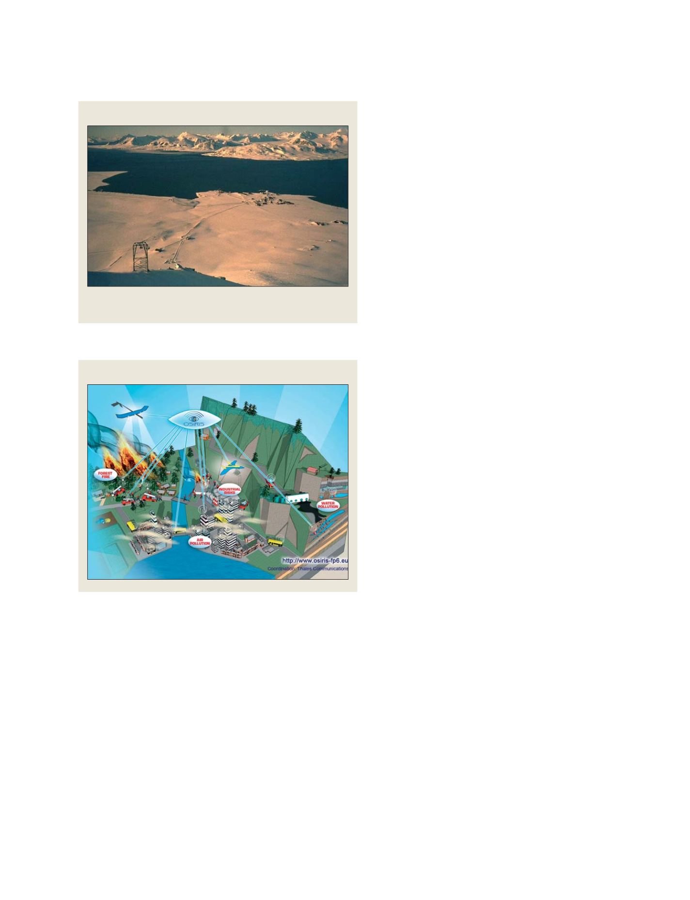
A Sensor Web enabled environmental data collection network
Source: Osiris project
The Ny-Ålesund station on Spitsbergen
Source: Osiris project
N
ATIONAL
& R
EGIONAL
R
EPORTS
The station will play an important role in the implementation of GEOMON to
study key compounds like HCL involved in stratospheric ozone depletion