


 32 / 280

[
] 32
Developing Arctic Modelling and Observing Capabilities for Long-term
Environmental Studies (DAMOCLES) project is focused on the effect of
global warming on the Arctic region, and the Global Earth Observation
and Monitoring of the atmosphere (GEOMON) project measures and
models the fluxes of carbon dioxide through the atmosphere.
The first actions to be supported under the Environment theme
of FP7 will deal with priority areas of GEOSS, namely monitoring
of the carbon cycle at global level; contributing to a global biodi-
versity observation system; monitoring the ocean interior, seafloor,
and sub-seafloor; developing a global soil observing system; build-
ing a geo-resource information system for Africa; improving
observing systems for water resource management, and developing
GEONETCast applications for developing countries.
The coordinated development of data and data processing systems,
data archiving, and spatial data infrastructures for effective data
updating and exchange should be continued. Finally, modelling and
prediction capabilities will need to be improved and expanded so
that a new generation of models is made available to ensure advance-
ment in predicting high-impact events.
Information and communication technology
– In the
field of information and communication technology
applied to environment management, the main research
objectives are to design tools and systems architectures
for improved technical interoperability, and to develop
or demonstrate collaborative systems for environmen-
tal management.
Many projects co-funded under the FP6 programme
are directly contributing to some of the ongoing GEOSS
tasks, for example on Sensor Web Enablement (SWE).
This technique can be described as follows: “With
advances in communications technology and ground-
based in situ technologies it is now feasible to consider
webs of sensors on all types of platforms with rapid
access for observations. This technology has been devel-
oped under the names of sensor webs and sensor
networks. A sensor web is a system of distributed sensors
that can be deployed to monitor and explore new envi-
ronments.”
Demonstration projects such as OSIRIS, led by indus-
try, apply this technique to innovative in situ monitoring
systems, in particular based on intelligent low-cost
sensors, self-organizing reconfigurable sensor networks
and sensor web architectures for environmental data
acquisition and integration. In addition, modern tools
are developed for public safety communication, includ-
ing work on the integration of alert systems,
communication to and from the citizen and rapidly
deployable emergency telecommunications systems.
Legal framework
The Infrastructure for Spatial Information in Europe
(INSPIRE) directive adopted by the EU in 2006 provides
measures that address exchange, sharing, access and use
of interoperable spatial data and services in Europe.
INSPIRE will also contribute to establishing global stan-
dards for geospatial data and information.
INSPIRE is a European directive that establishes the
legal framework for setting up and operating an
Infrastructure for spatial information in Europe, based
on infrastructures operated by member states. The
purpose of such infrastructure is to support formula-
tion, implementation, monitoring and evaluation of the
EU’s environmental policies and overcome major barri-
ers still impeding availability and accessibility of
pertinent data: inconsistencies in data collection with
gaps and duplication, incomplete documentation of
available data, incompatibility of spatial data sets and
services, lack of interoperability of infrastructures,
cultural, institutional, financial and legal blockage
preventing data sharing.
The collaborative process leading to the formulation
of the directive was based upon the following principles:
• Spatial data should be collected once and maintained
where most appropriate
• Seamless combination from different sources across
the EU should be possible
• Data collected at one level should be shared with
other levels of government
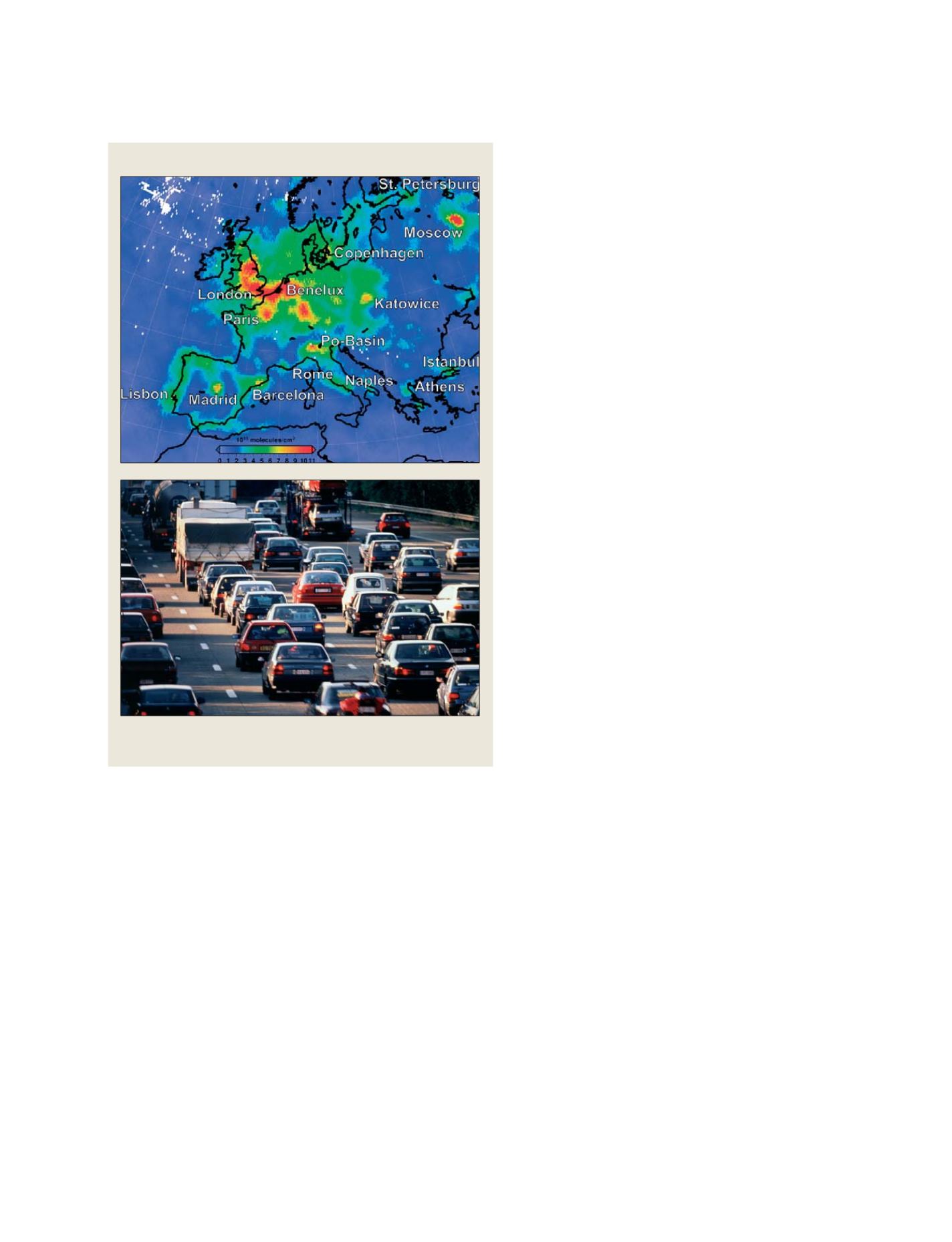
Source: GMES, PROMOTE Projects
GMES Atmosphere Core Service
Air quality over Europe, showing the impact of large urban and
industrial concentrations
N
ATIONAL
& R
EGIONAL
R
EPORTS