


 125 / 288

[
] 126
The Devils Lake Decision Support System
Fiona Horsfall, National Oceanic and Atmospheric Administration
A
s part of an ongoing project, the National Oceanic and
Atmospheric Administration (NOAA) is providing effi-
cient and accessible climate information to support the
communities of Devils Lake, North Dakota.
The years from 1990 to 2010 were the wettest 20-year period since
1895 in the Devils Lake Basin. Devils Lake, a closed natural lake
with no significant drainage or outflow, and the adjacent Stump Lake
collect the surface runoff, with Devils Lake collecting approximately
86 per cent. This runoff remains in the lake system until it evapo-
rates, enters the groundwater table or – when the water level at
Devils Lake reaches 1,458 ft above mean sea level – overflows into
the Sheyenne River, which flows into the Red River of the North.
The Red River of the North divides the states of North Dakota and
Minnesota and then flows into Canada, which introduces an interna-
tional component, in particular to water quality issues. In addition,
overflow into the Sheyenne River could be catastrophic as the typi-
cally low flows could become significant, causing changes in the
geomorphologic and ecologic characteristics of the Upper Sheyenne
Basin and significant flooding to the cities downstream.
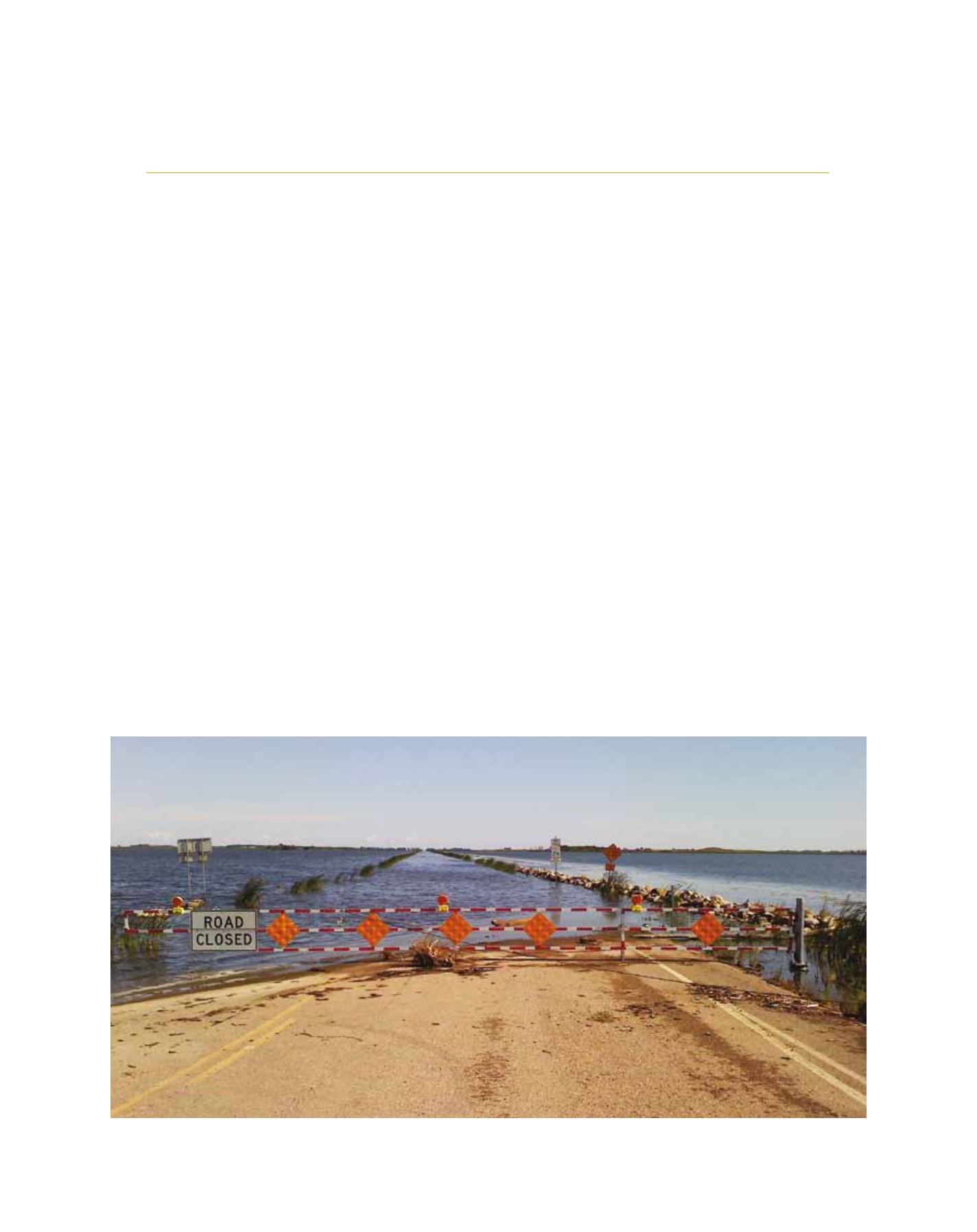
The water level within the lake has varied since measurements were
first taken in 1895, reaching its lowest level in 1940 at 1,400.9 ft.
1
The recent wet period in the region has caused the lake level to rise to
1,453.2 ft as of 31 May 2012, resulting in inundation of
the surrounding lands, including homes and agricultural
land. The flooding has also caused significant damage to
infrastructure, including roads, bridges, water and sewer
systems, and flood control systems.
2
These dramatic
changes have resulted in significant negative societal
and economic impacts for local residents and communi-
ties in the region, including the Native American Spirit
Lake Tribe, whose reservation adjacent to Devils Lake
was established by treaty between the United States
Government and the Sisseton Wahpeton Sioux Bands in
1867.
3
With over US$400 million already spent in flood
protection measures
4
and more investment necessary
by the United States Federal Government and the State
of North Dakota, the economic impacts of the flooding
are significant, and the risk of catastrophic flooding to
the local communities is deemed unacceptable without
further mitigation actions.
NOAA provides climate information support to
the communities of Devils Lake, North Dakota, state
and local level authorities and government, and other
federal agencies responsible for addressing the flood-
ing at Devils Lake. NOAA has provided on-site support
D
isaster
R
isk
R
eduction
Recent flooding caused significant damage to infrastructure including roads, bridges, water and sewer systems, and flood control systems
Image: NOAA