


 54 / 218

[
] 54
W
EATHER
,
CLIMATE
,
AND
water information is criti-
cal for agriculture in two key areas, firstly, with
regard to risk assessment. This involves evaluations
and predictions concerning such issues as the potential spread
of plant and animal diseases, the progression of invasive
species and the probability of extreme events. The second
application of meteorological data is concerned with agri-
cultural production system management. Examples of this
include crop and range planning, and irrigation scheduling.
This suite of agricultural services provided by National
Meteorological and Hydrological Services (NMHS) has hith-
erto been primarily concerned with the information needed
for agricultural production systems. In the future, it will be
imperative for increased attention to be given to risk assess-
ment.
Agricultural risk assessment is important because of the
inherent vulnerability of agricultural systems to climate vari-
ability, and also because of the direct linkage to plant disease
pests. The availability of weather, climate and water data and
the informational products derived from this information are
also of paramount importance. Its application can help agri-
cultural producers, managers and policy makers better under-
stand the risks at critical points before and during the growing
season, in order to minimize production losses.
Various approaches can be applied to the agricultural produc-
tion system to greatly enhance the efficiency and scope of the
management, and risk assessment of a specific area.
Crop planning
Seasonal climate data such as temperature, humidity or soil
temperature, can be usefully applied to facilitate crop plan-
ning. For example, the US Southeast Climate Consortium used
available climate data to provide early spring planting forecasts
for peanuts.
Irrigation scheduling for water-use efficiency
The US Department of Agriculture’s Agricultural Research
Service (ARS) has developed a water-use efficiency system for
arid areas such as the southwestern United States, the Middle
East and North Africa. The system includes a weather sensor
that is capable of measuring and recording wind speed, air
temperature, relative humidity and solar radiation.
There follow two specific examples of the practical applica-
tion of weather, climate and water information to the process
of agricultural risk assessment.
Early warning for invasive species
P. truncatus
(Giant Grain Borer) – The giant grain borer was
introduced to Africa from Mexico late in 1990. Within a short
period of time the species became a threat to the entire grain
supply of Africa. The International Institute for Tropical
Agriculture, in conjunction with the Danish Institute for
Agriculture Science, developed a climate simulation model for
an early warning system of the potential spread and growth of
the giant grain borer. The strategy was designed to manage the
threat the pest presented and thus reduce the overall loss of
grain. The borer is extremely sensitive to temperature and
humidity, and tends to spread south during the warm seasons.
Advanced and more precise climate forecasts will result in a
more accurate borer risk assessment model. This will improve
the effectiveness of pest management in Africa and enhance
food supply security.
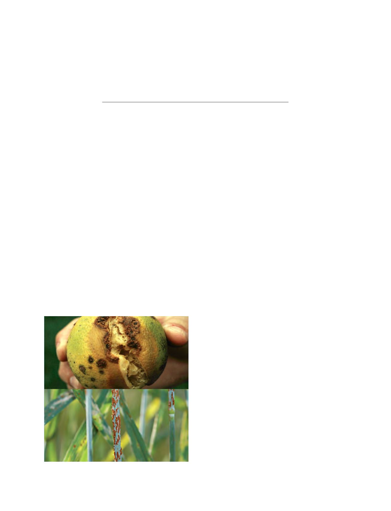
Spread of plant diseases
Citrus canker and wheat stem rust can cause severe damage to
the plants that they affect. Citrus canker was introduced to the
Weather, climate, and water information
for agricultural applications
Dr Pai-Yei Whung, Agricultural Research Service, US Department of Agriculture
Dr Donald A. Wilhite, National Drought Mitigation Center, University of Nebraska-Lincoln
Citrus canker and wheat stem rust