


 160 / 196

[
] 158
NASA science serving society: improving
capabilities for fire characterization to
effect reduction in disaster losses
Vincent G. Ambrosia, California State University – Monterey Bay/NASA-Ames Research Center;
Everett Hinkley, USDA-Forest Service – Remote Sensing Applications Center; Stephen D. Ambrose, NASA Headquarters
I
n late summer/fall of 2007 a series of large wildfires, spawned
by strong, hot, dry Santa Ana winds blowing off of the interior
southwestern US deserts, rampaged across southern California.
The Santa Ana winds, blowing up to 85 miles per hour (140 km/h),
downed power lines, directly causing fires as well as influencing
the starting of others by arson. On 20 October 2007 Santa Ana
winds spawned a series of 11 major wildfires in the Los Angeles
and San Diego regions. At least 1,500 homes were destroyed and
over 500,000 acres (2,000 km²) of land burned from Santa Barbara
County to the US-Mexico border. Over 900,000 residents were evac-
uated from affected areas. Nine people died as a direct result of
the fire; 85 others were injured, including at least 61 firefighters.
California Governor Arnold Schwarzenegger declared a state of
emergency in seven California counties where fires were burning.
President George W. Bush concurred, and ordered federal aid to
supplement state and local response efforts. The last fire was fully
contained on 9 November 2007.
Importance of real-rime, simplified information
for disaster management
One of the most critical elements in effecting a reduc-
tion in losses from disasters such as the fires in
southern California is the provision of near-real-time
data or imagery of the affected areas and the event
itself. In the case of fast-moving wildfires at the urban
fringe, timely and accurate fire locations are critical in
order to deploy firefighting resources, assets and
personnel and to determine safe public evacuation
routes, threatened or burning structures and the vege-
tative component and status in front of the fire line. To
assist disaster managers during the southern California
wildfires, the National Aeronautics and Space
Administration (NASA) and the US Forest Service
(USFS) collaborated to develop, demonstrate and
utilize innovative airborne and satellite remote sensing
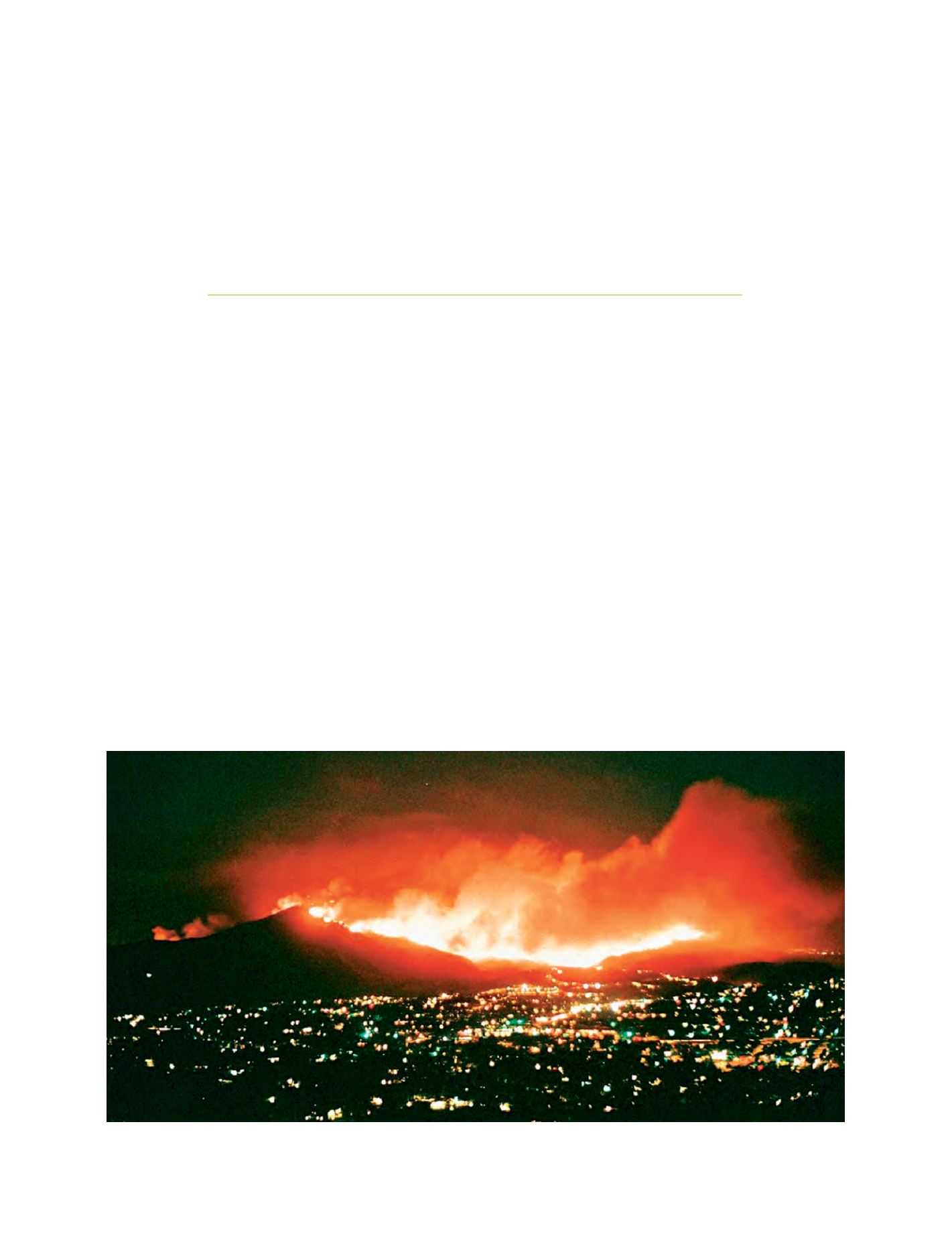
Image of the Harris Fire burning in San Diego County, California, October 2007
Image: courtesy of David S. Roberts