


 180 / 196

[
] 178
Decision support for disaster
risk reduction in India:
remote sensing and GIS-based
operational approach
P.S. Roy, C.S. Murthy, P. Manjusree and M.S.R. Murthy, Remote Sensing
and GIS Applications Area, National Remote Sensing Agency, India
T
he global risks due to disasters seem to be increasing.
Billions of people living in more than 100 countries are peri-
odically exposed to at least one natural disaster, causing
more than 184 deaths per day.
1
Diverse geo-climatic conditions,
increasing population and its expansion to vulnerable areas,
unplanned urbanization, inadequate carrying capacity of river
systems, poor drainage characteristics, uncertain monsoon condi-
tions and large areas of dry deciduous forests all contribute to
make India one of the world’s most disaster-prone countries.
The recurring impacts of these disasters on human life,
agriculture, livestock and the environment triggered the
momentum for adopting disaster risk reduction strate-
gies in a holistic manner. There has been a paradigm
shift in the disaster management approach in recent
years, from relief/crisis-centricity to a focus on preven-
tion, mitigation and preparedness. Recognizing the
importance of disaster management as a national prior-
ity, in 1999 the Government of India set up a
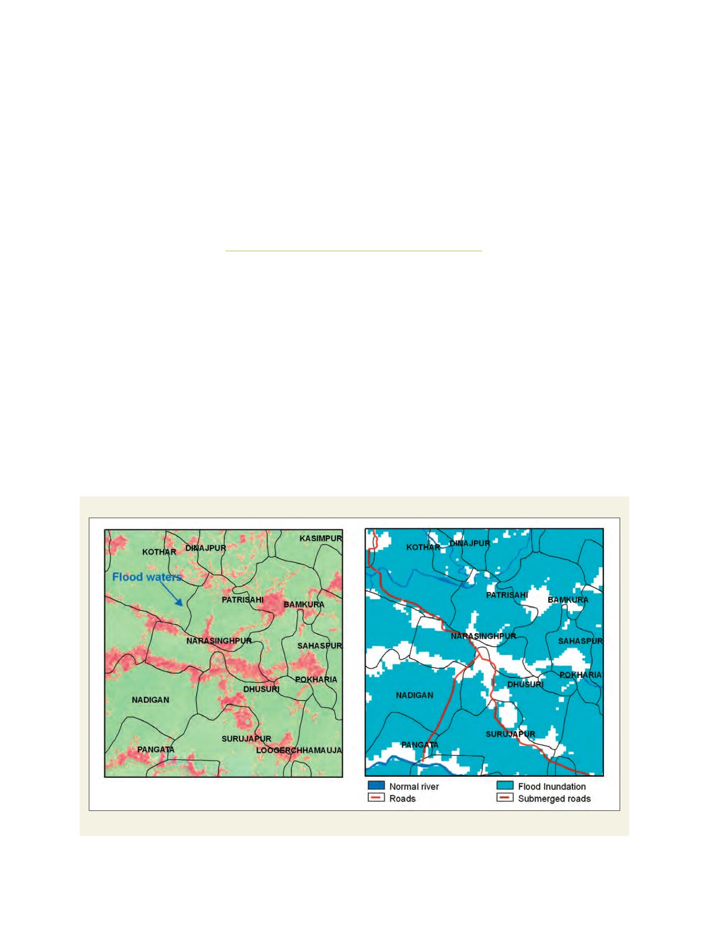
An example of near real-time flood mapping - part of Bhadrak district, Orissa state
Left: IRS-P6 LISS-III FCC 08-July-2007; Right: Flood Map showing submerged villages
Source: Annual flood report, 2007, NRSA, India