


 183 / 196

[
] 181
drought warning information is issued in terms of ‘Watch, Alert and
Normal’ categories. The ‘Alert’ warning calls for immediate external
intervention, in terms of crop contingency plans. During September
and October, drought declaration is done in terms of
‘Mild, Moderate and Severe’ drought. Monthly/fort-
nightly drought reports are disseminated to the decision
makers in drought management during the monsoon
season (June to November), by electronic and traditional
mail. The feedback received from the user community
on drought reports is encouraging. The drought infor-
mation is being used by the Indian Government’s
Ministry of Agriculture and by state agriculture and relief
departments in agricultural situation review meetings, as
well as for the development of relief management
measures.
Time series data on agricultural area NDVI, aridity,
rainfall, irrigation support, cropping pattern and soils is
integrated in a spatial information system to define the
criteria and limits for assessing drought proneness.
Prepared based on multiple criteria, the drought vulner-
ability status of the district is useful in developing
long-term drought management measures with locale-
specific action plans.
The establishment of automatic weather stations, soil
moisture estimation, quantitative assessment of drought
impact and drought early warnings are just some of the
research initiatives that can strengthen drought risk
assessment capabilities.
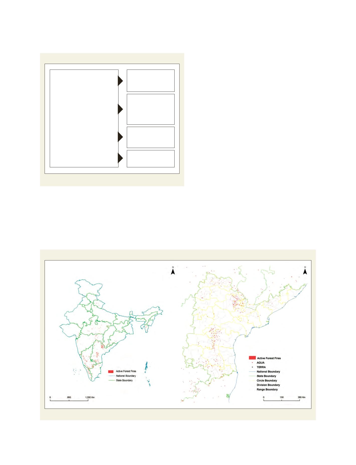
Forest fire
In the context of India, a conventional fire control
system is limited in terms of area under coverage, due
Daily fire alert products (daytime data)
Left: All India level; Right: State level value added product
Source: Perspectives of Geoinformatics in forest fire management, 2006, Technical Report of NRSA, India
Identification of drought proneness
Multi-criteria approach for delineation of drought prone blocks
Source: Murthy, C.S., Sesha Sai, M.V.R., Dwivedi, R.S., Roy, P.S., Rao, G.G.S.N. and Rama
Krishna, Y.S., 2008, An integrated approach for characterization and delineation of drought
prone areas, Proc. International Symposium on Agromet and Food Security, Hyderabad, India.
1. Probability of aridity
2. Irrigation support
3. Soil characteristics
(AWC-Available Water Content)
4. Spectral information (NDVI)
(a) <50%
(b) 50-75%
(c) >75%
(a) <50% cropped
area irrigated
(b) >50% cropped
area irrigated
(a) AWC <50
(b) AWC 50-100
(c ) AWC >100
CV >20%
Probability >50%