


 184 / 196

[
] 182
roads, overlays are also provided to the user depart-
ments. Damage assessment in terms of burnt area is
also taken up for critical areas based on the daily fire
alerts. Furthermore, studies are in progress to develop
a National Fire Danger Index, as well as an ecological
damage assessment system designed to facilitate effec-
tive fire management. Efforts are also underway to
develop spatial decision support systems for web-
enabled decision making, in order to improve
turn-around time and spatially explicit planning.
National Database for Emergency Management
A recent initiative called the National Database for
Emergency Management (NDEM) aims to develop an
organized database at different scales related to various
themes on natural and man-made disasters. The NDEM
serves as a national repository of geospatial databases
for emergency/disaster management, as well as to assist
stakeholders at various levels in hazard/risk zonation,
damage assessment, preparedness and emergency
response. The emergency trends, demographic patterns,
economic profiles, infrastructure status, communication
networks and public utilities will be analysed and shared
in coupling disaster reduction and economic develop-
ment, especially in vulnerable areas. NDEM will also be
crucial in the development of well-connected early
warning systems enabling knowledge warehouses,
developing spatial decision support systems for disas-
ters, and catalysing the process of preparedness,
response and mitigation.
Looking forward
The remote sensing and GIS community in India is
closely associated with the NDMA, an apex body for
disaster management in the country seriously engaged
in utilizing the benefits of aerospace technology in
reducing risk and hardship. Data from various satellite
sensor systems and aerial sensors is continuously
analysed to generate disaster-related information.
Integration of multiple data sets in a GIS environment
is being done for objective assessment of the prevalence
and progress of disasters – flood, drought and forest
fires – at different spatial and temporal dimensions. The
near-real-time, objective information on the intensity of
disasters that is disseminated to decision makers
through an exclusive communication network is of
immense help when evolving risk reduction strategies.
Disaster vulnerability maps generated using a multi-
criteria approach are useful when developing long-term
management strategies.
New initiatives utilizing technology such as airborne
laser terrain mapping to generate finer elevation data for
flood depth assessment, the establishment of automatic
weather stations and the quantitative assessment of
disaster impact further strengthen risk assessment capa-
bilities. The proposed launch of the state-of-the-art
indigenous microwave satellite RISAT in the year 2009
would further augment the use of space images for disas-
ter management.
to the vastness of forested regions and the inaccessibility of fire
affected areas. Besides, remote sensing data – with its multi-sensor,
multi-temporal and synoptic potential – in conjunction with the
Geographic Information System (GIS) and ground data is one of
the most powerful mechanisms in the development of fire manage-
ment tools. By relating actual fire patterns, a better understanding
of fire ecology can guide management decisions that facilitate the
restoration and conservation of fire-prone ecosystems in the Indian
region.
Because of the need to develop a national database of spatial infor-
mation on forest fires, the Indian Forest Fire Response and Assessment
System (INFFRAS) was established under the DSC, as part of the
Disaster Management Support Programme, to facilitate forest fire moni-
toring and management.
6
As part of INFFRAS, multi-resolution,
multi-temporal and multi-spectral satellite, remote sensing data-based
inputs are utilised in:
• Identification of daily active fire locations using MODIS and
DMSP-OLS satellite data and dissemination of active fire
location information to the concerned state forest departments
7
• Forest fire burnt area assessment
• Fire burnt area progression monitoring
• Ecological damage assessment due to forest fires.
Daily fire alerts are disseminated through e-mail and a website.
Based on specific requirements, value-added products in terms of
vegetation type, forest management boundaries, settlements and
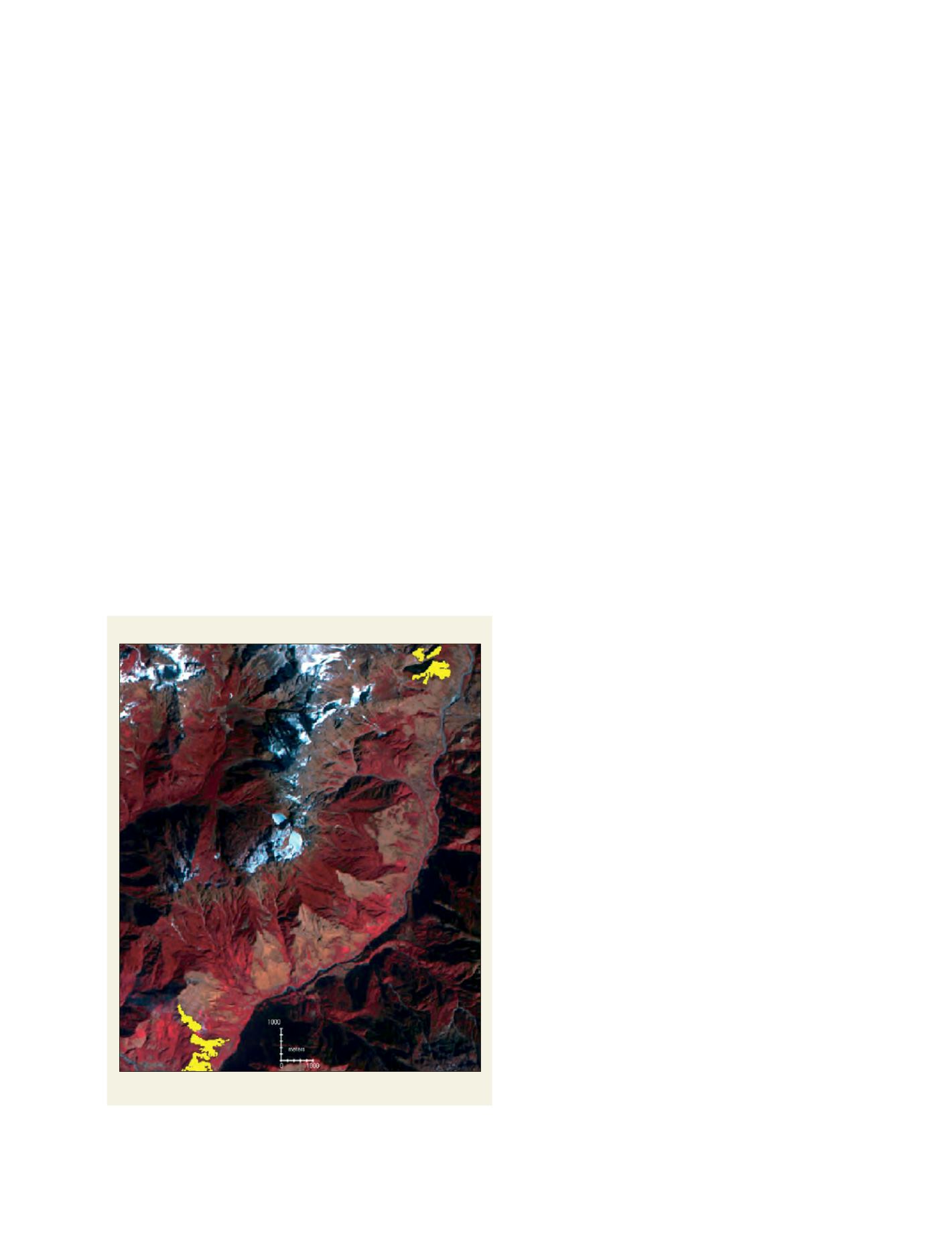
Forest burnt area mapping
Fire Burnt Area (yellow patches) Assessment for Chungthang District, Sikkim
Source: Perspectives of Geoinformatics in forest fire management, 2006, Technical
Report of NRSA, India