


 187 / 196

[
] 185
The main activities of Sentinel Asia are as follows:
• Emergency observation in case of major disasters by Earth observa-
tion satellites via observation requests of JPT and ADRC members
• Wildfire monitoring and flood monitoring
• Capacity building for utilization of satellite images for disaster
management.
SA Step 1 operations have been running since October 2006 with the
opening of its website.
2
JPT consists of 51 organizations from 20 coun-
tries and eight international organizations at the time of writing. The
Japan Aerospace Exploration Agency (JAXA) is a secretariat of the JPT.
Currently, a website dedicated to SA is open to the public provid-
ing the following content:
• Recent disasters and emergency observation
• Hotspots data for wildfire monitoring
• Accumulated precipitation data for flood monitoring in
cooperation with the Global Flood Alert System (GFAS)
• MTSAT imagery in cooperation with Japan Meteorological
Agency (JMA)
• Capacity building.
JAXA’s ALOS satellite and the IRS satellite of the Indian Space
Research Organization (ISRO) have carried out emergency observa-
tions in the case of major disasters in the Asia-Pacific region.
Wildfire is a major and recurring phenomenon that has a serious
impact on property and human health, affecting many countries in the
region. Compared to other disasters in the area, it does
not necessarily cause many immediate fatalities. However,
it causes serious impact on property and human health
due to smoke. Responding to requirements from Asian
countries, wildfire monitoring has been chosen as one of
SA’s activities. Having accurate information on the loca-
tion and intensity of the fires, and subsequent control of
wildfire, are therefore very important and urgent tasks
across the region. SA primarily addresses the issue of near-
real-time information distribution on wildfires in the
region. Furthermore, its effects are of great relevance both
at a regional and global level, and accordingly bear
substantial influence on global warming.
Flood is also a major and recurring phenomenon
affecting many countries in the Asia-Pacific region, and
flood monitoring has been chosen as one of SA’s activi-
ties. At the moment, SA is providing accumulated
precipitation data from GFAS, MTSAT imagery on Web-
GIS and inundated area information observed by satellite.
A good human network has been constructed between
the space and disaster reduction communities since oper-
ations began in October 2006. At the same time, some
difficulties have appeared which need greater attention
and more work to resolve, such as narrowband areas in
Asia, where it is very hard to see information via the
Internet.
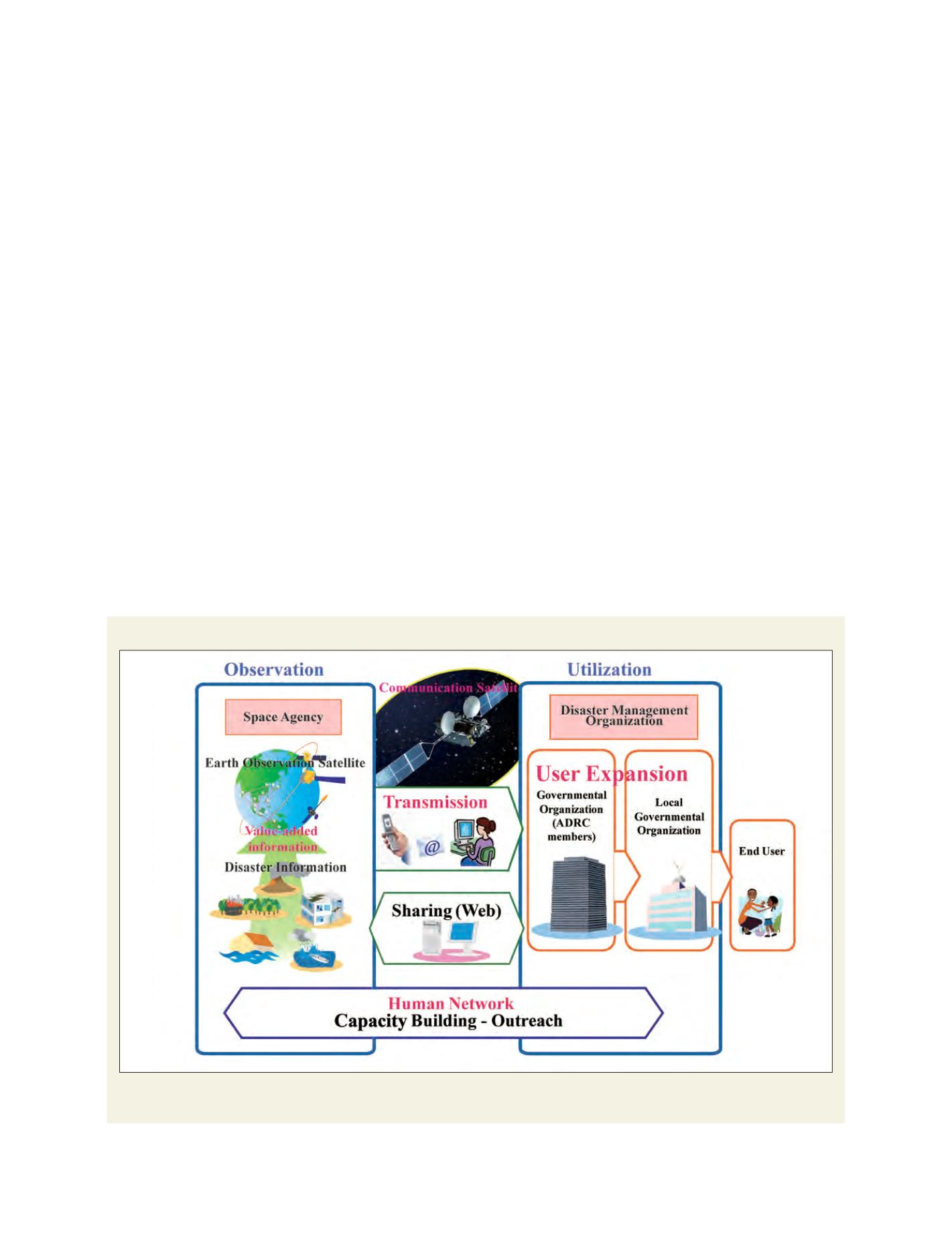
Sentinel Asia Step 2 aims to broaden the reach of Step 1
The point of SA Step 2 is shown in red: to make value-added information from satellite imagery, to transmit the information to users using communication
satellites in addition to information-sharing by Internet in Step 1, and to expand users. Finally, these activities are supported by a human network
Source: Kazuya Kaku