


 191 / 196

[
] 189
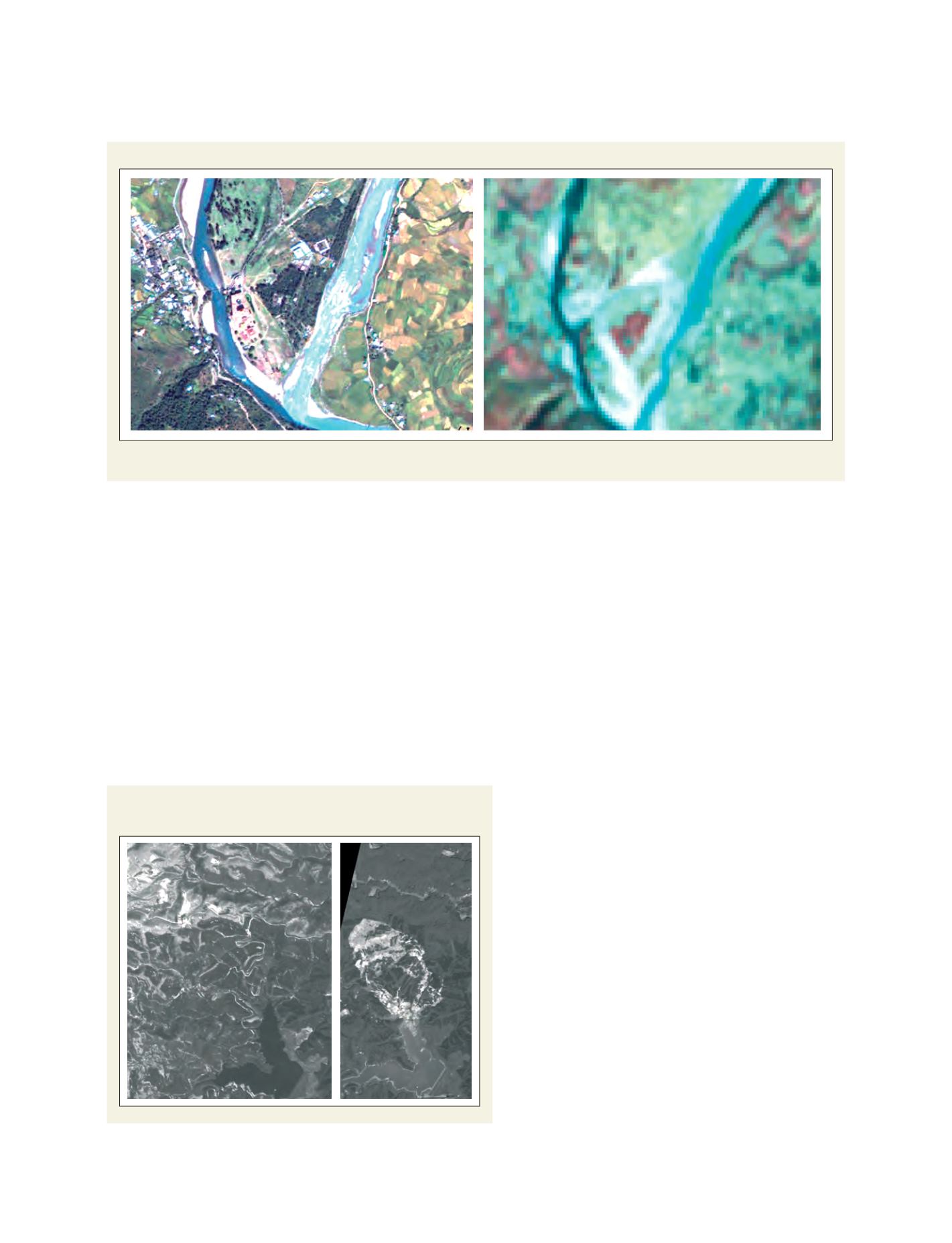
A large scale landslide which occurred at the north side of
Aratozawa Dam was captured by ALOS PRISM
Source: Remote Sensing Technology Center of Japan
also the latest topography. Currently, we are continuing the analysis
to understand the mechanism of this landslide and mitigate the
effects of similar disasters in the future.
Capacity building for monitoring disasters using Earth obser-
vation data
RESTEC has organized the remote sensing group training course for
more than 30 years, ever since its establishment in 1975. Over 1,200
researchers or scientists from about 50 countries have been trained
through this course. Recently we arranged the following two types
of training on remote sensing for disaster/environmental monitoring.
Technical assistance and capacity building on satellite-based moni-
toring of ground cover in Andean glacier regions – We collaborated
with the World Bank on the Adaptation to Rapid Glacier
Retreat in the Tropical Andes project. The objective of
RESTEC is to provide training using ALOS data to the
scientists of the participating four countries (Bolivia,
Columbia, Ecuador and Peru), on a state-of-the-art
remote observing system to be used for interpreting
climate change impact on high mountain ecosystems
(including glacier basins) in the Andes. The training
took place at the Hydraulic and Hydrologic Institute
(IHH) in Bolivia from 5 November to 6 December 2007,
with a total number of 15 participants. The results of
these activities are a scientific and technical monitoring
system for the analysis of the dynamics of glacier retreat.
JICA group training programme, satellite remote
sensing data analysis technology for disaster/environ-
mental monitoring – We implemented this training
programme under the contract with JICA. The
programme aims to allow remote sensing experts from
disaster/environment-related agencies of Asian and other
developing countries to improve synthetic aperture radar
(SAR) and other data analysis capability.
In areas where clouds tend to cover the land surfaces
throughout the year, an optical sensor merely acquires
land surface images. However, by utilizing SAR, land
surface data can be acquired regardless of weather and
sunlight conditions. By analysing SAR data,
disaster/environment damage can be understood widely
and the results will supply important information for
planning measures. In this programme, the participants
will acquire the necessary skills of SAR data analysis and
learn to provide precious information for disaster
management and the problems of environment-related
organizations. The training is held at RESTEC in Japan
from 11 August to 12 September 2008. Nine participants
from six countries (Argentina, Bhutan, Brazil, Indonesia,
Malaysia, and Sri Lanka) will join the training.
Temporal change of GLOF damaged area
Comparison of the GLOF damaged area acquired in 2006 by ALOS (Left) and in 1995 by JERS-1/OPS (Right)
Source: Remote Sensing Technology Center of Japan