


 181 / 196

[
] 179
dissemination of information and constant interaction
with decision makers are just some of the priority tasks
of the DSC. Furthermore, the DSC also provides support
to the International Charter on Space and Major
Disasters.
Floods and cyclones
Since a flood is a dynamic disaster, monitoring them
and the timely dissemination of flood information plays
a crucial role in the management task. During
monsoon season, floods and cyclones are continuously
monitored and mapped in near-real time through aerial
and satellite data.
2
All weather space images from
microwave sensors are also of immense help to map
flood events.
3
Using hydro-meteorological data, a
constant watch is kept on the flood/cyclone situation
in the country. Accordingly, optical and microwave
synthetic aperture radar (SAR) data is planned and
acquired from Indian and foreign satellite missions
respectively. Currently, images from Resourcesat 1,
Radarsat and are being used extensively. Indigenously
developed SAR instruments mounted on an aircraft can
also be flown over the affected areas, depending on the
requirement.
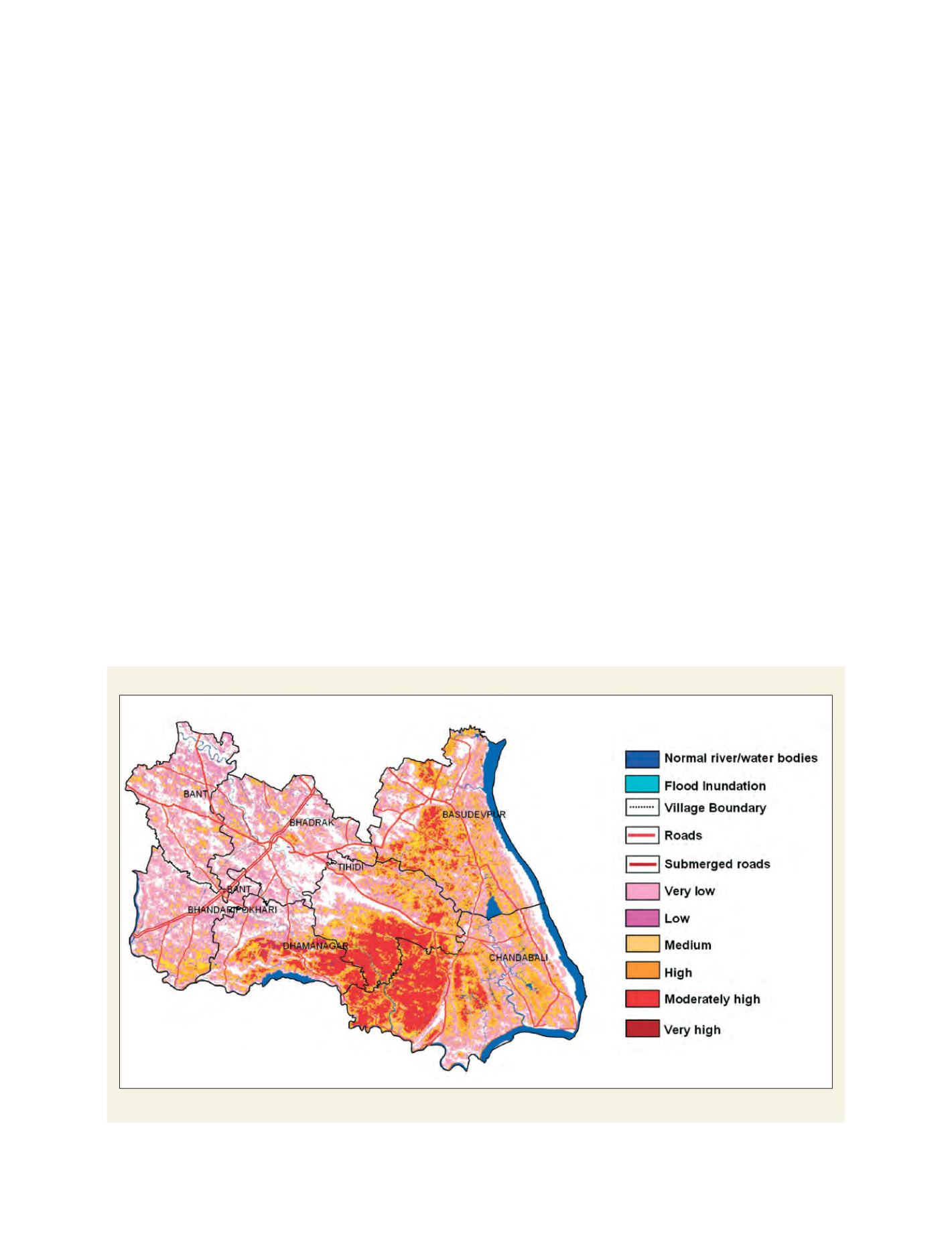
Automated procedures have been developed to delin-
eate flood inundation layers from satellite images. Flood
maps are composed at various scales from 1:500,000 to
1:25,000 showing administrative boundaries, settle-
ments, roads and rails and the extent of inundation.
high-powered committee – as well as a national committee after the
Gujarat earthquake in 2002 – for making recommendations on effec-
tive management of disasters in the country.
In December 2005 the Government enacted a Disaster
Management Act, which envisaged the creation of the National
Disaster Management Authority (NDMA) and the State Disaster
Management Authorities to develop and implement holistic
approaches for disaster management. The NDMA is responsible
for evolving policies, plans and guidelines for disaster manage-
ment, as well as coordinating the enforcement and implementation
of said policies. There are a number of organizations in the country
such as the Indian Space Research Organization (ISRO), the India
Meteorological Department, the Geological Survey of India and
the National Geophysical Research Institute, which are closely
associated with the NDMA and regularly contribute to disaster
management activity in a significant way.
Having more than two decades’ experience in the application of
remote sensing technology for operational disaster monitoring and
risk assessment, the Indian Government’s Department of Space
(DOS) has embarked upon the Disaster Management Support
Programme (DMSP), to take the benefits of aerospace technology
and apply them to disaster risk reduction in the country.
The Decision Support Centre (DSC) has also been established at
National Remote Sensing Agency (NRSA) to serve as a single-window
delivery point for disseminating value-added information on five
types of natural disaster. The DSC keeps a constant watch on the
prevailing disasters in the country by gathering information from
different sources. Analysis of space/airborne images, integration with
ground data, generation of user-friendly information products, timely
Flood hazard zonation map
Map showing the flood hazards for the Bhadrak district, Orissa state
Source: Flood reports of NRSA, India