


 127 / 280

Forest
– Improved forest class and biodiversity information at a
Pan European level.
Land carbon
– Understand and assess the impact of weather and
climate variability on terrestrial biospheric carbon fluxes in the
context of international conventions.
Natural resource monitoring in Africa
– Environmental monitor-
ing capacity in African countries.
Global crop monitoring
– Provides objective, real-time crop assess-
ment and yield forecasts to support EC policies in agriculture
(Common Agriculture Policy) and food security.
Next steps, new challenges and perspectives
The 2008-2010 period will be a key stage for the progress of GMES and
the success of its operational implementation. There are several key
challenges including, involving end-users and successfully collabo-
rating with the regional authorities; defining the balance between
mutualisation of resources at European level and
subsidiary at regional/member state level; building on
current preoperational services developed by the
European service industry; ensuring sustainable
public funding for the operation of core services; guar-
anteeing continuity of Earth observation sources and
increased coordination between satellite missions, cover-
ing sensor types, resolution and revisit; promoting
education, user training and public awareness, and coor-
dinating synergies and integration with other
international initiatives.
The Infoterra Group, along with all of its partners in
Europe, continue to contribute to the successful imple-
mentation of GMES, by providing geo-information
services, based on Earth observation data, to support the
day-to-day management of our changing world.
[
] 127
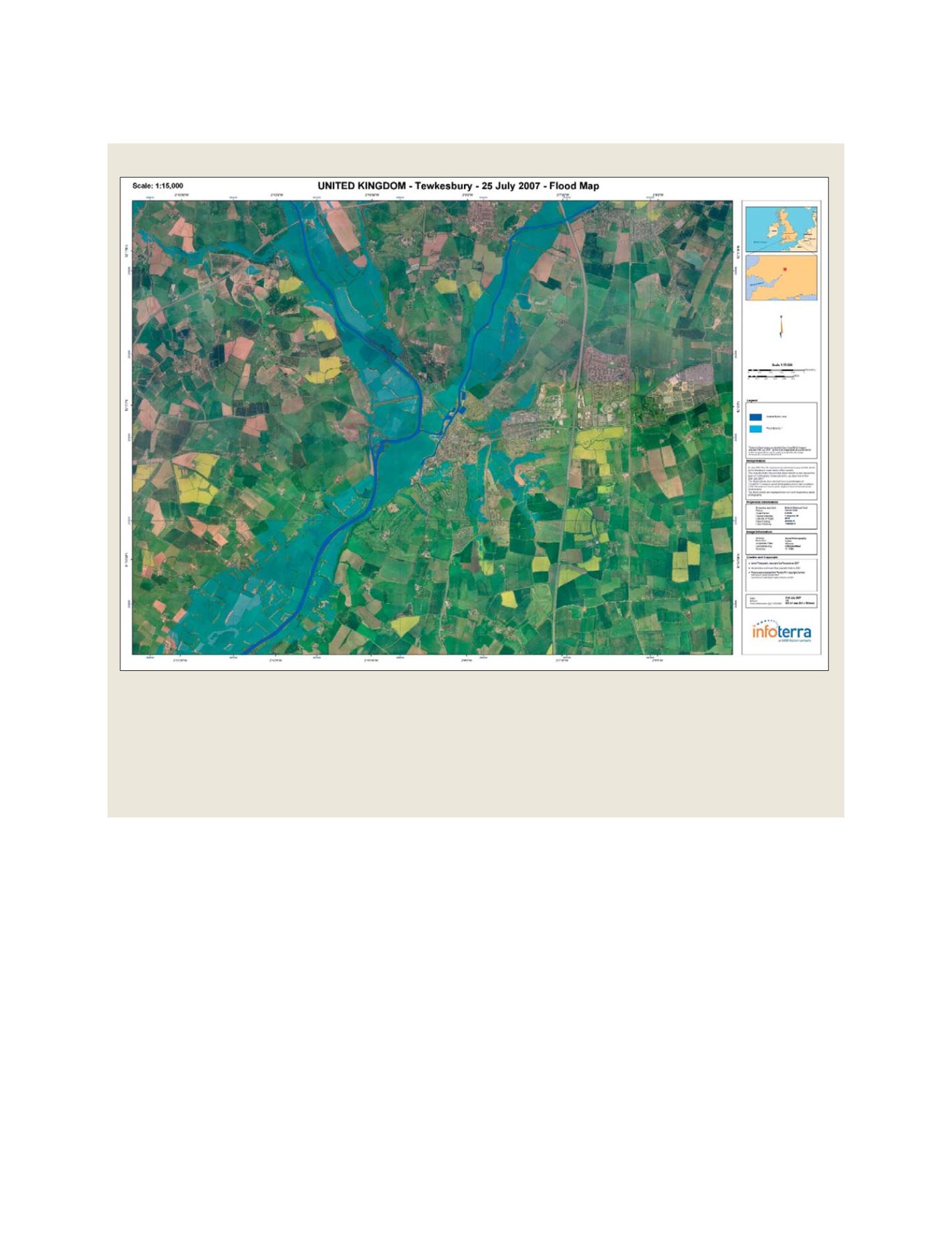
Flood mapping using new high resolution SAR images
Launched in June, the TerraSAR-X satellite has already delivered extremely
impressive test images displaying a remarkably high level of detail and quality.
The satellite is a joint venture under a public-private-partnership between
DLR and Astrium. Astrium developed, built and launched the satellite; the
exclusive commercial exploitation rights are held by Infoterra.
In July 2007, as a demonstration of the system capacity, TerraSAR-X was
used to map the extent of the floods affecting the United Kingdom. Infoterra
by combining radar imagery from TerraSAR-X with aerial imagery, produced a
flood footprint to show the impact and extent of a flood at that point-in-time.
Infoterra has produced a set of information layers combining
real-time EO imagery and GIS data, very useful for the
decision-making during and after the crisis. Infoterra’s experts
also ran various simulations using these information
products.
In addition to the Charter satellite fleet, TerraSAR-X satellite
has been tasked to provide high resolution radar imagery of
other flooded areas, although the satellite is still in the
commissioning phase
Source: ©Infoterra ©GeoPerspectives
GEOSS C
OMPONENTS
– D
ISSEMINATION
/I
NFORMATION
S
YSTEMS