


 129 / 280

[
] 129
But satellites see only the surface of the ocean;
processes taking place in its great depths cannot be
detected from space. Deep, global in situ observations
are necessary. This is a formidable challenge. One of the
key components of the Global Ocean Observing System
(GOOS) is the Argo network, which has been progres-
sively deployed during the last decade, to the point
where it is now reaching its nominal target of 3,000
floats in operation.
The information provided by the EMCS consists in
regular, operational, best estimates of ocean fields: temper-
ature, currents, waves, ice, heat content, surface fluxes
(evaporation), nutrients, chlorophyll, primary production,
etc. The products include observational and model data,
real-time mapping and forecasting. Ocean bulletins, indi-
cators, synthesis and statistics are prepared. Baseline data
are obtained from long-term retrospective analysis.
EMCS architecture: a system of systems
The system of systems relies on a network of monitoring
and forecasting centres, thematic data assembly centres,
and the associated information management infrastruc-
ture. The present pre-operational system comprises global
and regional monitoring and forecast centres (Arctic,
North-Atlantic and European shelves, Baltic, and
few years later, moorings are placed in a few selected locations. The
Argo network provides deep measurements every ten days on average.
One of the challenges and objectives of the EMCS is to combine
those data sets into coherent syntheses, to obtain systematic, uniform
and regular information on the state of the ocean. The basic method
to achieve the synthesis is well known, and widely used, for instance,
in weather forecasting. All available data are merged and assimilated
into high-resolution ocean models in order to monitor the ocean
physics, biogeochemistry and ecosystems and to provide forecasts
on prediction timescales ranging from days to months. One of the
main features of the system is its ability to provide consistent esti-
mates of the state of the ocean and regional seas as it is now, as it
was over the recent past (up to several years), and in the near future
(forecasts to a few weeks).
Satellite sensors provide invaluable data on such key parameters
as sea surface temperature, sea-ice concentration, extent and drift
velocity, wind and waves, sea level height, surface currents and
optical properties (which are related to biological processes). The
sensors are either active (high accuracy altimeter for sea level,
synthetic aperture radar or scatterometer for sea ice, wind and
waves), or passive (radio-meters operating in different spectral bands
for sea ice, ocean colour, or sea-surface temperature). Since the data
come from different satellites, each with its own characteristics,
careful inter-calibration work is needed to construct uniform vali-
dated and merged data sets for any given parameter.
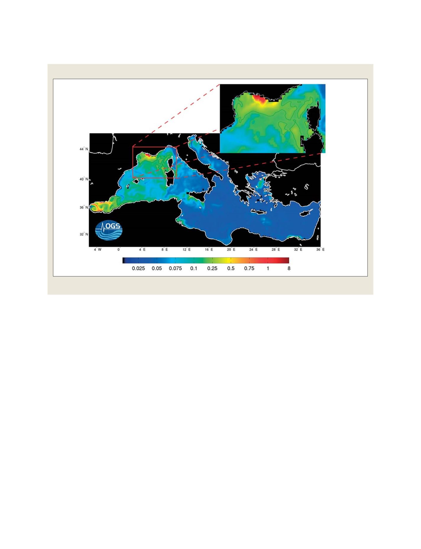
GOOS-derived image of the Mediterranean
Surface chlorophyll is predicted every week over the European regional seas
Source: Istituto Nazionale di Oceanografia e di Geofisica Sperimentale – OGS
GEOSS C
OMPONENTS
– D
ISSEMINATION
/I
NFORMATION
S
YSTEMS