


 135 / 280

[
] 135
Who is involved
The innovative SERVIR system is the result of collab-
oration between many partners. The US Government,
through direct technical and financial support from
the National Aeronautical and Space Administration
(NASA) and the US Agency for International
Development (USAID), and indirect support from the
National Oceanic and Atmospheric Administration
(NOAA) and the US Geological Survey (USGS), works
with CATHALAC, the Central American Commission
on Environment and Development (CCAD), and
participating countries to implement the system. Key
partners include the World Bank, the United Nations
Environmental Programme (UNEP), the Nature
Conservancy (TNC), the Institute for the Application
of Geospatial Technology (IAGT), the University of
Alabama in Huntsville (UAH), the University of
Maryland (UMD), and others.
Future plans
The SERVIR system is expanding functionality to
provide decision support for climate prediction, coral
reef monitoring, biodiversity conservation, agricultural
crop forecasting, and air quality monitoring. Upon
request, the system can be replicated and tailored to the
needs of other geographic regions. Current expansion
efforts are focused on Africa.
1
implications for flash flood forecasting. In Panama and El Salvador,
weather forecasters on the major television stations make use of
SERVIR forecasts in their daily televised weather reports.
Disaster response
– The SERVIR system has become an impor-
tant tool for policy makers in times of emergency. In November
2006, a stationary front in the Caribbean caused severe flooding
and landslides in Panama. Roughly 1,300 people were left home-
less, while 13 were reported dead or missing. Faced with further
damage to the country as the storm continued to develop, the
President and Vice President of Panama, along with the Ministers
of Housing and Health, visited the SERVIR facility in Panama to
get assistance with formulating a course of action to address the
crisis. The analysis by the SERVIR team regarding potential scenar-
ios of the storm provided the Panamanian Government, for the
first time in the nation’s history, with important information to
issue advisories to the communities at risk. To ensure that the
vulnerable populations received evacuation notification, the civil
protection authority worked with private phone companies to send
warnings via cell phone text messaging. As a result of the advi-
sories, the inhabitants of Panama’s northwestern provinces were
prepared for the flooding and landslides, which occurred as fore-
cast. Among others, the SERVIR team has also provided decision
support in the case of Hurricanes Stan and Dean, in the flooding
of the Sixaola River between Costa Rica and Panama, and the 2007
Mountain Pine Ridge fires in Belize.
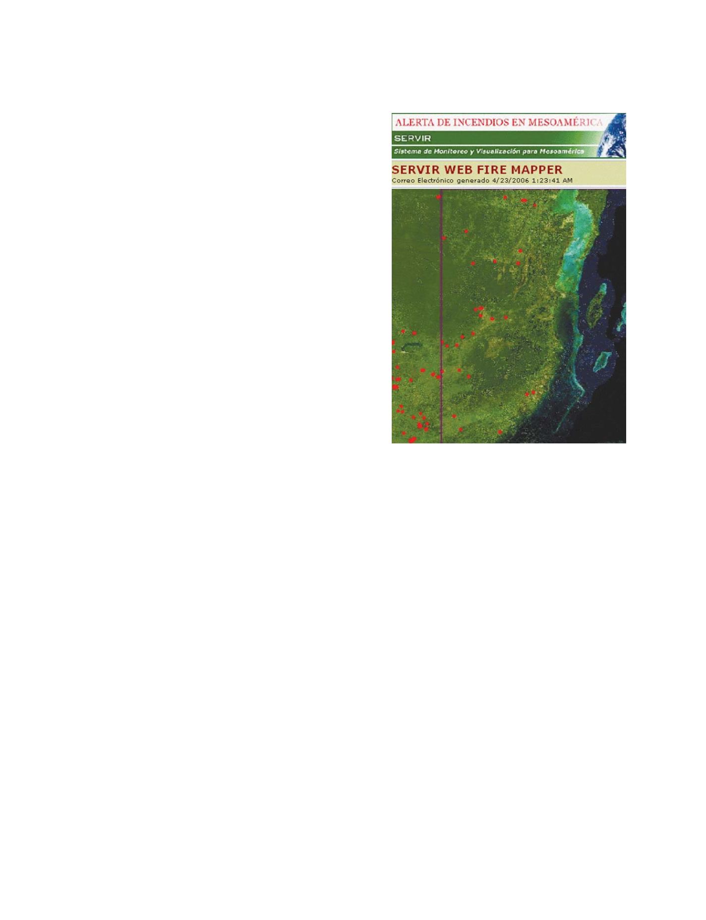
Fire monitoring
– SERVIR is used by managers of protected areas
throughout Central America. By monitoring hotspots throughout
the region, the system’s Web Fire Mapper, implemented in part-
nership with the University of Maryland, detects burning fires and
can alert users via e-mail about the location of the fires. In
Nicaragua, the forestry department sends out ground crews to
assess the situation upon receipt of fire alerts from the system.
Fire alerts can be made available to anyone who requests them
through the SERVIR web portal.
Red tides
– Harmful algal blooms in the ocean indicate toxic
conditions for fishing. Commonly referred to as red tides, algal
blooms can be detected with remote sensing technology. The
SERVIR system makes available satellite data that can be used to
monitor the ocean tides. In El Salvador, for instance, the Ministry
of Health uses SERVIR to check potentially unsafe areas, thereby
avoiding health problems for fish consumers and maintaining an
economically healthy market for domestic consumption and export.
Air pollution
– In May 2007, the countries of Guatemala, Costa
Rica and Nicaragua alerted their citizens of a toxic cloud hover-
ing overhead that was perceived to have blown across the Atlantic
Ocean from Africa. Concerned about breathing the outdoor air,
people remained indoors and authorities considered keeping chil-
dren out of school and even closing businesses. Amid multiple
reports in the media of the toxic African cloud, the SERVIR team
was asked to conduct analyses of the cloud to better understand
the potential threat to the population. Using satellite and model
data from the SERVIR system and recreating the region’s weather
patterns, the team was able to show that the cloud did not origi-
nate in Africa, but within Central America. The ‘toxic cloud’ was
actually smoke from areas burning in Central America, and had
circulated back over the land due to an unusual calming of the
trade winds. Once the media obtained the SERVIR analysis, news
reports allayed public concern about the cloud, and people
returned to normal life.
SERVIR provides resource managers across Mesoamerica with
access to information on daily fire hotspot locations, shown
here as red dots
GEOSS C
OMPONENTS
– D
ISSEMINATION
/I
NFORMATION
S
YSTEMS