


 128 / 280

[
] 128
European Marine Core Service: global
and regional ocean monitoring and
forecasting, a service to society
Yves Desaubies, MERSEA project and European Marine Core Service Consortium
T
he pervasive influence of our planet’s ocean, seas, and
coastal areas on climate and their impact on a range of
essential activities is widely recognized, and forcefully
argued elsewhere in this volume. Mankind, living on less than 20
per cent of the Earth’s surface, is heavily dependant on the ocean
and its seas for living and mineral resources, notably fisheries,
sea farming and offshore industry. Most of the transport of
goods, in particular oil, is by way of the seas; on the ocean floor
are laid countless pipe and gas lines; fiberoptic cables convey
information and data from continent to continent. A large part
of the Earth’s population lives in coastal areas, vulnerable to
storm surges, sea-level rise, erosion and pollution.
It is understandable that responsible management and wise use of
our planet’s resources requires global observations of the highest
quality. But beyond observations and data, a wide range of stake-
holders – policy makers, scientists, service providers, the general
public – expect information and specific products
designed for their needs. They also expect a service that
not only provides easy access to the information and
data, but also assistance and expertise.
The European Marine Core Service (EMCS) is being
set up to provide an integrated service in support of safe
and efficient offshore activities, environmental manage-
ment, security and sustainable use of marine resources.
The service relies on an integrated European operational
system of global monitoring and forecasting of the ocean
and a coordinated network of regional systems tailored
to European waters. EMCS delivers a set of basic, generic
information products based on physical and biogeo-
chemical state variables.
Although the services are developed primarily to fulfil
the reporting, monitoring and forecasting requirements
of European agencies and stakeholders, they do have a
global scope. The provision of services is based on access
to ocean products and information, such as long time-
series data to define the mean, fluctuations and past
trends in the state of the marine environment; to record
its evolution and the success or otherwise of policy
responses and, with predictions of future change, to estab-
lish baselines for effective environmental management.
The system is critically dependant on the availability
of Earth Observation data from satellites, from global in
situ networks, such as the Argo
1
array, surface drifting
buoys and other moored and ship borne data, and from
coastal observing systems. EMCS validates, combines
and merges all available data to produce regular and
systematic reference information on the state of the
global ocean and of the regional European seas.
From data to information: the challenge
The Global Ocean Observing System (GOOS) delivers
diverse data sets, from satellite sensors and from in situ
networks, over the global open ocean and over coastal
areas, mostly in industrialized countries. The coverage is
very sparse, leaving vast areas unsampled, and it is irreg-
ular in time and space: repeat tracks from orbiting
satellites can range from 10 to 30 days, inter-track spacing
from 300 to 100 km, with different swath width; obser-
vations along ship lines are repeated once a month. Or, a
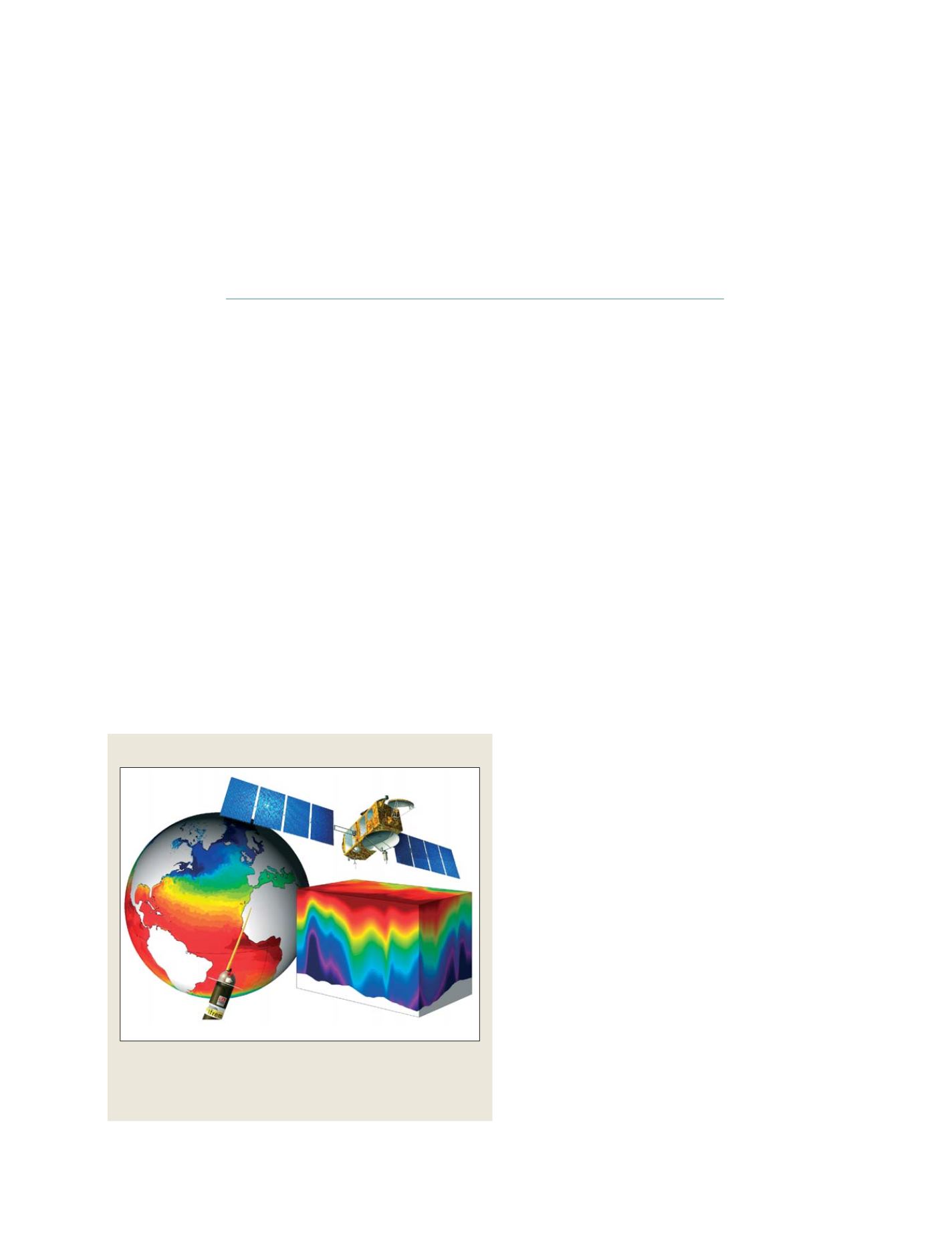
Global Ocean Observing System
The EMCS combine observations from space and in situ (from the Global
Ocean Observing System) to monitor and forecast the state of the global
ocean and the European regional seas. Here, a global sea surface
temperature analysis
Source: Mercator Ocean
GEOSS C
OMPONENTS
– D
ISSEMINATION
/I
NFORMATION
S
YSTEMS