


 238 / 280

[
] 238
Rapid biological and ecological
assessments using Earth observation data
Douglas M. Muchoney, Group on Earth Observations
E
arth observation data including satellite, aerial and ground
data have an extensive history of use to characterize and
monitor marine, coastal, freshwater and terrestrial environ-
ments. Rapid assessments are undertaken for a whole host of
reasons, including protected areas system design and gap analy-
ses, protected areas assessments, threat assessments, management
planning, and biological and ecological inventories.
Such assessments are conducted across the entire array of the Earth’s
ecosystems including marine parks and corals reefs, coastal zones,
wetland and forests. Rapid assessments are undertaken when there is a
need to quickly obtain information on biological, ecological and envi-
ronmental status over large areas, and where there are constraints on
resources or access issues such as harsh or dangerous terrain.
Rapid assessments take advantage of the synoptic view that satellites
provide, in addition to other geospatial data such as soils, geology and
terrain data (often satellite-derived as well). They often use aerial data
such as photography and videography, and collect field data to under-
stand the relationship between what is observed from space
and the air, to actual ground conditions. The field data are
also used to ‘teach’ or ‘train’ computer pattern recognition
algorithms to recognize different types of vegetation. The
pattern recognition software can be quite straightforward,
involving just a satellite image interpreter that uses colour,
tone, pattern and texture to distinguish between different
features of the landscape, while others use sophisticated
decision tree and neural network algorithms that are
designed to function as the human mind does.
In this sense, rapid assessments incorporate many of
the aspects of GEO: they require satellite data for synop-
tic views of the landscape, they use intermediate aerial
and high-resolution satellite image data, they integrate
remote sensing and other geospatial data, and they
employ field data collection to understand the satellite
and aerial data. The data that are used include soils,
geology, digital terrain, climate and hydrology. There is a
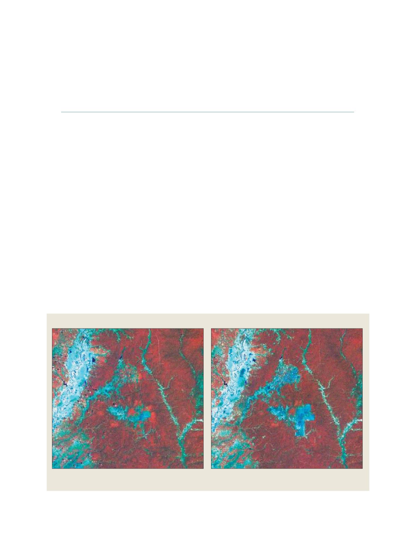
Landsat Thematic Mapper Data 2002 (left) and 2004 (right)
The data enabled the researchers to map the extent and condition of the
groundwater swamp forests of the Prey Long region, as well as its alteration over time
Source: Landsat satellite data, courtesy US Geological Survey
S
OCIETAL
B
ENEFIT
A
REAS
– E
COSYSTEMS