


 237 / 280

[
] 237
extending the existing 1990 and 2000 Geocover Landsat global dataset.
The 2005 dataset marks a major contribution in terms of basic data
support for any global and regional land mapping activity where user
communities require land change information at least
every five years. Many national programs already work
with such data.
Meanwhile, the international community is producing
a ‘best available’ global land cover dataset that could evolve
into a ‘GEO global land cover product’. Starting with exist-
ing, moderate-resolution global land cover datasets, the
community harmonizes and validates existing data to
derive the best land cover estimate for each location world-
wide. Synthesized global maps have been developed for
particular user communities. The idea is to further develop
this product including regional high-resolution products
until a new high-resolution (change) product is produced
(the final goal of DA-07-02).
Ongoing commitment and priorities
GEO has helped to bring the relevant community together
over guidance and implementation plans for building a land
cover observing system as part of a global earth observation
system of systems. On the strategic level, the land cover
community provided a roadmap built onGEO requirements
to formulate global observation strategies and implemen-
tation guidelines (i.e. integrating IGOL into GEO).
There is an essential need to ensure the availability of
baseline observations. For 2010, the availability of Landsat
and Landsat-type data is considered tenuous, and the
community is asking GEO to help with ensuring that the
decadal global high-resolution satellite mosaic will be
produced to reach at least the quality of the 1990, 2000 and
2005 global datasets. There is no lack of observations since
many countries maintain Landsat-type satellite assets, which
are used for a variety of land cover and secondary products.
It would be an international coordination task to ensure
such a global mosaic is jointly produced, but also a major
step towards building a system of systems.
Existing national and regional land cover databases,
Globcover and efforts to evolve a GEO global land cover
map will be the starting point to developing new global
high-resolution (change) products. It is important to
emphasize that an operational land cover observation and
validation system is needed to fully achieve the societal
benefits advocated. We expect GEO to mobilize more
international actors and countries to sign up for this
process and jointly participate in continuous and consis-
tent global land cover observations. As an example, global
land cover issues are increasingly addressed as part of the
European Commission’s activities for Global Monitoring
for Environment and Security (GMES).
International cooperation on the continuity of global
observations, ensuring consistency in land monitoring
approaches, community engagement and country partic-
ipation in mapping activities, regional networking and
capacity building remain essential challenges for building
a sustained global land cover observing system. The expe-
riences and progress reported here demonstrate initial
GEO successes that should evolve and be further extended
to related issues which are currently thoroughly addressed
by GEO (e.g. fire observation) or need further GEO
engagement (e.g. land use observation).
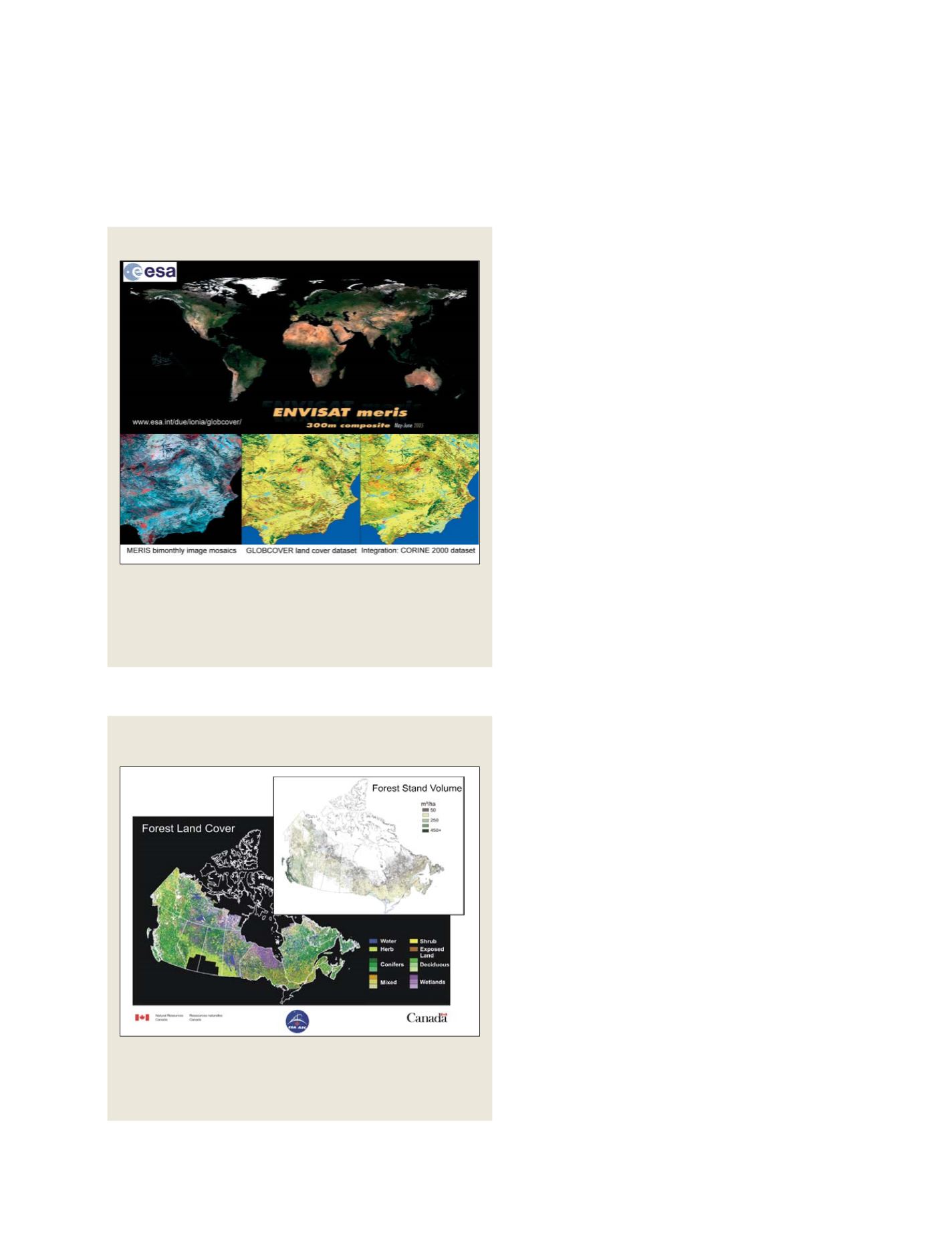
Global mosaic of MERIS satellite data
Global mosaic of MERIS satellite data presented at ESA’s Envisat conference
in April 2007 (top). The bottom row presents examples of processed MERIS
bimonthly mosaics (in an area of Southern Spain) used to create the
Globcover 2005 land cover data. Efforts are underway to link the new global
data with regional products like the European Corine 2005 dataset
Source: O. Arino, ESA
National land cover and secondary
product using Landsat-type satellite data
An example of a Landsat-type national product is the Earth Observation for
Sustainable Development (EOSD) land cover map of the forested areas of
Canada. The inset map depicts forest volume distribution, derived from
integrating land cover with climate and Canada forest inventory data
Source: R. Hall and E. Arsenault, NRCan
S
OCIETAL
B
ENEFIT
A
REAS
– E
COSYSTEMS