


 241 / 280

[
] 241
have been possible without a long-term, regional satel-
lite data archive.
Distinguishing human-induced degradation from
drought
In arid and semi-arid regions vegetation production
varies between years caused primarily by inter-annual
rainfall variability. Southern Africa suffers periodic
droughts, some caused by the El Niño phase of the El
Niño-Southern Oscillation (ENSO) cycle. Extreme vari-
ability in vegetation production between years makes it
exceedingly difficult to distinguish long-term changes
caused by human-induced land degradation from the
effects of periodic droughts. One approach to monitor-
ing land degradation is to use both long-term AVHRR
NDVI data and rainfall surfaces to identify any negative
trends in vegetation production per unit rainfall through
time (1985–2003).
8
In the Limpopo Province negative trends were
largely associated with the degraded communal lands,
although some well-known degraded areas did not
show continued negative trends during the study
period (1985–2003). A distinction should be made
between degradation that occurred within or before
the start of the satellite time-series; some homelands
were created as early as 1913 so much of the degra-
dation could have occurred before and may not have
worsened since. The results of this analysis in north-
ern SA are validated by the National Report on Land
Degradation,
9
which shows the perceived rates of
energy used by plants for photosynthesis. Remotely sensed vegeta-
tion production may very well be the single most useful indicator of
land degradation at regional and decadal scales.
3
In the early 1990s NDVI data from the Advanced Very High
Resolution Radiometer (AVHRR) sensor on the NOAA series of
meteorological satellites were analysed and showed that the Sahara
desert was not marching southwards into the Sahel, but rather
expanded and contracted as a result of interannual variations in
rainfall.
4
Recently, a number of studies using 20 years of AVHRR
NDVI data have shown that the Sahel, which was once believed to
be suffering severe desertification, has in fact become greener
during the past ten years as a result of higher rainfall.
5
The occur-
rence of desertification in the Sahel and elsewhere has become
highly controversial, but the debate is being conducted in the
absence of objective, consistent data at the appropriate scales.
While repetitive, global remote sensing has been applied to
mapping and monitoring degradation, interpretation of the results
has not always been based on sound ecological principles. A criti-
cal aspect of a useful degradation mapping and monitoring system
is the ability to distinguish the impacts of human activities from
natural variability in climate and spatial variations in soils and land
cover types.
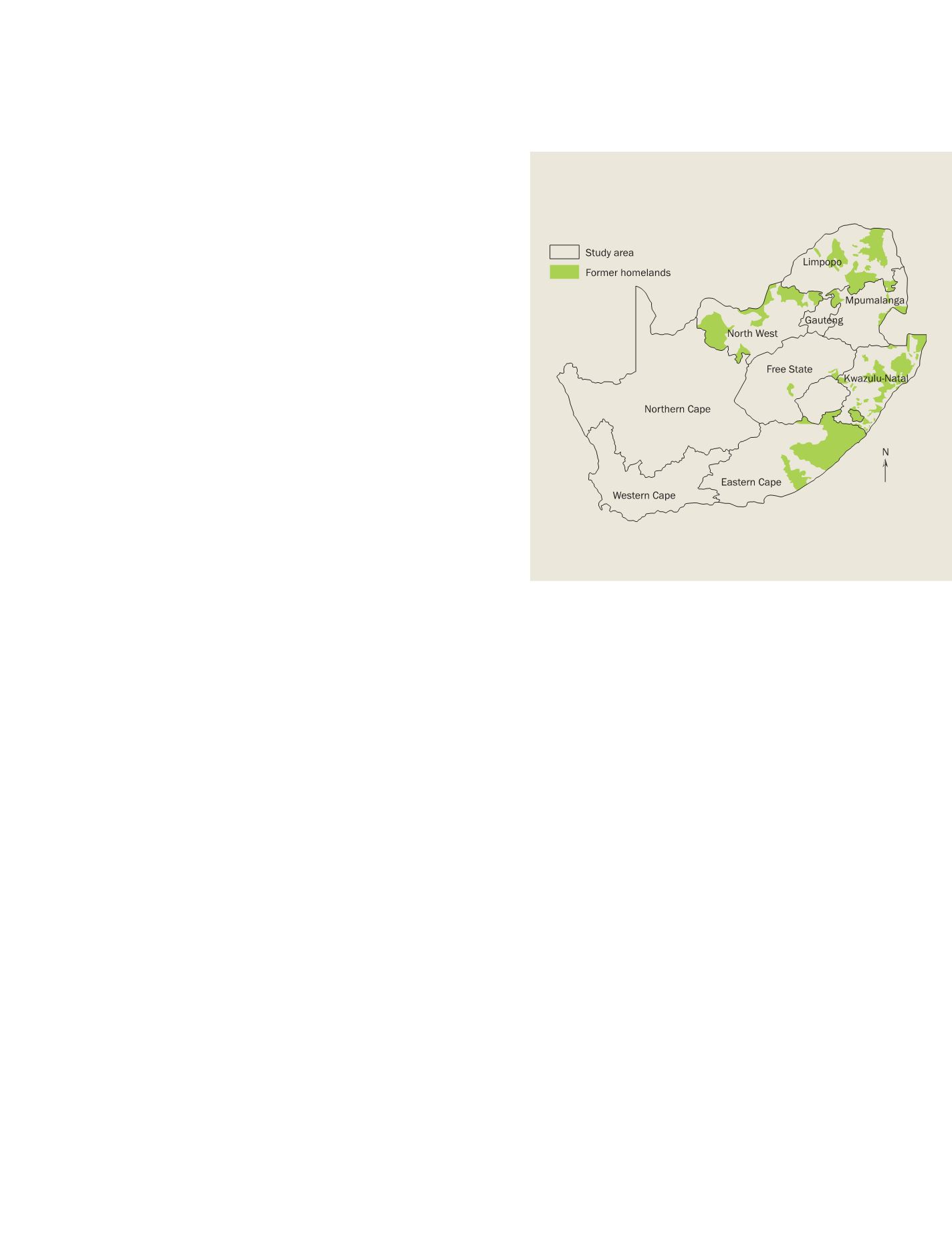
Land degradation in the former homelands of South Africa
In South Africa, large degraded areas have been found within the
former ‘homelands’ – self-governing areas created before and during
the Apartheid era.
6
Today these homelands, now called communal
areas, are characterized by high human and livestock populations,
overgrazing, soil erosion and sparse grass cover. Degradation contin-
ues to threaten the local resource base upon which rural communal
livelihoods depend. The underlying cause of degradation is a combi-
nation of unemployment, poverty and an absence or failure of land
use regulation. The degradation observed in the communal lands is
thus principally a consequence of high population densities caused
by the oppressive apartheid system rather than the outcome of tradi-
tional communal pasturalism.
These degraded rangelands have been subjectively mapped using
single date Landsat images as part of the National Land Cover (NLC)
map. The vast majority of the large degraded areas fall within the
communal areas. We investigated the long-term vegetation produc-
tion of these degraded areas with 18 years of 1km
2
resolution
AVHRR NDVI data by comparing them to non-degraded adjacent
areas with the same soils and climate. It was found that the non-
degraded areas had consistently higher vegetation production as
indicated by the seasonal total of NDVI obtained from satellite obser-
vations despite a six-fold variation of annual rainfall. This indicates
that the degraded areas produce less vegetation per unit of rainfall
and suggests that they may have changed to a different ecological
state. The results nevertheless indicate that these degraded areas are
functionally stable and resilient, but never reach the same vegeta-
tion productivity as the neighbouring non-degraded areas.
7
These
results are both alarming and encouraging: alarming because the
degraded state seems to be permanent; and encouraging because
the difference in productivity was approximately 20 per cent, far
from a complete loss of production as is sometimes suggested in
degraded areas. Whether the difference in total rangeland produc-
tion translates into economic loss remains to be determined. These
results have made a significant contribution to understanding the
ecological processes in degraded areas – research that would not
Former homelands, provinces and study area in South Africa
Source: K Wessels
Large degraded areas have been found in South Africa’s former homelands
S
OCIETAL
B
ENEFIT
A
REAS
– E
COSYSTEMS