


 245 / 280

[
] 245
Developing operational satellite data products for community
benefits
The Indian National Centre for Ocean Information Services
(INCOIS), in an effort to support the communities of small trawler
owners, has been generating Potential Fishing Zone (PFZ) advisories,
which use satellite-based sea surface temperature and chlorophyll
maps to identify features such as upwelling, eddies, fronts, and mean-
ders. The coincidence of frontal zone positions of chlorophyll and
SST gradients indicate coupling of biological and physical processes
and potential fish aggregation sites. These identified features are used
to generate PFZ maps and PFZ text that give those with access to
GPS systems information on latitude, longitude and depth of PFZs.
Considering that the majority of users are traditional fishers, infor-
mation on angle, direction and distance from landing centres/light
houses are also provided. PFZ advisories are prepared in many
languages and disseminated through a variety of media formats.
Results show that PFZ advisories have reduced search times between
30 to 70 per cent, improving the benefit to cost ratio from about 1.3
to over 2.0. Twenty-seven per cent of trawler owners (about 27,000)
use the facility. Future plans include integration of currents to increase
the validity of the forecast and closer liaison with the Department of
Fisheries to monitor the effect of increased catches on fish stocks.
Training in the use of operational satellite products
In September 2003, Nigeria successfully launched NigeriaSat-1. This
marked an important step in using satellite remote sensing for coastal
management in the country, and of utilizing space-acquired infor-
mation for management and research. The critical mass of capacity
to maximise benefits from NigeriaSat-1 has suffered severe attrition
through lowered funding support, resulting in a shift away from this
field. Against this background the National Space Research and
Development Agency (NASRDA) and the Institute of Ecology and
Environmental Studies, Obafemi Awolowo University, signed a
memorandum of understanding for capacity building in remote
sensing and GIS in 2006.
Many ‘train-the-trainer’ initiatives have been conducted to catalyze
a large home-grown manpower development programme in the country,
culminating in the commencement of a series of regular regional capac-
ity building workshops. The first such, held in collaboration with the
Source: CICESE Wave Group
The use of such devices marks an important step in using satellite remote
sensing for coastal management, and of utilizing space-acquired information
for management and research
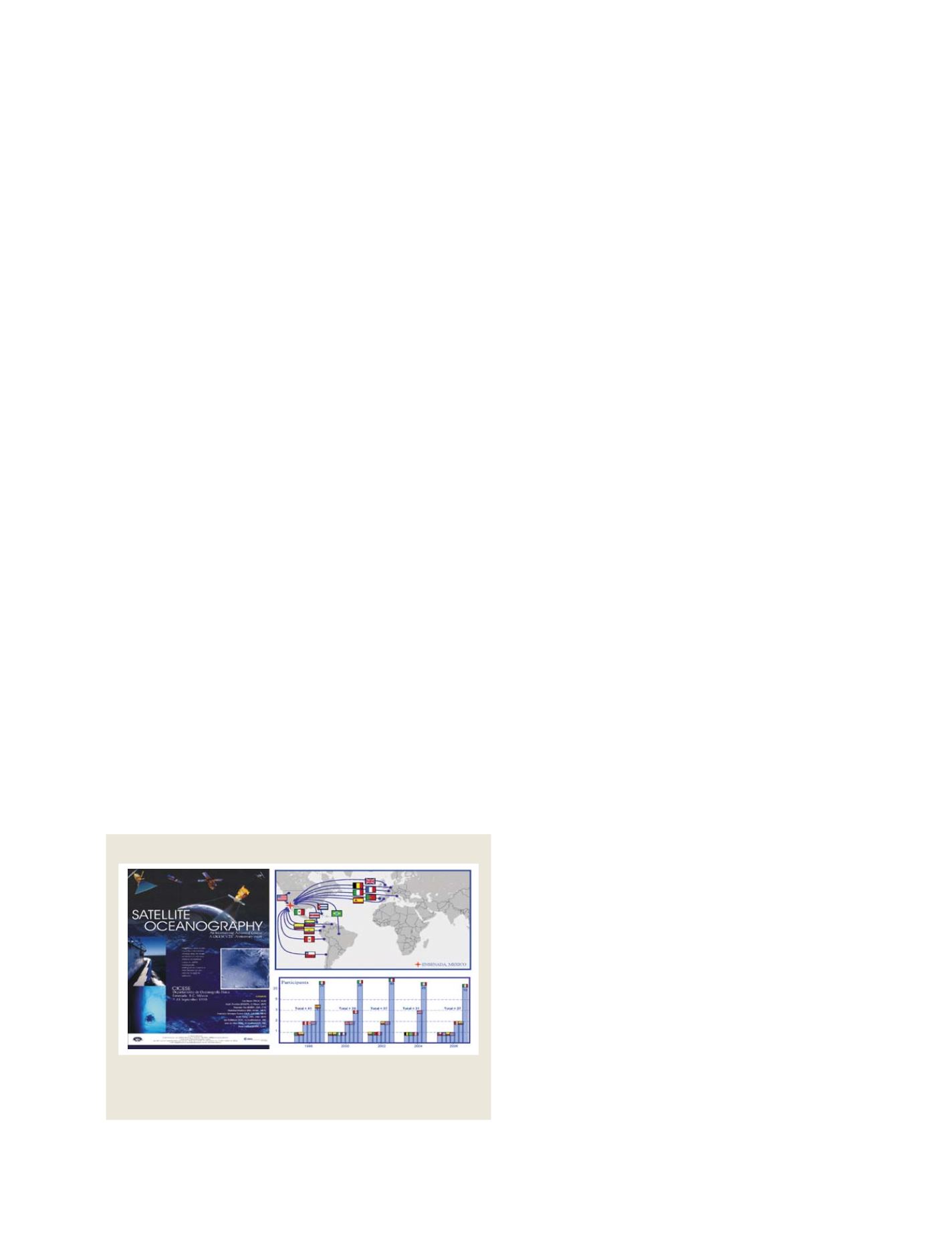
The Satellite Oceanography course
African Regional Centre for Space Science and Technology
Education and supported by UN Office for Outer Space
Affairs, was on Capacity Building on Use of Landsat Data
Sets for Sustainable Management in Africa. The govern-
ment’s programme to use space-acquired information is
supported by a self-driven effort in this regard.
Nurturing a world-class training course
Scientists from the Centro de Investigacion Cientifica y
de Educacion Superior de Ensenada (CICESE) recog-
nized that directing the capacity to train students from
developing nations in satellite and in situ data analysis
and applications leads to wider and better use of Earth
observation data sets. As a result they established a
successful satellite oceanography course that has run
every second year since 1998. Internationally recognized
faculty and researchers have participated in this course
each time it was offered. The satellite oceanography
course has been mainly supported by the European Space
Agency (ESA), while some financial aid has also been
received from other international and national offices.
CICESE will host the sixth edition of a three-week inten-
sive course in satellite oceanography in August 2008.
Through the course, students and young profession-
als learn to utilize satellite data for applications relevant
for ocean monitoring. The course is now highly regarded
and its strong foundations, based on lecturers of the
highest academic standards, are widely appreciated. One
could argue that it provides an example for capacity
building strategy that international agencies could
follow for other areas in Latin America and the
Caribbean. However, it is important to remember that
few institutions in the developing world have a suffi-
cient number of experts to delve as deeply as the
CICESE satellite oceanography course, which covers
practically all ocean observation and sensor types.
The way to sustainability
The capacity-development process promises to be a
lengthily one, but done correctly it could be our only
chance to achieve true sustainability. Many examples
show that in spite of poor resources, determination at
the policy-makers level can always drive the agenda. In
these cases, capacity-development is self-driven and
sustainable. However, the question of poor infrastruc-
ture remains. It is in this area that sponsors can make
the greatest contributions in collaboration with recipi-
ent countries.
It is clear that there are two primary phases that
emerge in sustainable capacity-development. The first
is in establishing firm foundations in marine sciences
and the competencies to address national priorities.
Once these are established scientists from the develop-
ing world are in a better position to create the products
that their governments need. It will be at this time when
they can collaborate as peers in regional implementa-
tion of global programmes. Only then will GEOSS
become a globally shared and globally beneficial
Observational System of Systems.
S
OCIETAL
B
ENEFIT
A
REAS
– E
COSYSTEMS