


 67 / 280

[
] 67
Argo – a global ocean
observing system for the 21st century
Howard Freeland, Institute of Ocean Sciences/Fisheries and Oceans Canada;
Dean Roemmich, Scripps Institute of Oceanography;
John Gould, National Oceanography Centre,
and Mathieu Belbéoch, Argo Technical Coordinator
A
rgo is an innovative ocean monitoring programme that
is entirely different from anything undertaken previously
in the oceans of the world. To understand how different
it is from earlier approaches, it is instructive to compare it with
the only previous attempt to observe the climate state of the
oceans.
The World Ocean Circulation Experiment (WOCE) was first
suggested in the late 1970s, and following a decade of planning, it
became reality with an intensive field programme between 1990 and
1997. During that period, scientists from 25 nations collaborated in
a top-to-bottom survey of the world’s ice-free oceans.
During WOCE, research vessels carrying large science teams occu-
pied more than 20,000 sampling stations, measuring temperature,
salinity, velocity, dissolved oxygen, nutrients and geochemical
tracers. The ship-time alone, 25 ship-years spread across the inter-
national research fleet, cost about USD200 million. The WOCE
survey was of enormous scientific value, not least in providing a
baseline against which change can be measured. But in being tied
to the research fleet, it had intrinsic limitations. There were large
unobserved areas between the survey lines. Not only were there
gaps in spatial coverage, but the long time required to complete the
global survey also posed problems. This ‘snapshot’ of
the oceans extended over seven years during which
there were seasonal changes but also, more importantly,
climate shifts came and went. There were strong inter-
annual changes due to El Niño and other climate
phenomena and so this snapshot raises serious issues of
representation. Finally, and perhaps most significantly,
the high cost of research vessel surveys allows only a
subset of the WOCE lines to be resampled approxi-
mately every decade, giving limited information on
global scale climate variability.
A technological breakthrough was needed to enable
regular sampling of the ocean’s interior, and the seeds
of that breakthrough sprouted early in the WOCE
survey itself. As a part of WOCE, free-drifting buoys
were developed to measure ocean circulation patterns
at about 1 km depth. These instruments rose to the
sea-surface on a monthly basis to have their positions
determined by satellite, and then sank again to their
drifting depth. As the technology matured, tempera-
ture sensors were added to the buoys, and then salinity.
By the late 1990s it became apparent that a revolu-
tionary new way of doing oceanography had been
developed.
In 1998, the Argo Prospectus was circulated, outlin-
ing this new method. Scientists of all nations were
invited to participate in the deployment of a global
array of 3,000 robotic drifting buoys. These would drift
in deep water; have lifetimes of four-to-five years and
supply profiles of ocean properties every ten days. By
collecting over 100,000 profiles per year of tempera-
ture and salinity and drift measurements of ocean
circulation, Argo would be able to track the physical
state of the oceans. So in only a decade, the time
required to obtain a snapshot of the climate state of the
oceans had been reduced from seven years to just ten
days!
The Argo plan was enthusiastically received, being
quickly endorsed by the World Climate Research
Programme’s Climate Variability and Predictability
(CLIVAR) study, the Global Ocean Data Assimilation
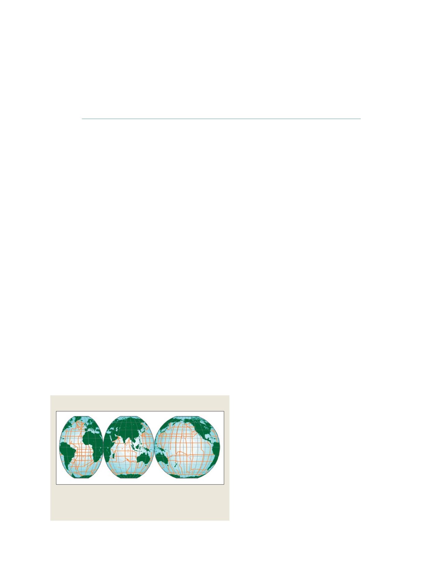
Survey lines occupied during the field programme phase of WOCE
This ‘snapshot’ technique had intrinsic limitations, with large unobserved areas
between survey lines, gaps in spatial coverage and a long timescale that did
not necessarily observe climate shifts and interannual changes. Thus, it raised
serious issues of representation
Source: WOCE Hydrographic Program Office
GEOSS C
OMPONENTS
– O
BSERVING
S
YSTEMS