


 68 / 280

[
] 68
Argo data are subjected to automated quality checks
and made publicly available within about 24 hours of
collection at two Global Data Assembly Centers
(GDACs). Operational centres and other users may
acquire this near real-time data either from GDAC via the
Internet or from the World Meteorological Organization’s
Global Telecommunications System. A research-quality
version of the data is prepared by expert examination of
all float data, using internationally agreed protocols, and
is similarly available from the GDACs. The Argo
Information Centre maintains a searchable database of all
float positions, and serves the programme in many differ-
ent ways by facilitating communication and exchange
between national Argo programmes and users.
While the basic Argo float collects temperature and
salinity profiles in the upper 2 km of the oceans, tech-
nological advances will broaden the use and applications
of Argo in the future. Argo floats can carry additional
sensors for dissolved oxygen and other ocean proper-
ties. Several approaches are being tested to allow
sampling under seasonal ice cover. The present 2,000-
metre depth limitation could be extended with
modifications to the pressure hull and pumping system.
Finally, a sophisticated new version of the instrument
(the glider) with wings, a streamlined hull and active
Experiment (GODAE), and the Global Ocean Observing System
(GOOS). The strong consensus for a global Argo array was promoted
by national agencies as well as by scientists around the world, and
plans to begin deploying Argo floats developed rapidly. Initial deploy-
ments began in 2000, with regional arrays expanding and
technological hurdles being overcome in 2001-2003. By 2004 deploy-
ments were on a global scale and the target rate of around 800 floats
per year was achieved. As of mid-2007 there are 26 nations deploy-
ing floats in support of Argo, and the initial objective of a global
array of instruments at about 3° spacing has been reached.
How do Argo floats work?
Argo floats are made in several countries, and while there are differ-
ences in design, the basic concept does not vary. A float is launched
at the sea surface from a research vessel, commercial ship or aero-
plane. The float sinks to about 1,000 metres depth, and drifts with
ocean currents for ten days. After this interval, the float dives to
about 2,000 metres, and then ascends to the sea surface, measuring
temperature and salinity on the way up. At the sea surface, the data
are transmitted to a satellite and relayed to a ground station and data
centre. Meanwhile, the float again sinks to 1,000 metres to start a
new ten-day cycle. To achieve this ascent and descent, floats change
their buoyancy using a high-pressure pump that moves mineral oil
into an external rubber bladder for ascent, or draws it back inside the
instrument for descent.
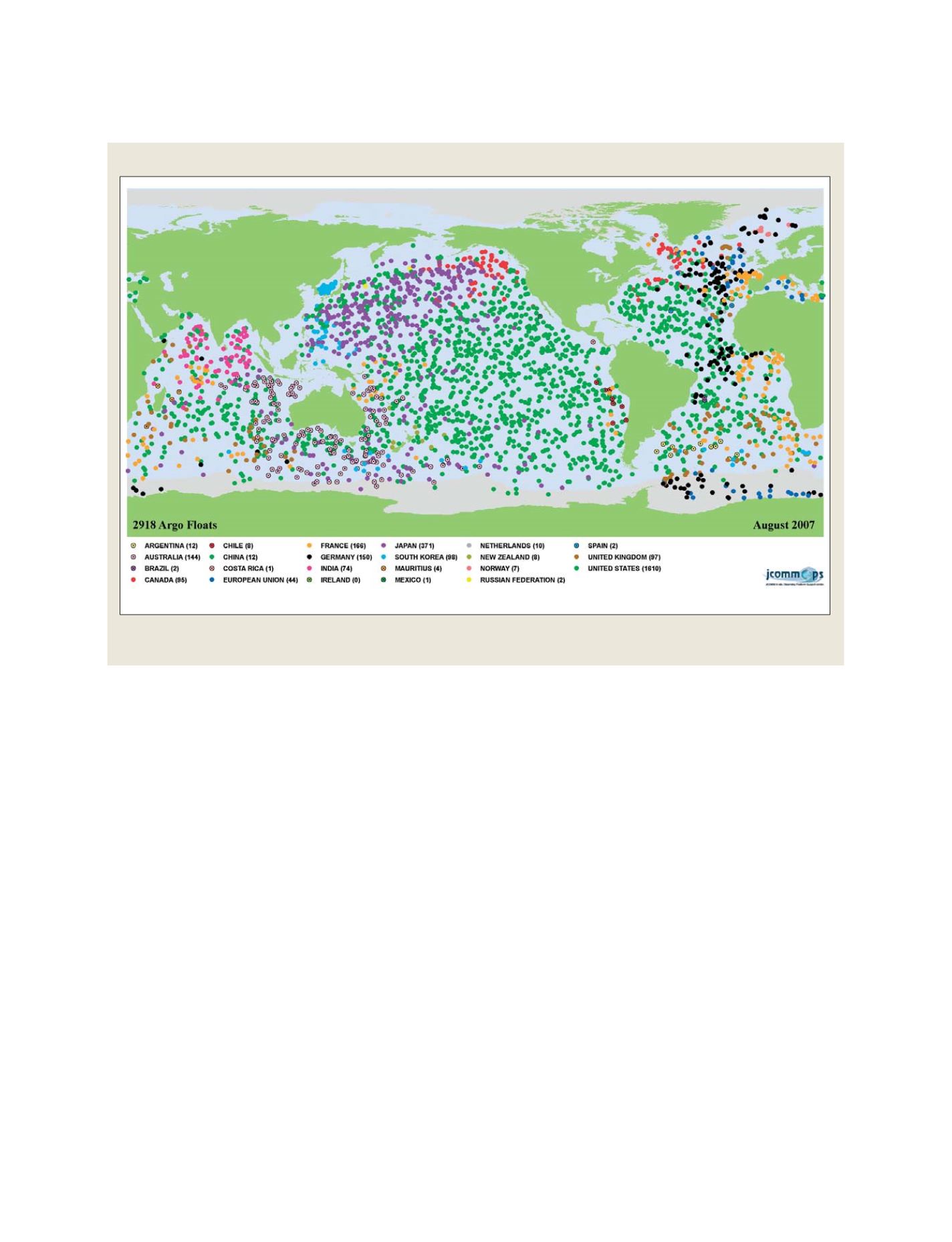
The distribution of floats in the Argo array, August 2007
As of mid-2007, 26 nations were deploying floats in support of Argo.
The initial objective of a global array of instruments at about 3°spacing had been achieved
Source: Argo Information Centre – Mathieu Belbéoch
GEOSS C
OMPONENTS
– O
BSERVING
S
YSTEMS