


 71 / 218

[
] 71
releasing a sufficient discharge at Manantali, taking into account
of the real-time discharge of Bakoye and Faleme Rivers, which
are downstream of the dam. This time, scheduling allows the
starting of recession cultures before mid-November, in relation
to the properties and needs of the plants.
The now research aims to improve the potential benefits
given by the forecasts for Manantali. With this aim, many
different rules for use of the forecast in management will be
tested leading to an improved set of management rules.
Furthermore, similar research will be done for neighbouring
catchments of West Africa, aiming to forecast the natural flood
discharges of rivers like Niger or Volta with Arpége results. The
use of the probabilistic forecast will be also tested in the near
future, notably translating it in terms of possible scenarios and
actions for the dam manager. Finally recalibration of the whole
application will be scheduled by the end of 2007/beginning of
2008, in order to benefit from an improved version of the
Arpège model, namely a coupled version using improved para-
meterisations and improved assimilation for the oceanic state,
an increased size for the ensemble (41 members) and for the
hindcast experience. These perspectives are clearly supported
by the agreement signed in November 2005 between OMVS,
Météo-France and IRD (Protocol of Paris) allowing the whole
process to be put into a sustainable form, notably with the
provision of forecasts free of charge by Météo-France until
2015.
So, the partnership between OMVS, Météo-France and IRD
stands, without any doubt, as a prominent international refer-
ence in terms of use of seasonal forecasting information to the
benefit of a cross boundary African river basin, contributing
to an interdependent and sustainable development of this semi
arid region.
By the end of July, the seasonal forecasting model developed
by the Institut de Recherche pour le Développement (IRD) and
Météo-France allows estimations of the natural flow of the
Senegal River at Bakel (at the entrance of the valley, down-
stream of the dam) over the September-October period. Using
downscaled information (both in space and time) derived from
the forecast rainfall of the Arpège Climat model, this provides
very accurate forecasts of the river flow. Interestingly, critical
years, which correspond mainly to dry years, are quite well
predicted. Consequently, the information brought by this
model limits the risk of taking a bad water resource manage-
ment decision in such years. A first evaluation using
simulations on the hindcast experience, showed that the use of
seasonal forecasting information brings around 80 per cent of
the maximum possible profits corresponding to a perfect fore-
cast of the flow river. This information coupled with the
optimization management software of the Manantali (POGR –
a joint effort between OMVS and IRD), brings energy produc-
tion optimization to near 35-40 per cent, and the artificial
flood, allowing a surface of 50,000 hectares for recession
culture, is guaranteed for 20 years over 24, compared to only
five years in a natural regime (over the 1970-1994 period).
The concrete procedure starts from Toulouse, where rainfall
forecasts are issued at the end of July. These forecasts are specif-
ically formatted and sent to Dakar at the beginning of August
using mail facilities. The information is then transformed into
a flow forecast and introduced into the POGR software in order
to issue the relevant information to the Water Permanent
Commission. According to the available water stock on 20
August and related to the decision about a minimal surface of
recession cultures in the valley, an idealized hydrogram in Bakel
is targeted. This hydrogram is then realized until October by
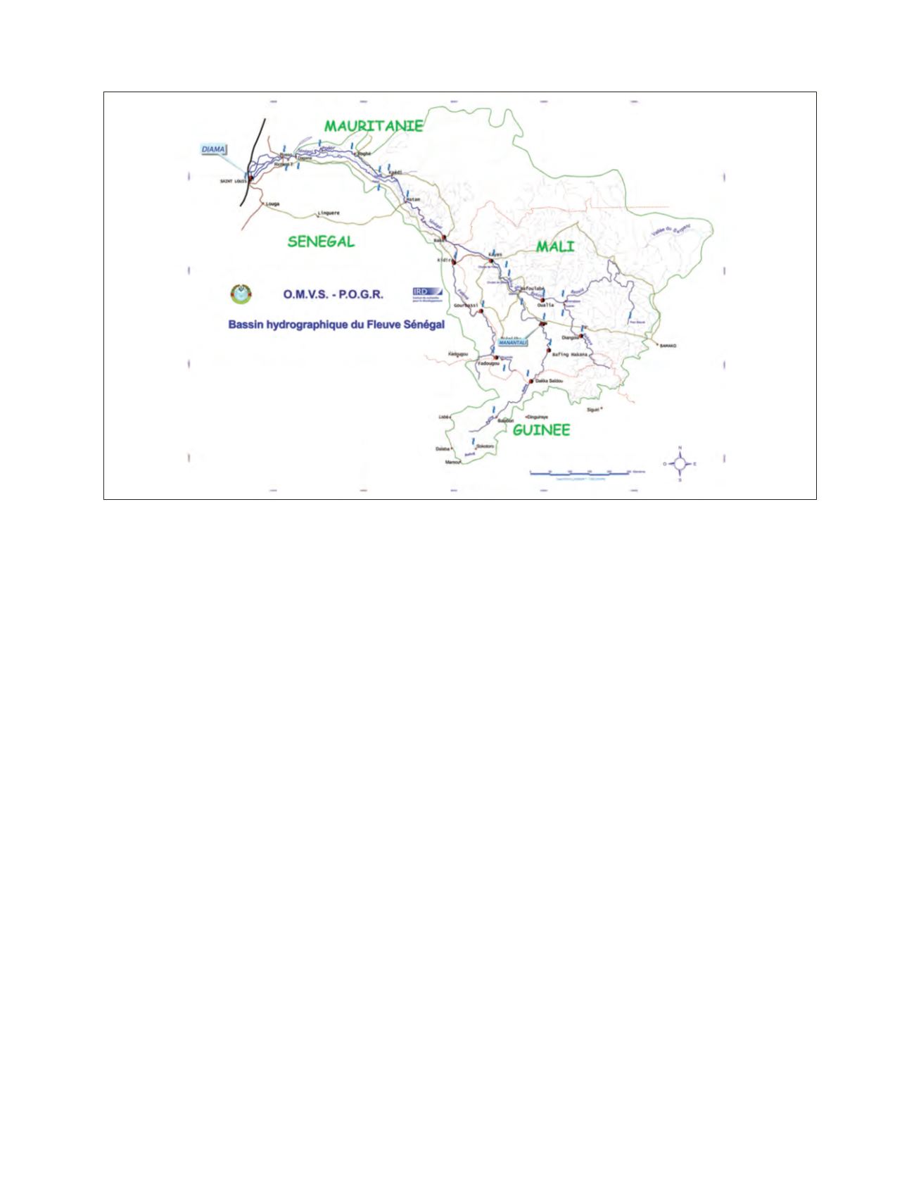
The catchment of the Senegal River, with blue bars delineating the zone where recession crops are evaluated. Calibrating the forecasting model:
using forecast and downscaled rainfall from the Arpège model and adapting them to the specific flow forecast to estimate the ‘natural’ flow of the
Senegal river at Bakel, September-October
Photo: IRD and OMVS