


 130 / 168

[
] 130
and thus fall short in providing an understanding of pastoral vulner-
abilities linked to relevant and sustainable responses at the local
level. The two priority axes for improvements include the following.
Improving pastoral analysis frameworks in Mali, Niger, Mauritania,
Chad and Burkina Faso
This axis targets the five project countries in the Sahel, and specifi-
cally entails the adaptation and development of the technical
component of the GIS tools, such as satellite imaging and informa-
tion tools, and ensuring full operational coverage of all technical
components within the five Sahel countries (these include pasto-
ral movement mapping, transition and concentration areas, water
points and villages, and social movements). The existing analytical
frameworks are mainly focused on evaluation of available pasto-
ral resources, and while they enable early warning, they are unable
to transform the information into actionable preparedness and
response plans. Planning an appropriate humanitarian response in
these countries requires a sound knowledge of the affected popula-
tions, the degree to which they are affected, and what their coping
strategies will be. Developing new tools and improving existing
ones, including gathering additional qualitative information, will
allow for a more clearly defined and robust approach to planning
for preparedness and response to humanitarian crises.
Initiating the handover of improved tools to national and sub-regional
bodies in charge of DRR and early warning systems
The second axis focuses on providing the following resources to
national and sub-regional services:
• The tools and methods to lead in the surveillance,
development, and management of pastoral areas
• Simplified tools and proven methodologies for
improved access to essential information relevant
for monitoring and evaluating pastoral resources,
providing recommendations, and planning
interventions.
The active involvement and participation of affected
communities and stakeholders remains critical for the
development of the tool itself, and specifically for trans-
forming early information into real action and positive
impacts at field level.
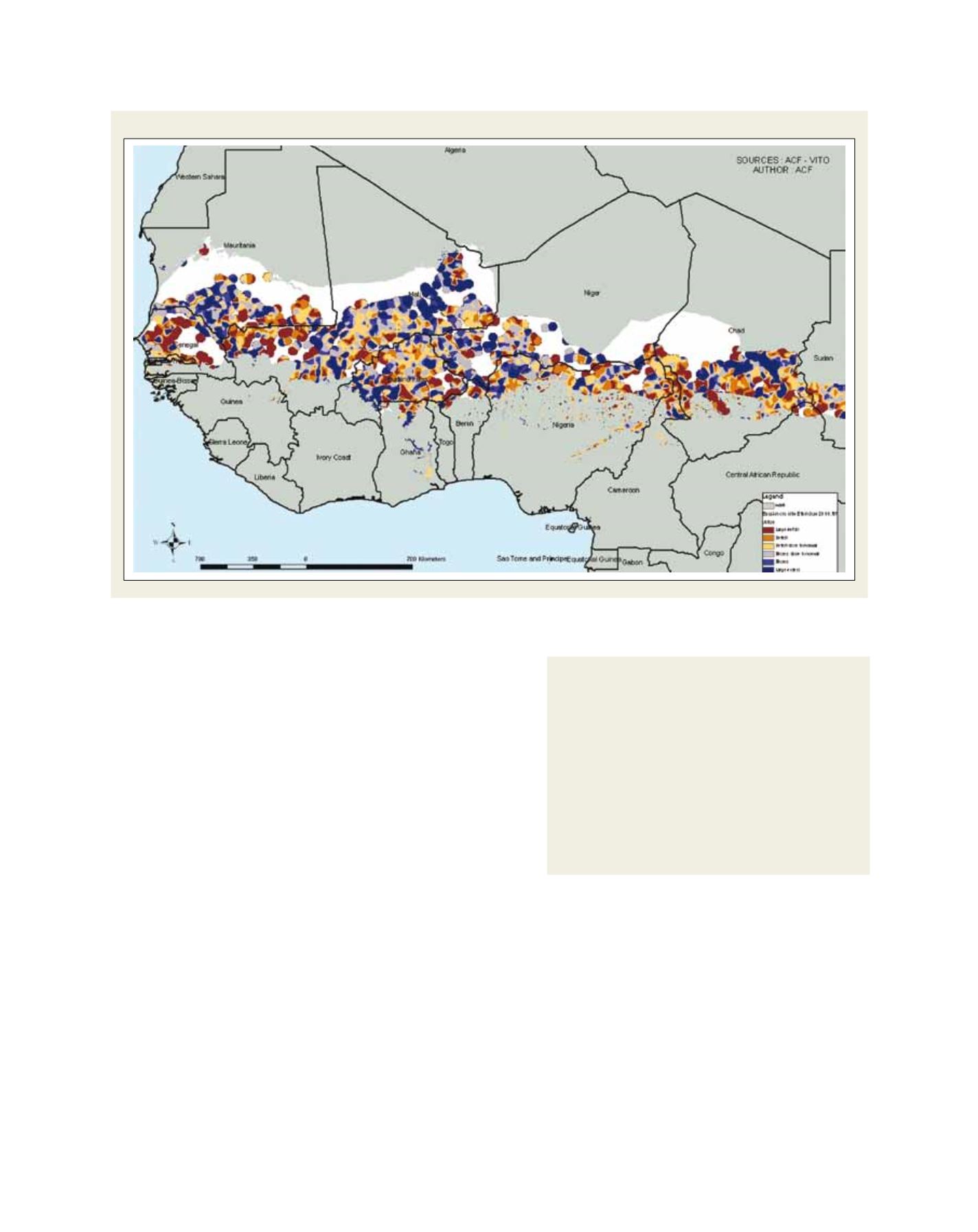
Surface water anomaly, 11 September 2010. West African Sahel
Source: ACF International and VITO
Components of the ACF pastoral surveillance and
early warning system
The ACF pastoral surveillance and early warning system
involves two computer-based tools developed by ACF,
integrating satellite images with water and vegetation data.
The Biogenerator tool allows the calculation of available
vegetation, and the Hydrogenerator tool analyses surface
water bodies and their evolution throughout the year. Both
tools allow for a semi-automated biomass and surface
water monitoring, which directly relates to the vulnerability
of pastoral populations on a regional scale, hence
contributing to improved early warning for pastoral areas.