


 131 / 168

[
] 131
2009 and 2010 by ACF, considers surface water bodies
and their evolution throughout the year. The tool real-
izes a decadal sum of detected cells and represents a
cumulative surface water detection map for the period
between 2000 and 2010. For one given year, the tool
also produces a surface water accessibility map which
helps to characterize pastoral zones, considering
distance to water sources and their relative influence
on a 30-kilometre buffer ring around the detected cells.
Concentration area mapping
Pastoral movements and concentration areas may
vary considerably in response to available resources.
However, ‘usual’ movements can be determined and
compared to the actual movements of the considered
year in order to get a better understanding the possible
adaptive strategies of breeders, and to anticipate the
difficulties people could face some time later. These
mapping activities have been realized empirically in
Mali and Niger thanks to the expertise of pastoralists,
scientists and experts in Sahelian pastoral systems.
Participatory mapping workshops led to the validation
of these works in 2010.
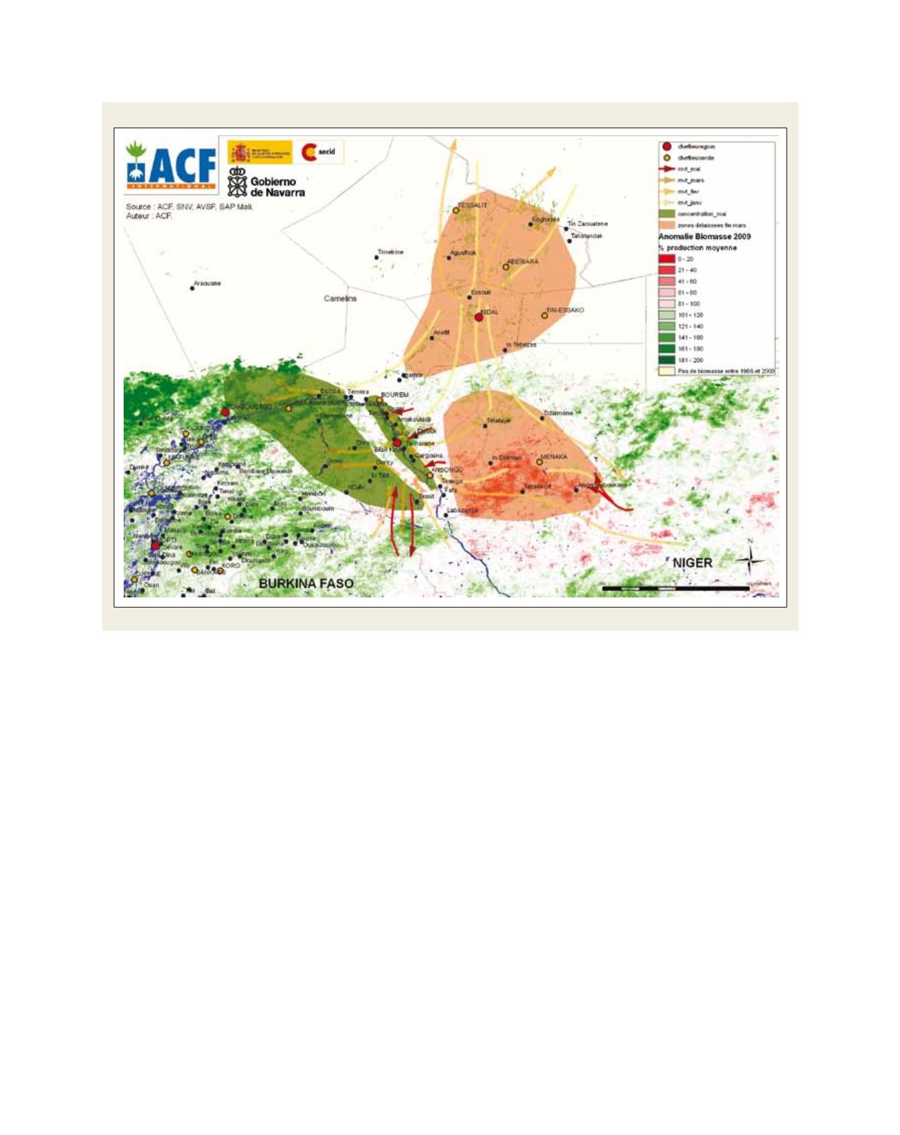
Biomass monitoring
In the north Sahelian context, the pasture growing period finishes
a few weeks after the end of the rainy season. After that, it’s possi-
ble to set up the pasture balance of the area for the current year. A
computer-based tool developed by ACF and called the Biogenerator
uses satellite images to estimate biomass production throughout
the whole studied territory at the end of the rainy season. The
result is the total dry matter production of the considered year,
expressed in kilograms of dry matter per hectare. In addition, the
tool produces anomaly maps that show the difference between the
current year biomass production and the mean value calculated
on the available time series data (1998-2011). Areas highlighted
in red represent areas with lesser biomass availability, and those in
green represent areas with higher biomass availability comparative
to the mean value.
Surface water monitoring
In the pastoral context in Sahel, water is a fundamental resource
for breeders and cattle. Depending on the area, wells, boreholes,
water ponds or rivers can provide the required water to animals
and people. Water is not systematically available next to the grazing
places, in which case cattle have to realize short-cycle movements
to get the required water. The Hydrogenerator, developed between
Movements and vulnerable zones in the regions of Gao and Kidal, May 2010
Source: ACF International, SAP Mali, SNV and AVSF