


 64 / 168

[
] 64
The community’s local knowledge is crucial
to validate the relevant risks and hazards. In the
process of producing the map, discussion is encour-
aged to promote awareness of underlying risks and
how to reduce them as well as how to plan actions
for before, during and immediately after emergen-
cies and disasters.
CBDRM trainers take this opportunity to identify
locations for helipads, drop points for food distribution
and other important aspects in planning for response
during a disaster.
The hazard map also contains photos and notes that
are taken from the town-watching activity as references.
The map is a guide to help the local community with
disaster preparedness and response.
Contingency plans
The CBDRM training also prepares individuals
to carry out certain critical actions before the wet
season, such as monitoring media notifications of
weather patterns, clearing away rubbish and main-
taining drainage, checking ‘survival packs’, clearing
furniture from the ground floors of houses, moving
livestock to safety, and stockpiling crops while carry-
ing on with life as normal.
Follow-up actions
As a follow-up to the CBDRM, grassroots leaders,
residents and district authorities also create well-
planned strategies and actions based on the hazard
maps produced. Action plans include placing warning
signs regarding water levels; maintenance of alter-
skills are also taught to ensure that the community is ready to face
emergencies and disasters. The objective is to enable people to help
themselves and those caught in emergency situations prior to emer-
gency services arriving at the scene.
The NDMC’s engagement with communities is a bottom-up
approach from the grassroots to management level in every district.
It is aimed at helping people to realize that preparation for disaster
is not the sole responsibility of the Government and that self-help
is important in tackling local issues during every phase of disas-
ter management. It has established a sense of ownership within
communities, so that they are involved in planning and implement-
ing disaster risk reduction activities.
Since the introduction of the programme in 2010, the community
has studied three modules: Town Watching and Hazard Mapping;
First Aid and Cardio-Pulmonary Resuscitation; and Fire Safety. Each
module comprises theoretical and practical lessons.
Hazard mapping in flood-prone areas
Trainers from relevant government agencies use historical data to
conduct risk identification assessment in the selected area, with
special attention to the types of disasters for which the community
is at risk. The trainers also conduct interviews with communities
and their leaders to enhance understanding of the situation.
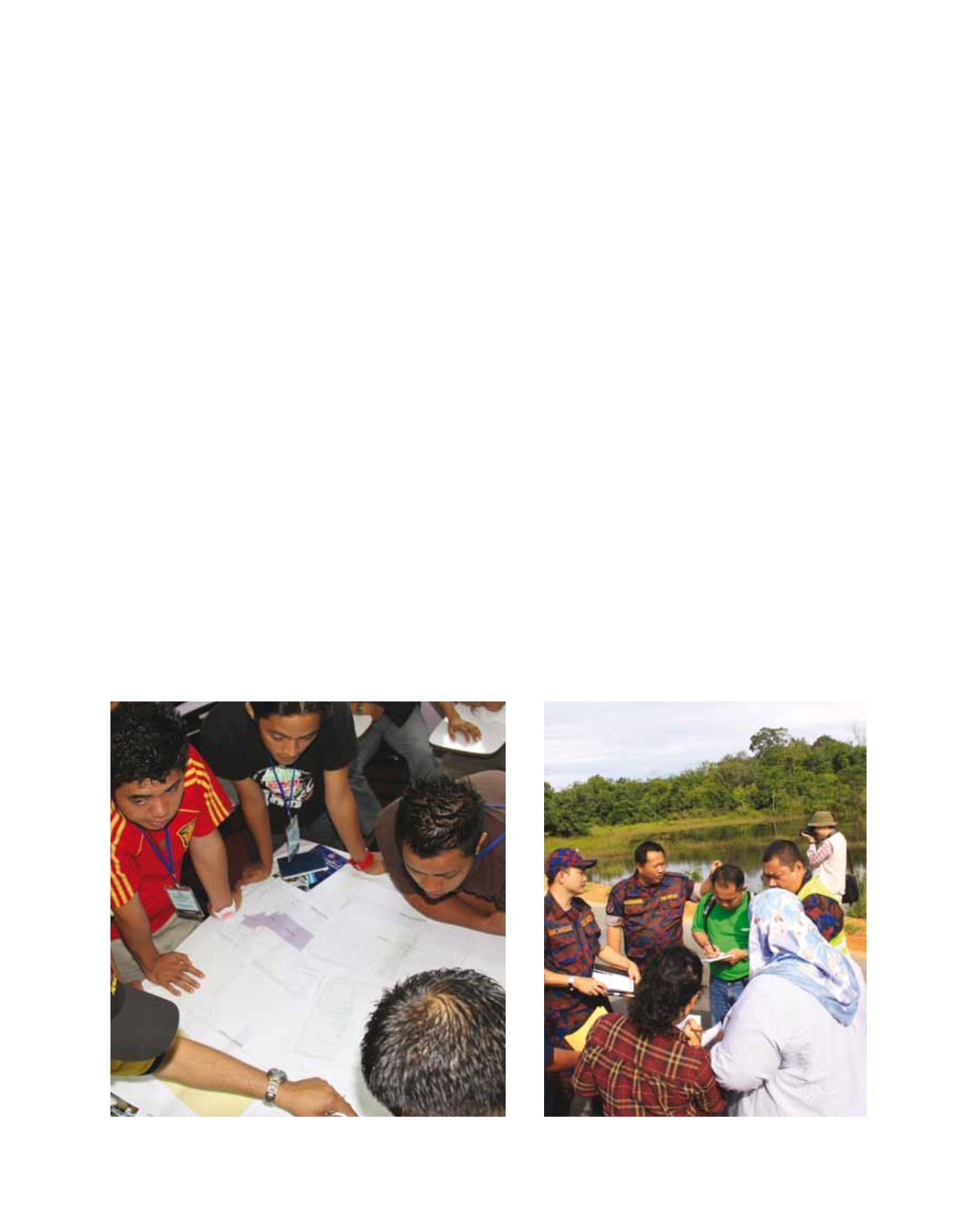
Hazard mapping is used as an effective tool to engage and improve
awareness of hazard risk as well as to manage risk during an emer-
gency. Prior to producing this map, the community, assisted by the
trainers, conducts its own ‘town-watching’ activity. In this type of
exercise, the community members identify risks, hazards and other
potential danger zones. They also identify alternative routes to safer
and higher ground suitable for evacuation areas and temporary car
parks. The creation of the map requires the collaboration of trainers
and the community.
Hazard mapping is used as an effective tool to improve awareness
Strategic locations are pinpointed for response coordination
Image: NDMC
Image: NDMC