


 154 / 196

[
] 152
1. Accumulate in shellfish, causing Neurotoxic
Shellfish Poisoning in humans consuming contam-
inated shellfish
2. Are aerosolized in coastal areas, resulting in human
respiratory problems
3. Cause massive fish kills and mortality of protected
species (e.g. dolphins, manatees, birds and turtles).
In 1999, with the launch of new satellites, remote sensing
monitoring for
Karenia brevis
blooms, using ocean colour,
became possible. The Florida HAB Forecast System
(FHABFS) works by integrating data from satellite
imagery and sampling results from the State of Florida
combined with local wind and current model data. The
satellite imagery allows bloom location using the light
absorption caused by chlorophyll in the HAB cells. The
anomaly in satellite-estimated chlorophyll, obtained by
comparing imagery of the previous two months, indi-
managers, health officials as well as the tourism, restaurant and recre-
ational industries.
Given these significant health, environmental and economic costs,
the primary goal of the NOAA National Centers for Coastal Ocean
Science is to develop a regional warning system that forecasts bloom
initiation, persistence, movement, landfall and toxicity. Once research
has provided a clear understanding of the interaction of physical and
biological processes promoting HAB development, it is possible to
develop reliable models that can identify times and places poten-
tially susceptible to outbreaks. Presently, NOAA has developed two
operational HAB forecasts and others are in various stages of devel-
opment and demonstration.
Examples of successful operational forecasts
Florida HAB Forecast System
–
Karenia brevis
blooms occur almost
annually along the West Florida shelf, less frequently throughout
the rest of the Gulf of Mexico, and can even be transported up the
east coast of the US.
Karenia brevis
produces potent neurotoxins that:
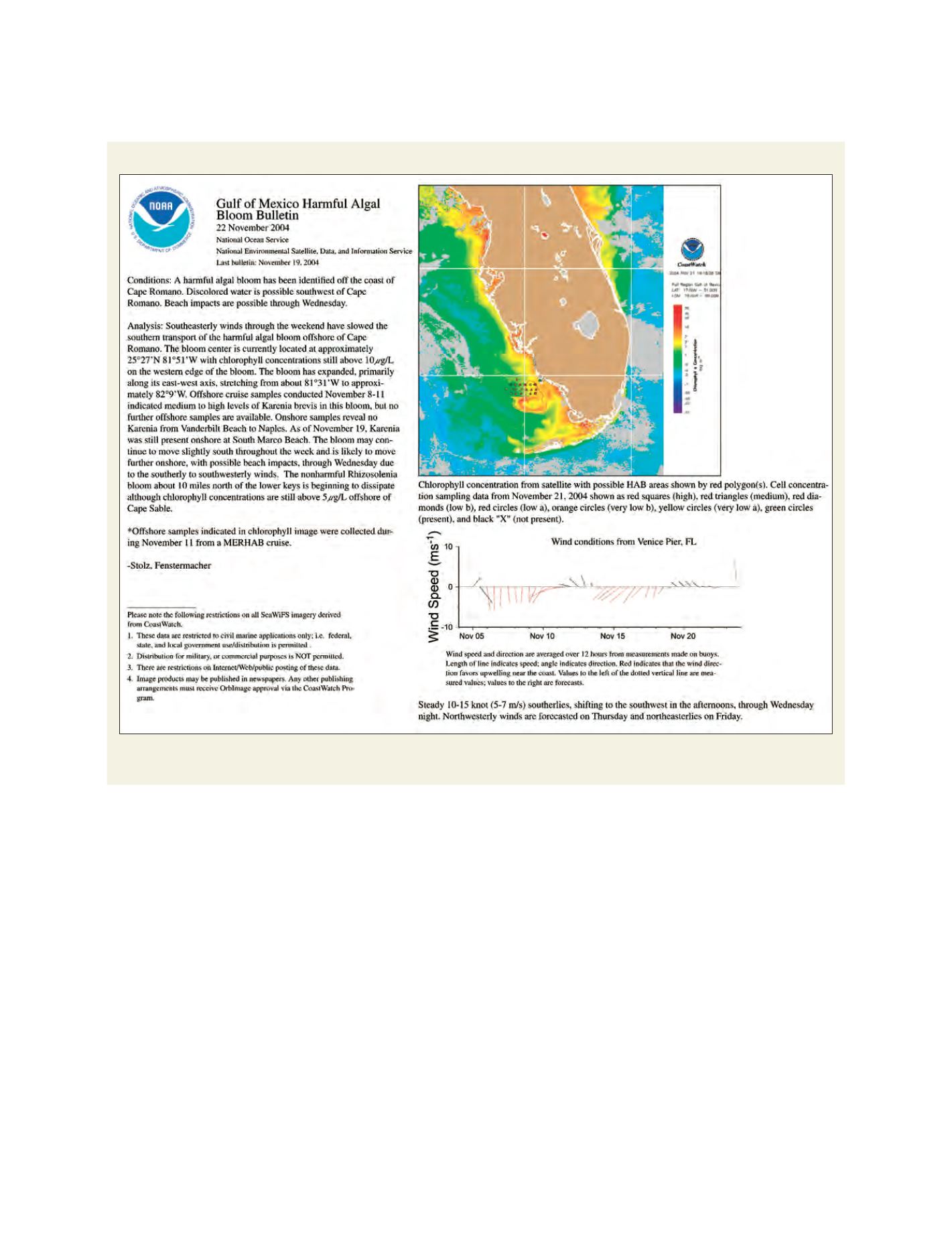
Example of the bulletin provided to managers in the eastern Gulf of Mexico
The bulletin includes an analysis of satellite imagery with various data sets, and includes forecasts of potential impacts at the coast,
as well as possible transport of the HAB
Source: NOAA, National Ocean Service