


 48 / 196

[
] 46
sive warning service and that public awareness was inad-
equate. The Australian Tsunami Warning System
(ATWS) project has been developed to provide a
‘comprehensive tsunami warning system for Australia
that is capable of delivering timely tsunami warnings to
the Australian population in an effective way’.
To provide a comprehensive tsunami warning system
for Australia, an end-to-end system was required that
incorporated enhanced seismic, sea level and tsunami
information in the Indian Ocean and Southwest Pacific
regions. Deep ocean modelling and inundation studies
have established areas in which the community is at high
risk. Even though these events are rare the ATWS has
placed a high premium on community awareness
campaigns. The first step has been education of emer-
gency management agencies that service coastal
communities, resulting in regionally relevant ‘action
statements’ for inclusion in alerts and warnings. These
community response guides are now included in public
education material. A recent event that impacted the
east coast of Australia on 2 April 2007 resulted in a
degree of public panic, with some evacuations, traffic
jams, school closures etc. Consequently, Australia has
concentrated recent tsunami modelling development on
warning stratifications. Stratified warning categories of
‘no threat’, ‘potential threat’, ‘marine warning’ and ‘land
sum of factors that includes fuels, ignition triggers, timing and dura-
tion of fire seasons, significant weather triggers and resources
available in an area.
A cross-disciplinary approach is required to evaluate this potential,
entailing inter-agency cooperation. To this end, severe-weather mete-
orologists from the Bureau of Meteorology Regional Forecast Centres,
climatologists from its National Climate Centre, and fuel and fire
management specialists from the various state fire and land manage-
ment agencies meet to produce a consensus outlook of bushfire
potential for the forthcoming fire season. Thus antecedent condi-
tions that affect fuel state, the seasonal climate outlook, and
socioeconomic factors that affect resource availability are all included
in making the assessments. As well as the most likely scenario, best
case and worst case scenarios are also presented as part of the risk
assessment. The outlooks are presented as a map showing areas of
above normal, normal, and below normal bushfire potential.
Tsunami risk mitigation and community warnings
As a direct result of the tsunami generated off the coast of Indonesia
on 26 December 2004, the Australian Government reassessed its
ability to minimize the loss of life and economic impact on the
Australian community. At the time of the tragic 2004 Indian Ocean
tsunami, the Australian Tsunami Alert Service (ATAS) was in service,
informally operated jointly with Geoscience Australia, Emergency
Management Australia and the Bureau of Meteorology. It was readily
apparent that the system was not intended to provide a comprehen-
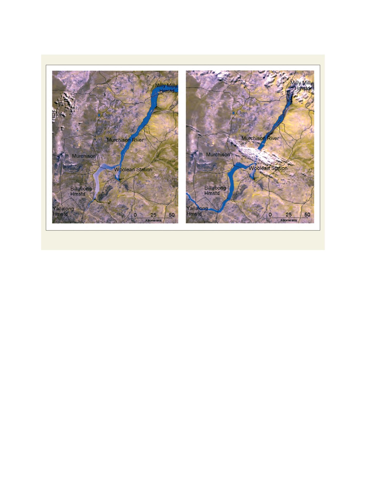
MODIS Image: Murchison River Flood, 8 March 2006 and 12 March 2006
Near real-time satellite imagery available through the FloodMap service assisted with the management of flooding from tropical cyclone Emma in March 2006
around the Murchison area in Western Australia. These images show the movement of the floodwaters between 8 March (left) and 12 March (right)
Source: Land Information Authority Western Australia (Landgate)