


 50 / 196

The recognized benefits are improved real-time forecasting and
warning capabilities for the Bureau of Meteorology, together with
updated storm tide statistical estimates for long-term land use planning,
emergency response strategies for disaster mitigation, and near-shore
extreme wave statistics for coastal zone protection and management.
Compared with earlier studies, the project results indicated a
reduction of estimated storm tide levels for many parts of the
Queensland coast. This is consistent with the expectations of under-
taking numerical modelling to a higher resolution and accuracy than
achieved previously. However, the more detailed estimates for zones
along the southern Queensland coast, which include allowance for
wave setup, suggested that previously nominal allowances for this
component may have been widely underestimated, thus increasing
the potential impact on coastal erosion and the likelihood of inun-
dation of some near-shore communities.
The longer-term safety of coastal communities has been enhanced
by virtue of the fact that the potential impacts of climate change sea
level rise have been quantified, thereby allowing low-lying coastal
communities to plan accordingly. Three greenhouse scenarios were
considered:
• Scenario A – the combined effect of a ten per cent increase in
maximum intensity and a pole-ward shift in tracks of 1.3
degrees
• Scenario B – Ten per cent increase in tropical cyclone frequency
• Scenario C – Mean sea level rise of 300 mm.
The enhanced greenhouse scenarios are predicted to increase present
climate storm tide levels by about 0.5 metres on average (approxi-
mately a 19 per cent increase), with a standard devia-
tion of 0.13 metres.
Queensland’s efforts in developing forecasting and plan-
ning tools for tropical cyclone impacts have been
nationally recognized. The project has won a number of
prestigious prizes including a Queensland Engineering
Excellence Award, and both Queensland and Australian
Safer Communities Awards. The innovative work has also
been presented at several international conferences. The
numerical and statistical modelling methodologies used
in this project are consistent with world best practice
methods used overseas in the United States by the Federal
Emergency Management Authority (FEMA).
The study provided the first state-wide basis for eval-
uating the relative risks from storm tide inundation,
and serves as a baseline for more detailed studies which
are being progressively undertaken by local govern-
ment authorities. Associated benefits include the
mapping of storm tide hazard zones to be used for
emergency response. These maps necessarily conform
to the
National Storm Tide Mapping Model for
Emergency Response
and are produced to a standard
colour scale that exactly aligns with the graphical
warning product issued by the Bureau of Meteorology.
Copies of the project reports can be downloaded from
the Internet, as can storm surge and wave frequency
analyses for selected locations along the Queensland
east coast.
2
[
] 48
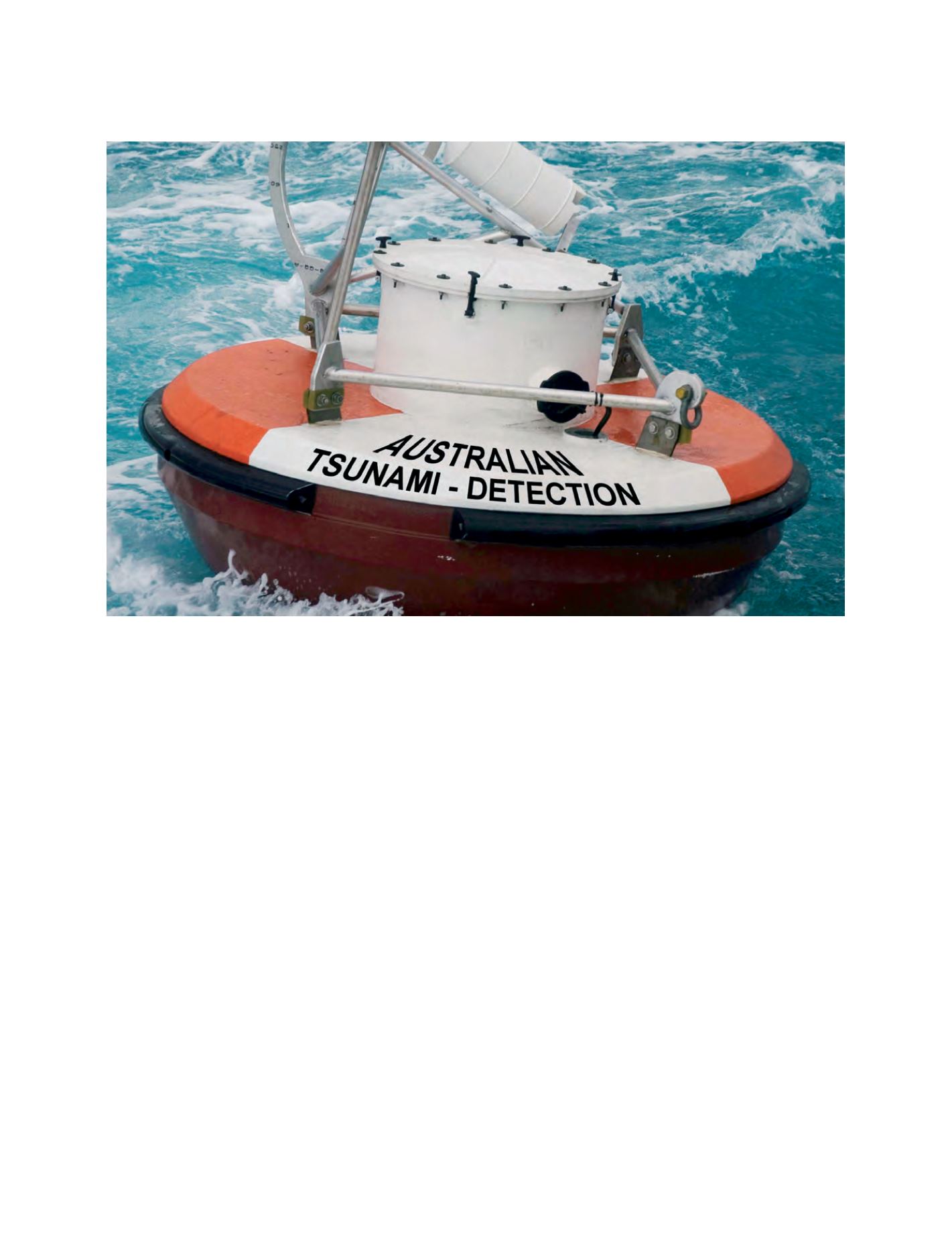
An Australian tsunami detection buoy deployed in conjunction with the USA National Oceanic and Atmospheric Administration
Image: Australian Bureau of Meteorology