


 252 / 280

[
] 252
global agricuture assessement methods and models. It
must also establish a strong consortium of well under-
stood, consistent, readliy avaialble earth observations
datasets via the GEOSS.
There are many partners and programs that could be
used as starting points to support such a global need,
including: USAID’s Famine Early Warning System-
Network (FEWS-NET) and Global Monitoring for Food
Supply (GMFS). These programs and many other similar
ones need to be supported and capitalized on by GEO’s
future work.
Finally, a strong global land monitoring program via
GEOSS will support global sustainable agriculture and
all of the GEO societal benefits, including: disasters -
natural and man made hazard monitoring and assess-
ment; agriculture - disease, pests, drought monitoring
and assessment; biodiversity - invasive species detection
and monitoring; ecosystems - monitoring change;
energy - infrastructure assessment and monitoring;
health - disease carrier monitoring and prevention; water
- floods, droughts, water quality monitoring and assess-
ment; and weather - environment impact monitoring
and assessment.
time can be used to monitor and assess global biomass in support of
agriculture. Moreover, accurate knowledge of type and amount of
land biomass is essential input for fire hazard information in the
framework of disaster prevention and mitigation. Burn Area
Emergency Rehabilitation (BAER) teams are formed and dispatched
to all wildland forest fires to assess damage and implement a burn
area rehabilitation plan.
Such plans consider safeguarding human life and property, protect-
ing municipal watersheds, stabilizing steep slopes, and protecting
cultural resources. They mitigate soil erosion, mudslides and the
movement of hazardous tree skeletons. The goal is to have a burn
area rehabilitation plan created within five days of wildland fire
containment. The first task on land denuded by fire is the stabiliza-
tion of the soils and slopes. After stabilization, workers move to
long-term rehabilitation, which includes reseeding native grasses,
replanting trees, and preventing noxious-weed growth.
GEO and GEOSS support for agriculture sustainment
There is strong need for an operational, earth observation-based agri-
cultural monitoring system. A system that can provide the
inforamtion needed as input to analytical tools and models for agri-
culture risk assessment including crop failure, crop water stress,
bio-mass, forest monitoring, and surface change. GEO must work
to help estabish tools and methods via its work plans to obtian better
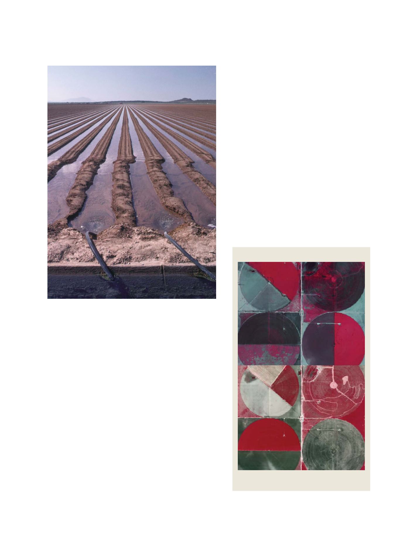
Laser-leveled irrigated land near Phoenix, Arizona
Photo: Tim McCabe, USDA/Natural Resources Conservation Service
Monitoring and Assessment
Moisture assessment using aerial digital camera data from
2004 and 2006 in Ochiltree, Texas
Source: USDA Farm Service Agency National Agriculture Image Program
S
OCIETAL
B
ENEFIT
A
REAS
– A
GRICULTURE