


 255 / 280

[
] 255
Left image: MODIS Science Team, NASA/GSFC. Right image: Kobus Agenbag, Marine and Coastal Management, South Africa
A true-colour image of northwestern Australia, captured by the MODIS ocean
colour sensor on 2 July 2003. Commercial oyster farms are located in the
clear waters around Broome and the Buccaneer Archipelago. High sediment
loads, clearly visible in King Sound, are detrimental to the pearling industry
and can be monitored using MODIS data
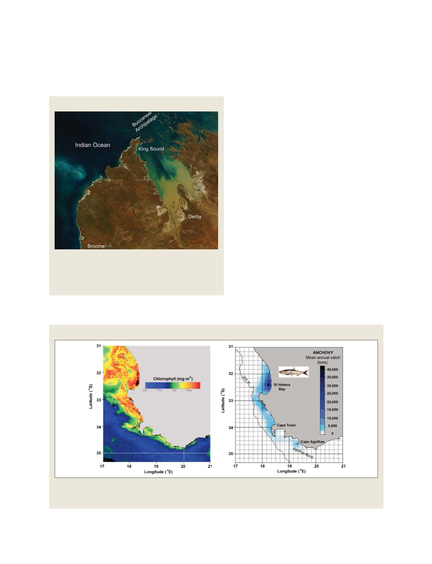
Benguela upwelling
On the left is an example of a three-day composite chlorophyll image from the Benguela upwelling region off the coast of South Africa captured by the
MODIS ocean colour sensor. High chlorophyll concentrations along the coast are indicated in red/yellow, while areas of low chlorophyll are indicated in
blue. The image on the right shows the distribution of the mean annual catch of anchovy
Coastal sediments
Generally, we find that the ecological organization is
controlled by physical forces, such as currents and wind
patterns. In turn, it is frequently found that the spatial
extent of fishing stocks is related to the spatial patterns
depicted in a partition of the ocean into ecological
provinces. An excellent example is found in the
Benguela ecosystem off the west coast of South Africa,
which is driven by strong south-easterly winds that
induce upwelling of cold nutrient-rich water. This strong
coastal upwelling leads to high levels of primary produc-
tivity, which in turn supports the large commercial
fisheries in the area.
From the examples presented, it is clear that there is
enormous potential for EO to benefit society through
application to fisheries and aquaculture. However, such
applications are still in their infancy. To encourage and
coordinate, at the international level, the pursuit of
excellence in this field, the Canadian Space Agency has
agreed to fund the Societal Applications in Fisheries and
Aquaculture using Remotely-sensed Imagery (SAFARI)
programme in the context of GEO Task AG 06-02. This
programme will host an international coordination
workshop; highlight excellent demonstration projects
of EO in fisheries; produce a monograph on the state of
the art, develop an outreach component to increase
awareness of the value of EO in the fisheries and aqua-
culture sector, and convene an international symposium
on this timely topic.
All things considered, there is a promising and
exciting future for the application of EO to fisheries and
aquaculture, extending the ways that society can benefit
from investment in EO capacity.
can observe its seasonal modification in real time. Here again,
EO proves to be a very useful tool.
Source: MODIS Science Team, NASA/GSFC and the Remote Sensing and Satellite
Research Group, Curtin University, Australia
S
OCIETAL
B
ENEFIT
A
REAS
– A
GRICULTURE