


 92 / 280

[
] 92
New marine observing systems around Africa
Geoff Brundrit and Stewart Bernard, GOOS Africa;
Mika Odido, ODINAfrica and Lucy Scott, ACEP
N
ew capabilities in marine observing and information
systems are being brought into use on the coasts and in
the oceans around Africa. These initiatives are pan-
African in extent, covering many countries and all the regions
of Africa. They are being developed in support of the Global
Earth Observation System of Systems (GEOSS) vision of a future
in which decisions and actions for the benefit of humankind are
informed by coordinated, comprehensive and sustained Earth
observation and information. At the same time there is inten-
sive promotion of the scientific and technological capacity
needed to take advantage of the new capabilities.
Further advances are planned, to be undertaken within ocean part-
nerships established by Africans for Africans. Key players within
these partnerships are IOC/UNESCO’s Global Ocean
Observing System in Africa (GOOS AFRICA); the
IOC/IODE’s Ocean Data and Information Network in
Africa (ODINAfrica), and the pan-African Large Marine
Ecosystem (LME) and related programmes of the Global
Environment Facility. Good progress was made with this
cooperative planning at the pan-African LME/GOOS
Africa Leadership Workshop on Operational
Oceanography and Remote Sensing, held in Cape Town
in November 2006.
The three case studies below illustrate the new capa-
bilities and future prospects in marine observing and
information systems that are being brought into use on
the coasts and in the oceans around Africa.
ODINAfrica sea level monitoring
ODINAfrica, in collaboration with various partners, has embarked on an
initiative to develop a network of sea level stations, providing data in
near-real time, and addressing the key oceanographic phenomena along
the African coastline. A survey of the status of the network undertaken in
2005 revealed the existence of at least 40 operational stations spread
unevenly along the African coastline and island states. Long stretches of
the coastline did not have operational tide gauges.
Since 2005, ODINAfrica has installed new tide gauges in Congo,
Djibouti, Ghana and Mauritania. Additional stations have been installed
or upgraded by the University of Hawaii Sea Level Centre (UHSLC) in
Kenya, Mauritius, Seychelles, Tanzania, and by the Global Sea Level
Observing System (GLOSS) in Mozambique and South Africa. Other
countries where new gauges will be installed in 2007 include Cameroon,
Egypt, Madagascar, Morocco, and Senegal.
ODINAFRICA Sea Level Data Facility
(www.sealevelstation.net)
ODINAFRICA has collaborated with the Flanders Marine Institute (VLIZ)
and the Pacific Tsunami Warning Centre (PTWC) to develop a sea level
data facility. The facility receives real-time sea level data directly from
the Global Telecommunication System (GTS). It provides information on
the status of sea level stations, real-time data display and station
metadata. The facility enables fast remedial action if a station fails by
providing information (online, by e-mail and SMS), and also provides
back-up to the centres monitoring tsunamis and other marine related
hazards.
The Global Tide Stations Web Service (GTSWS) pilot project contributes
to the ODINAfrica Sea Level data facility by providing up-to data metadata
for the stations which are essential to ensure correct decoding and
display of data.
Contacts: Peter Pissierssens
(p.pissierssens@unesco.org), Mika Odido
(m.odido@unesco.org)
URLs:
www.odinafrica.org,
www.sealevelstation.net,
www.iode.org/glossafrica,
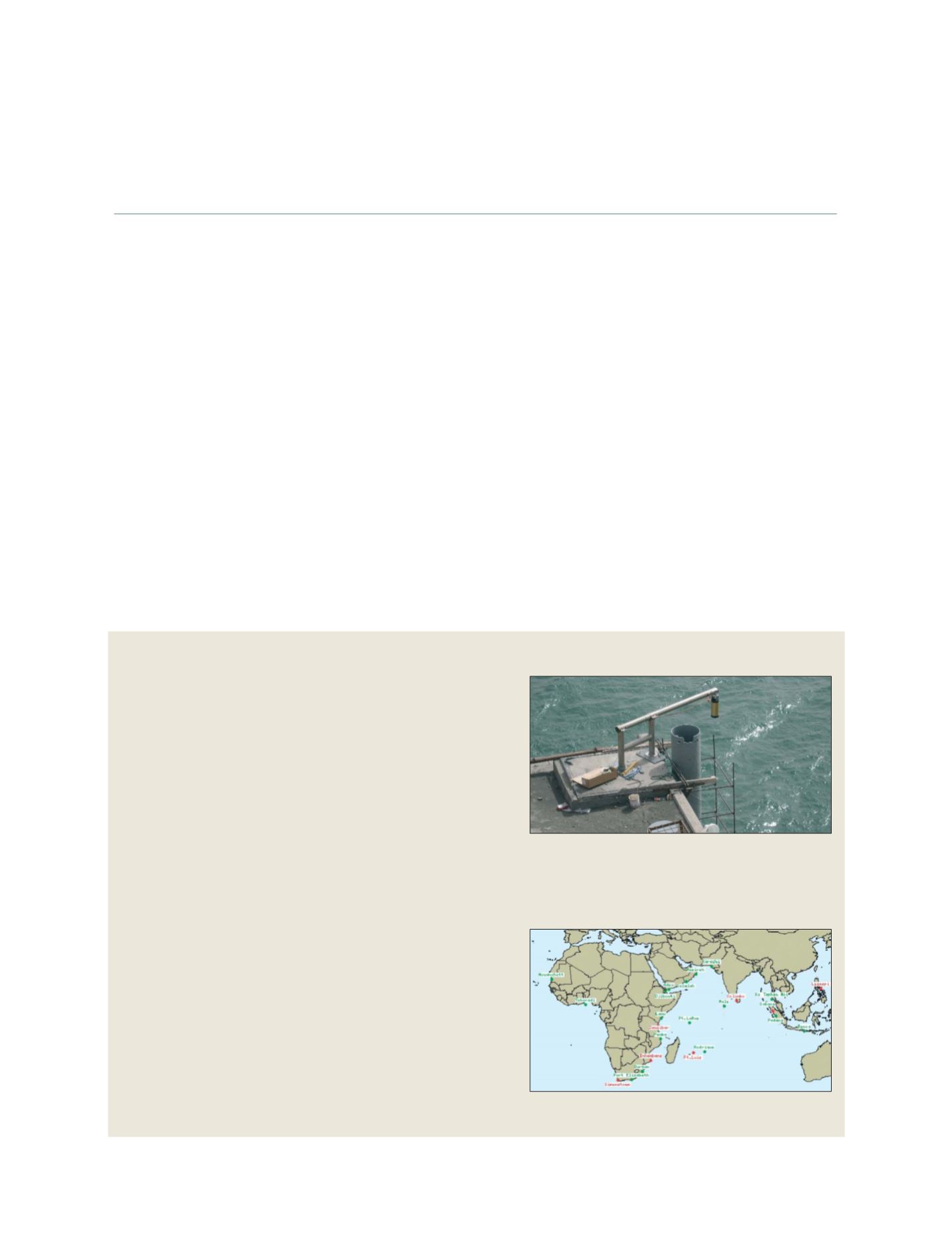
http://ioc3.unesco.org/iticTide gauge being installed at Noukchott, Mauritania
ODINAfrica, is working with various partners to develop a
network of sea level stations, providing data in near-real time,
and addressing the key oceanographic phenomena along the
African coastline
Station status map
This station status map shows operational stations in green,
with non-operational stations in red
GEOSS C
OMPONENTS
– O
BSERVING
S
YSTEMS