


 154 / 218

[
] 152
S
URROUNDED BY THE
Alpine mountains to the west, and
the Carpathian mountains to the north and east Hungary’s
basin situation is accompanied by several long and short-
term weather extremities despite its temperate climate, which
is accredited to its 46-48 N geographical latitude. Four such
extreme events are droughts, heat waves, vast local precipita-
tion (flash-floods) and convective windstorms. By looking at
the phenomenology and regional characteristics of these
events, it will be possible to point to the relevant services
provided in each case by the National Meteorological Service
(NMS), including forecasts and warnings of the event.
The phenomena are listed in decreasing order of their time
scales. Hence, the possibility and importance of forecasting
(i.e. the factor of timely warning) rapidly increases, whereas
our ability to judge more recent and future trends, diminishes.
Drought
Hungary is situated in the Carpathian basin, surrounded by
mountains but open to the south. This geographical position
can also contribute to the fact that precipitation tendencies in
Hungary are similar to those in the Mediterranean region. In
addition, the largest decrease of precipitation can be found in
the more humid areas. Therefore, almost the whole territory
of the country suffers from water scarcity, mostly through
frequent drought events.
Monthly precipitation can reach 200 millimetres in almost
any month and region, but months without a drop of precipita-
tion may also occur in any season. Sometimes both flood and
drought are experienced in the same region during the same
year. Annual and seasonal precipitation amounts are decreasing,
with one exception. The summer precipitation totals have no
definite trend themselves, but the water management situation
is still worsening, as precipitation occurs in fewer cases and with
higher intensity. Besides this inconvenient dosage of precipita-
tion, positive temperature trends also intensify the problem.
The average situation is well characterized by the temporal
evolution of annual minima and maxima of the Palmer
Drought Severity Indices (PDSI) in Debrecen. Both the annual
maxima and minima have a decreasing tendency, indicating an
increasingly large chance of droughts. Debrecen is situated in
the north-east region of Hungary. From among the three typical
climats that influence Hungary (oceanic, Mediterranean and
continental), the climate of Debrecen is mainly governed by
the latter.
The Hungarian Meteorological Service (HMS) operates an
interactive irrigation advisory system through its homepage,
free of charge
(www.met.hu). The irrigation model uses the
observed data of precipitation and plant-specific, estimated
evapotranspiration, all obtained from automatic weather
stations to describe the actual plant water demand.
Heat waves
The mean summer temperature was 19.6 degrees Celsius in the
1961-1990 normal period. Since its end, however, both the average
and the deviations from it seem to have changed significantly.
Parallel to global warming, the simple linear trend of the summer
Battling extreme weather under
a temperate climate – Hungary
Gyuró, Gy., Á. Horváth, M. Lakatos, S. Szalai and J. Mika, Hungarian Meteorological Service
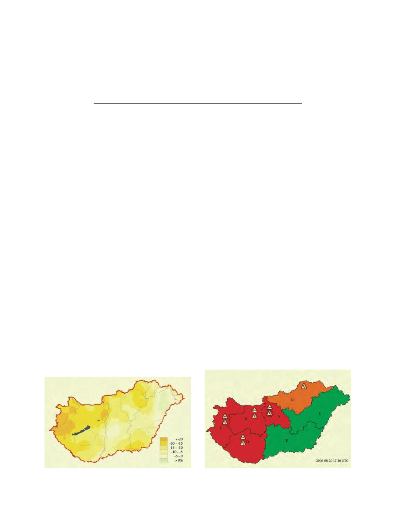
Change in annual precipitation (%) in Hungary for the period
1951-2004. Exponential trend estimation is applied, and the
results relate to the 54-year long interval
Source: OMSZ
Severe weather warning for 20 August 2007, issued at 17:38 UTC
for the official website of the Hungarian Meteorological Service
Source: OMSZ