


 64 / 218

[
] 64
land use and land cover, climate change, building dams and
channels, inter-basin transfers, irrigation, and drainage can all
dramatically change the local hydrological balance.
Sustainability of water resources: assessment
Water resources assessment is necessary to the development
of sustainable activities such as domestic and industrial water
supplies, maintenance of human health, hydropower, irriga-
tion, flood protection, droughts, navigation, recreation, and
preservation of the environment. The first step in developing
a water resources sustainability strategy and management plan
is to know the quantity and quality of water available. This is
not a trivial task even in data-rich regions of the world, but in
data-sparse regions it becomes almost impossible. One has to
start with adequate reliable hydrologic data on the quantity
and the quality of the available water resources. One must then
account for modifications in the hydrology brought about by
human uses, agriculture, manufacturing, and pollution control.
For many regions of the world, and particularly in the devel-
oping world, these data do not exist or are unreliable.
Embarking on a data collection campaign with traditional
methods and instrumentation is extremely expensive and
requires a large supporting infrastructure.
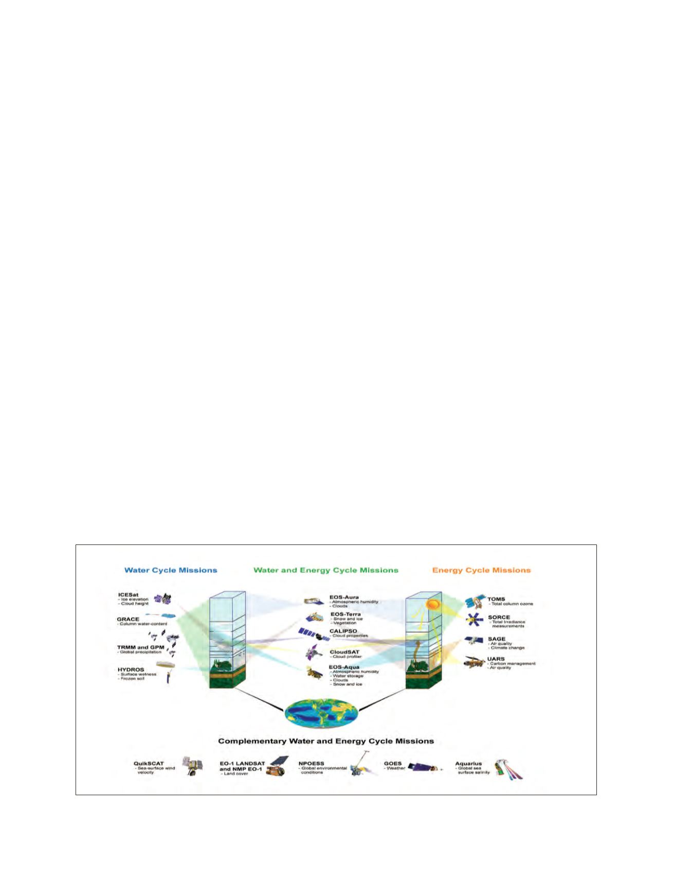
A satellite hydrology solution
The major space agencies and their partnering meteorological
services maintain a vast array of Earth observing satellites
capable of providing basic measurements of hydrological data,
weather, climate, land use, water use and diversions, and natural
and anthropogenic hazards. Recognizing the potential of Earth
observations has lead to the establishment of the Group on
Earth Observations (GEO) and the Global Earth Observation
System of Systems (GEOSS), an international partnership
promoting the free exchange of Earth observational data. The
US participates in GEO and GEOSS through the United States
Group on Earth Observations (US GEO) – a standing subcom-
mittee that replaced the Interagency Working Group on Earth
Observations (IWGEO) – consisting of representatives from a
collection of 15 US Federal agencies that either supply or use
observational data. Data collected and information created from
Earth observations have the potential for providing critical
inputs to sustainable water resources development and manage-
ment. These Earth observations also provide information for
informed decision-making and for monitoring conditions and
progress at multiple special and temporal scales. NASA’s fleet
of satellites are able to provide important measurements of the
hydrologic cycle that can be used for water resources assess-
ment and management in regions of the world where traditional
data are insufficient or nonexistent.
Satellite contributions to sustainability
of water resources
There are numerous examples that demonstrate how measure-
ments obtained from Earth observing satellites have been used
in data-sparse regions of the Earth. The following are brief
examples of some, but not all of the existing satellite data and
products that could make significant contributions to water
resources assessment for sustainable development.
Snow cover and snow water equivalent
– The Aqua and Terra
satellites provide daily images of global snow cover via the
Moderate Resolution Imaging Spectroradiometer (MODIS)
sensor. In addition, the Advanced Microwave Scanning
Radiometer-Earth Observing System (AMSR-E) passive
microwave measurements are being used to augment snow
cover products by providing estimates of snow water equiva-
lent for much of the Earth.
Ground water
– The Gravity Recovery and Climate
Experiment (GRACE) mission, under the joint partnership
of NASA and the German Aerospace Agency Deutsches
Zentrum für Luft- und Raumfahrt (DLR), was launched in
March 2002 with the goal of obtaining accurate global and
high-resolution measurements of the static and time-varying
components of the Earth’s gravity field. Variations in the
gravity field can be used to monitor changes in large ground
water aquifers, and thus provide measurements of abstrac-
tions or recharge.
Image: NASA
NASA missions for water resources assessment and management