


 65 / 218

Water quality
– The visible and near infrared regions of the
spectrum can be used to empirically detect water quality indi-
cators such as suspended sediments, algae, eutrophication
indices, and thermal pollution. In addition, remote sensing
products such as Landsat images provide for excellent track-
ing of these water quality indicators, spatially and temporally,
in large lakes, reservoirs and estuaries.
Data assimilation
– Data assimilation projects are character-
ized as real-time, hourly, distributed, uncoupled, land-surface
simulation systems that are scaled to different domains and
resolutions. Data assimilation merges satellite data, in situ land
surface measurements, and model estimates (all at differing time
and space scales) into one uniform product. The Global Land
Data Assimilation System (GLDAS) project is designed to
produce optimal output fields of land surface states and fluxes
for water cycle research, initialization of weather and climate
models, and water resources applications. To fully address land
surface and application research problems, GLDAS has been
implemented globally to a high resolution of 1 km with finer
Universal Transverse Mercator (UTM) level scales and 1-hour
and shorter time scales through the development of a proto-
type software library called the Land Information System (LIS).
The current LIS tools consist of a high performance land surface
modelling and data assimilation system to quantify terrestrial
water and energy fluxes (precipitation, runoff) and storages
(soil moisture, snow), critical for applications in water resources
assessment and management. Remotely sensed hydrologic state
or storage observations (temperature, snow, and soil moisture)
are integrated into the LSMs to improve prediction and produce
research-quality datasets.
Steps needed to realize the potential of satellite hydrology
Unfortunately, there is a substantial gap between the potential
of satellite products and their application to real-world problem
solving and the development of water resources sustainability
strategies. There is an opportunity for developing countries to
‘leap-frog’ into the 21st century and adapt these technologies
immediately. To do this we suggest the following steps:
1. Select a real water resources sustainability problem.
Examples might be:
• A ground water management problem to prevent over-
pumping or salt water intrusion
• A flood warning and damage mitigation scheme
• A fresh water supply for human consumption
• A new town with supporting agriculture, industry and
fresh water supply for human use.
2. Identify the decision support tools (DSTs) available to
conduct an assessment for the implementation of a
sustainable water resources management plan
3. Identify those data required by 2 that may be met with
remote sensing data or data products
4. Arrange to obtain these data from the various space agen-
cies
5. Arrange for training and capacity building in the use of
the DSTs and interpretation of the data
6. Implement the assessment and the DSTs
7. Define the initial baseline and document the improve-
ments made and the improvements possible with the
remote sensing data
8. Set up the infrastructure for implementing the procedures
and maintaining the sustainability of the particular water
resources issue
9. Integrate the technical DST products within a framework
that includes social sciences, legal frameworks, and envi-
ronmental considerations.
Most of these steps cost little or nothing. Many remote sensing
data and DSTs are free, and much of the organizational work
could be done through existing governmental ministries with
little or no added expense. Training and capacity building may
result in the largest expense. Item 9 is an essential step if all
stakeholders are going to accept the proposed plans for imple-
mentation. This item is also one that is often ignored or not
implemented for lack of experience in methods for involving
stakeholder participation. Fortunately, there are now organi-
zations and programmes that focus on public participation in
decision-making. The United Nations Educational, Scientific
and Cultural Organization (UNESCO) crosscutting programme
Hydrology for the Environment, Life and Policy (HELP) is an
example of this. HELP provides a framework that encourages
scientists, stakeholders, managers, and law and policy experts
to come together to address locally defined water-related issues.
Water communication and public participation are central to
creating effective water policy issues. HELP provides a plat-
form for sharing experiences across an international network
of catchments.
In summary, sustainability of water resources is essential
for almost all aspects of a successful and healthy society.
Developing sustainable water resources requires technical
knowledge of the type and extent of available water, and the
necessary tools to make plans and management decisions for
the benefit of society and the economy. Unfortunately, in
many parts of the world the basic data for planning and
management are sparse or nonexistent, However, recent
advances in Earth remote sensing provide an alternative
source of data and information for the planning and manage-
ment of water resources.
[
] 65
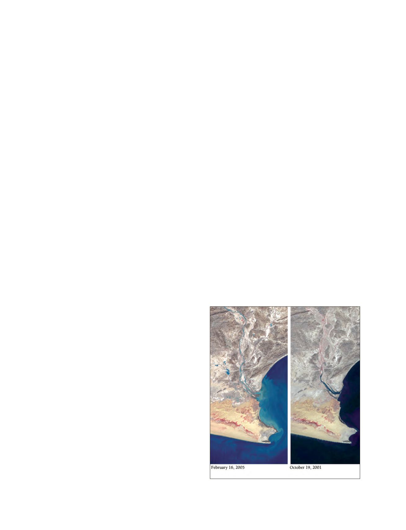
Image: NASA
Heavy rains flooded the Pasni area of Pakistan in 2005