


 119 / 168

[
] 119
• The physical characteristics of relevant hazards
• The systems, assets and resources of interest that
may be exposed to these hazards
• Characteristics that make those elements more
susceptible to impact and less able to cope.
Loss and impact data enable monitoring and allow
analysts to explore relationships between disaster
components and outcomes.
Collecting the data
While they do have limitations, information and
communication technologies (ICTs) can facilitate
data collection and management before, during and
after an event. Because actionable information is
often geospatial, a geographic information system
(GIS) provides critical support, helping to make DRR
and DM actions more effective and efficient. Location
and attribute data on losses, hazards and elements of
interest can be collected in a number of ways and can
need to understand the components of disaster, for example, what
factors affect the level of disruption, suffering and loss a community
experiences. Understanding these factors and the ways in which they
interact and overlap within a particular place is the key to effectively
reducing and managing disaster risk. How disasters and disaster risk
are characterized guides data collection and influences subsequent
assessments and decisions.
DRR is about transforming ‘conventional wisdom’ from a view of
disasters as acts of nature towards a more comprehensive under-
standing of disasters as the result of complex interactions within
human-environment systems operating at multiple scales. Injecting
human factors enables us to act, influencing interactions in ways
that reduce short-term impacts and long-term risks. Studies over
the last half century have helped to uncover some of the drivers of
disaster losses, while international campaigns have helped to estab-
lish more consistent characterization of disaster risk components,
and have emphasized physical, social, economic and environmental
dimensions.
1
At the most basic level, DM and DRR decisions require informa-
tion on
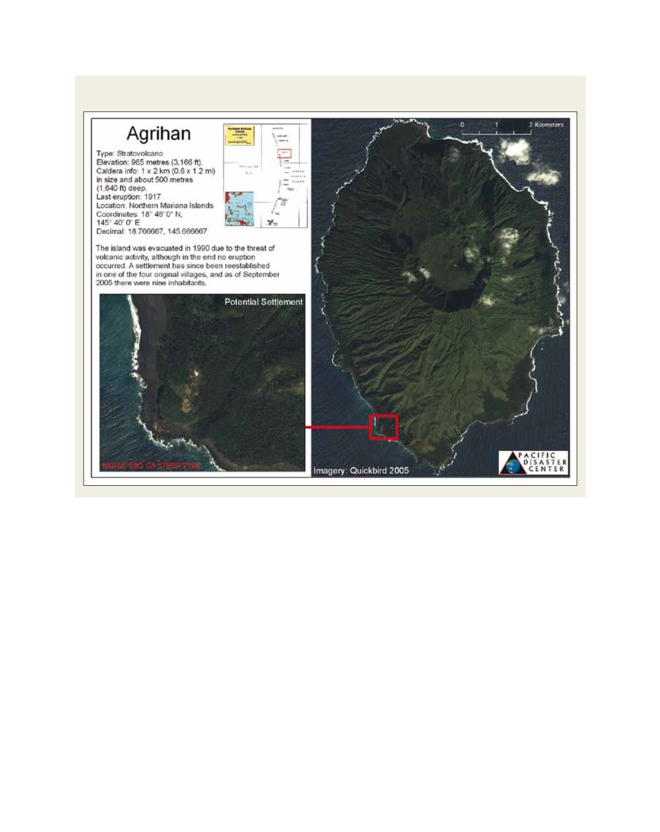
Source: PDC 2009
Relevant information and open communication helped search and rescue teams locate a remote, little-known settlement in the path
of super-typhoon Choi-wan, 2009