


 121 / 168

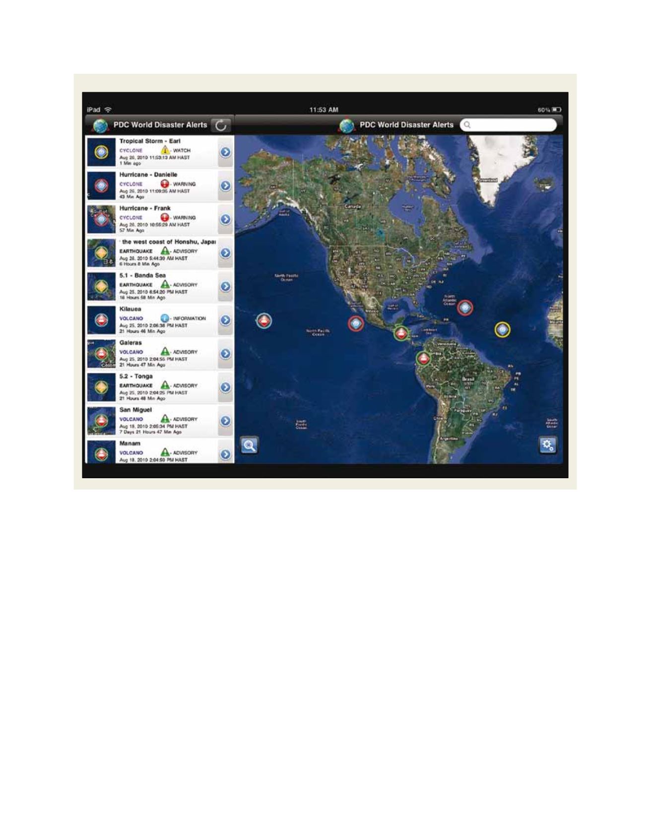
PDC’s Disaster Alert application for the iPad. Disaster Alert is also available for Android devices
Source: PDC 2010
[
] 121
tate damage assessments and loss estimations, which can then be
used to support response and recovery activities.
The collection methods described above do not readily capture
local drivers of risk. One way to ensure that local knowledge is
incorporated into decision making is through participatory mapping
and GIS exercises,
5
or vulnerability and capacity assessments.
6
These processes allow participants to tell their own stories and can
strengthen horizontal and vertical relationships while supporting
DRR and DM activities at the community level. The outputs of
these exercises may not be digital. However, digitizing data related
to local knowledge and experiences (whether spatial or not) makes
that information more easily updated, more accessible, more easily
included in analysis and analysis outputs, and thus more ‘visible’ to
decision makers and disaster managers.
Web-based collaboration tools and wikis can also facilitate the
collection of digital data in data-poor areas. While access to these
tools may be limited in certain regions and wikis pose challenges
related to data validity and verification, they have had some
success in generating useful data at relatively low cost. Ushahidi,
Crisis Commons and OpenStreetMap
7
have been invaluable in
responding to the 12 January 2010 earthquake in
Haiti and the recent Japanese earthquake and associ-
ated events.
While most visible in response activities, Web 2.0
initiatives support pre-event DRR and DM activities
as well. In 2010, The Guardian reported that at the
end of January, there were 239 people rebuilding
the map of Haiti
8
to reflect current conditions. In
addition to contributing to search and rescue and
response activities, this newly collected and proc-
essed information will support risk assessment,
recovery and development efforts. Another example,
Map Kibera,
9
combines the advantages of participa-
tory mapping and wiki-mapping to make informal
settlements, and the people who live in them, more
visible. Map Kibera began mapping critical base
data as well as themes of health, security, education
and water/sanitation in Nairobi in 2009. While not
specifically collected for disaster management, this
information can be leveraged for risk assessment and