


 55 / 168

[
] 55
commenced under the GD of Disaster Affairs. The project
consists of integrated multi-hazard mapping for three
provinces, Kastamonu, Karabuk and Bartin (Figure 2).
The region has been subjected to various kinds of natural
hazards, including earthquake, landslide, rock fall, flood
and wildfire. The main goals of the project are to assess the
hazard levels of the pilot provinces and to prepare multi-
hazard maps in GIS environments. The project will also
guide the rapid response plans of the provinces, supplying
information to city planners for land use planning and deci-
sionmaking. Earthquake, landslide, rock fall and flood have
been studied and hazardmaps have been prepared. Disaster
management has also been included in the project. In coop-
eration with General Mapping Command and the GD of
Mineral Research and Exploration, integrated hazard maps
of three pilot provinces have been accomplished and there
are plans to expand the project to the rest of the country.
Various Government institutions are using these multi-
hazard maps for planning purposes and engineering
designs. The PrimeMinister has ordered hazard assessment
and multi-hazard mapping studies for the future.
DRR and earthquakes
Since Turkey pays special attention to earthquakes due to
its location, AFADhas a dedicated Earthquake Department,
which contributes to DRR by operating and develop-
ing observation network systems such as Weak Motion
Seismic Observation Network and Strong Motion Seismic
Observation Network, which operate on a 24/7 basis
with 473 observation stations. Data collected from these
results obtained will be submitted as a final report to the Government
authorities in order to proceed to the next step.
AFADwill participate in the process of expanding theMitigationof Flood
Risk in the Flooded Areas in South Eastern Anatolia Project (GAPSEL),
focused on hazard mapping, structural measures against disasters and
education activities. This is being carried out in cooperationwith the Prime
Minister’sOffice and SouthEasternAnatolia Project Regional Development
Administration. The project proposal, which follows the framework of the
EuropeanUnionFloodsDirective, also aims to establish amonitoring, fore-
casting and earlywarning system, using floodhazardmaps in a pilot region
in order to prevent and mitigate flood risks in the long term.
Another project to be conducted on hydrometeorological disasters is
the 2012-2013 Capacity Building on Flash Flood Forecasting and Early
Warning System Project. The proposal has been prepared by AFAD
within the framework of the European Union Floods Directive and
within the scope of the EU Instruments for Pre-Accession Assistance
Programme, in cooperation with DMI, DSI and the Directorate General
of Electrical Power Resources Survey and Development Administration
(EIEI). It was submitted to the Prime Minister’s Office, Secretariat-
General for EuropeanUnionAffairs (ABGS) in February in 2011, in order
to enhance the capacity of the country in this specific area. The project
proposal is awaiting approval.
DRR and geographic information systems
Integrated hazard mapping by using geographic information systems
(GIS) is an important topic in DRR, both locally and internationally. In
this context, a pilot project has been implemented by AFAD and its pred-
ecessor institutions.
After the 1999 Marmara Region earthquakes, the Integrated Multi-
Hazard Assessment for North Western Anatolia Region Project
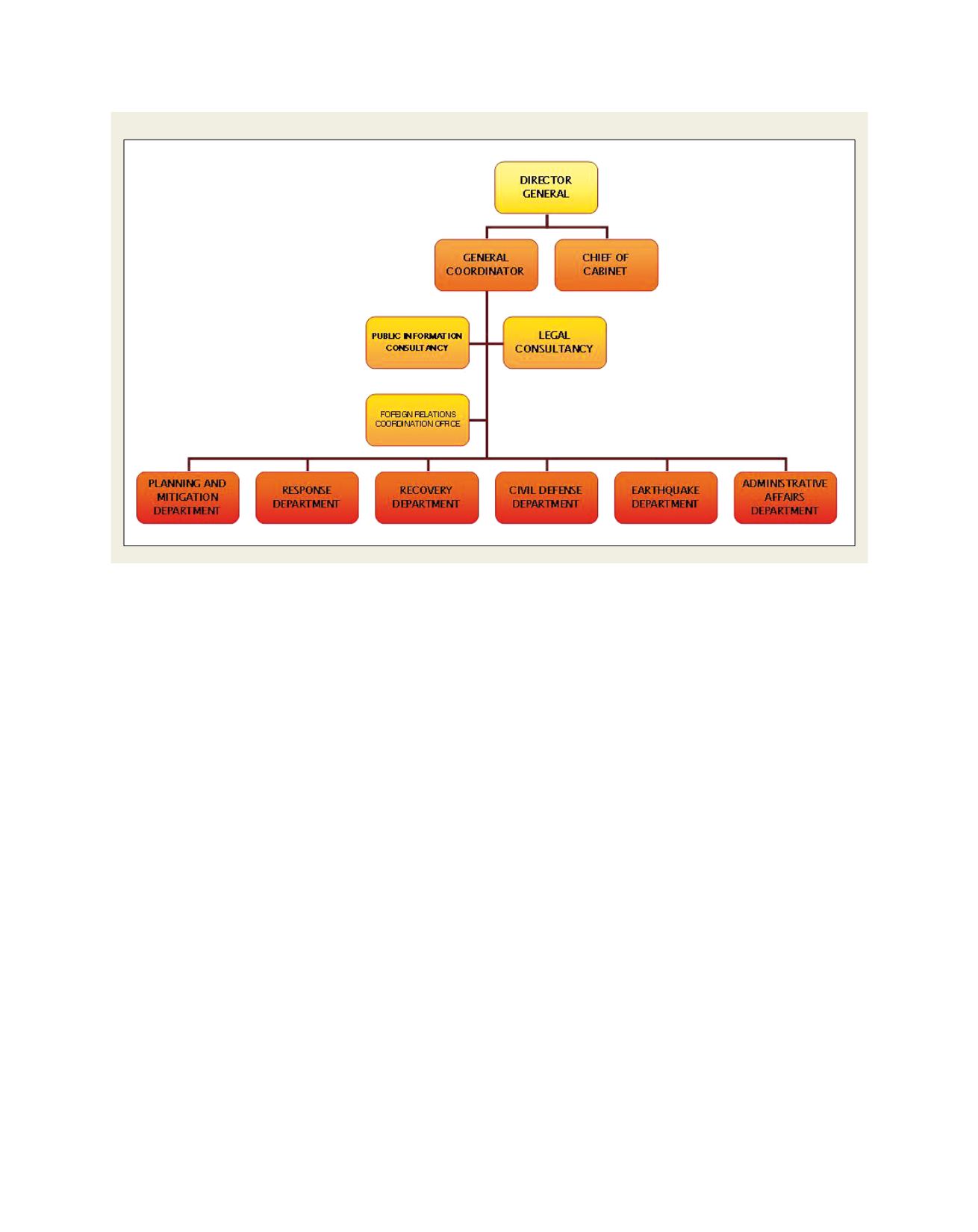
Figure 1: Organizational structure of Disaster and Emergency Management Presidency
Disaster and Emergency Management Presidency (AFAD)