


 50 / 168

[
] 50
Earthquake risk reduction in Indonesia
Krishna S. Pribadi and Wayan Sengara, Center for Disaster Mitigation, Institut Teknologi Bandung, Indonesia
I
ndonesia, an archipelago of more than 13,000 islands
spreading 5,000 kilometres from its western to its eastern
tips along the equator, is located where three global
tectonic plates (Indo-Australian, Eurasian and Pacific) meet.
Accordingly, high seismic and volcanic activity can be found
along the plates’ boundaries. Strong earthquakes are generated
along the subduction zones which are located in the sea trenches
west of Sumatra, south of Java, Bali and Nusa Tenggara islands,
as well as north of Sulawesi and Papua, exemplified by the
recent devastating earthquakes (Aceh Mw 9.2 in 2004, Nias Mw
8.6 in 2005, West Java Mw 7.0 and West Sumatra Mw 7.6, both
in 2009). Sumatra island is divided into two parts by the Great
Sumatra strike-slip fault, which consists of 19 segments. Other
inland faults can also be found on Java (which was responsible
for the killer Mw 6.3 Yogyakarta earthquake in 2006), Sulawesi
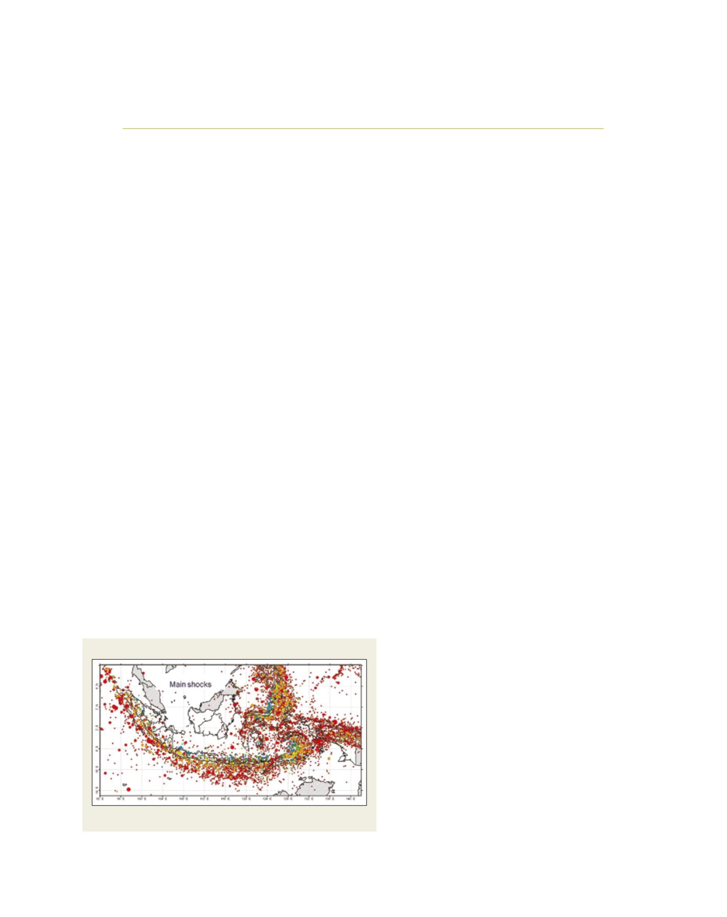
(the Palu-Koro fault) and Papua. Indonesian seismicity is well
represented in a map of main shocks (M>5.0), collected from
1900 to 2009 by the Indonesian Team for Revision of Indonesian
Seismic Hazard Maps.
1
Due to its high earthquake hazard potential and its physical and socio-
economical vulnerabilities, Indonesia is categorized among countries
with the highest risk from earthquake. In terms of mortality due to
earthquake, Indonesia shares with China and India the highest earth-
quake mortality index out of the top ten countries (8.5 on a scale of 1
to 10).
2
Earthquake risk in Indonesia is increased significantly by its
collateral hazards, in particular tsunamis and landslides. Data from
the OFDA/CRED International Disaster Database (EMDAT-CRED)
3
shows that almost 200,000 people were killed by earthquakes and
tsunamis from 1900-2011.
Earthquake damage to buildings in Indonesia
commonly results from problems with building quality,
regardless of the types of the buildings. Poor design
of buildings, caused by non-compliance to building
codes, often contributes to poor performance under
earthquake loading. Lack of detailing in the structural
drawing and building specifications leads to improvi-
sation by construction workers, resulting in structural
irregularities which may cause force concentrations and
disruptions in load transfer elements.
A 2005 study in Aceh shows that much building and
infrastructure damage was caused by strong seismic
motion causing soil liquefactions, lateral spreads, slope
failures, and settlements.
4
Soil erosion and foundation
failures which caused the damage to most single- and
two-storey buildings close to shorelines were due to high
tsunami wave force. Another study, on the reconnais-
sance survey and preliminary assessment of building
and infrastructure damage related to geotechnical earth-
quake engineering aspects, was conducted after the West
Java and West Sumatra earthquakes in 2006 and 2009.
5
Many instances of building and infrastructure damage in
both provinces were caused by relatively strong shaking
causing liquefactions and lateral spreads in some areas,
ground settlements and slope failures.
Traditionally, earthquake mitigation measures in
the form of local knowledge have been practised by
many indigenous people in the different islands in the
earthquake and tsunami-prone areas, such as the tradi-
tional construction of communal houses in areas of
West Sumatra,
6
the traditional architecture of the local
people in Nias island, the tsunami legends of the local
people in Simeulue island (which prompt them to move
to high ground when a strong earthquake occurs), and
the traditional rituals which serve to keep alive collec-
tive awareness of earthquake risk when the people of
Siberut island in West Sumatera build a new house.
7
However, the formal policy related to structural miti-
gation of earthquake risk began to appear only when the
Government of Indonesia established its first seismic
building code in 1970. In the years that followed, new
codes were developed and implemented.
Seismic monitoring system
Earthquake activities in Indonesia have been scientifi-
cally monitored since 1898 when the Dutch Colonial
administration installed a Ewing mechanical seismo-
graph for the first time. Since then, various types of
2037
Indonesian seismicity (main-shock)
Map showing that Indonesia is located in a highly seismic active zone
Source: Irsyam et al., 2010