


 168 / 196

[
] 166
e-Flood Map: flood damage
assessment in Thailand
Geo-Informatics and Space Technology Development Agency
L
ocated in the tropical zone, Thailand has suffered from
several tropical storms every year. During mid-2006, the
Pra Pirun and Chang San depressions caused damages
nationwide, with catastrophes in some large areas. It started
with heavy rainfall which caused massive landslides in Utaradit,
a province in northern Thailand, where hundreds of people were
killed, thousands were physically and psychologically impacted,
and their relatives and properties were lost. Subsequently,
massive water mass from the north overwhelmed agricultural
areas in the central part of Thailand. In order to protect the
Bangkok metropolitan, a massive amount of water was drained
into paddy fields in surrounding areas, which became inundated
for several months. Human beings, livestock and crops all
suffered from this deluge.
The Geo-Informatics and Space Technology Development Agency
(GISTDA) is a public organization that has played an active role in
implementing and supporting the use of geo-informatics technolo-
gies for disaster risk management, including flood. As the main
distributor of satellite imageries and a major GIS/RS application
agency of Thailand, GISTDA has proved the value of Earth observa-
tion data to the field of disaster management. Throughout the long
period of the 2006 flooding, GISTDA dedicated its resources to serve
the needs of local governmental officers for up-to-date data which
was crucial for their work. The flooded areas were interpreted from
various available satellite imageries using automatic classification
together with manual checking. Data was provided to end users daily
in the form of paper maps, digital satellite images, and GIS (vector)
data of flooded areas. This daily work lasted for over four months,
and since then, GISTDA has been the main responsible supporter of
ready-to-use Earth observation data for flood management.
Due to the extensive period of flooding and the burden on farmers
whose farms were inundated in order to protect the City of Bangkok,
it was necessary that the Government provide compensation for each
farmer and for suffering people. The calculation for compensation is
based on the number of days that each area was inundated. GISTDA’s
e-Flood Map project was then initiated to serve such a purpose, as
well as to monitor the flooded area. The developed solution requires
lots of work and intensive GIS analysis. The project’s results are not
limited to valuable information about the total amount of days each
administrative region and each land use type was affected by the flood;
the relevant data collected in the database can also be beneficial for
many other applications. e-Flood Map DVDs containing flood statis-
tics, study reports, summarized figures, satellite images, GIS data of
the flooded area and a software application that enables users to
examine the data were distributed to end users nation-
wide.
The e-Flood Map Project is considered a major and
resourceful flood risk management project using Earth
observation systems. Results from the project play a
crucial rule not only in the process of compensation,
but also in the process of rehabilitation at local level.
Furthermore, distributed data from the project is
useful for a vast number of user communities includ-
ing researchers, students, politicians, farmers and
bankers. It also offers an excellent opportunity for
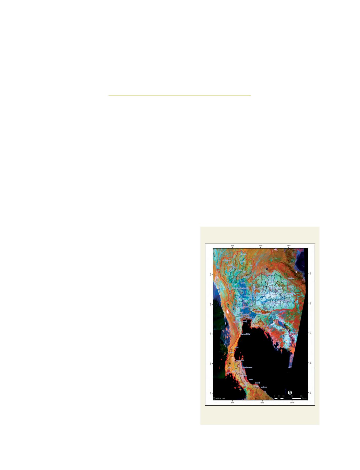
Mosaicked False Colour Composite Landsat Imagery
with Inundated Data of 2006 in Thailand
Data from the e-Flood Map project is distributed to a number of
end users
Source: GISTDA