


 124 / 287

[
] 125
O
bserving
, P
redicting
and
P
rojecting
C
limate
C
onditions
and Water Assessment Tool of the Grassland, Soil and Water
Research Laboratory in Temple, Texas, USA to estimate soil
moisture and stream flow. These would be related to SPI and
Normalised Difference Vegetation Index data, and implies that
rainfall indices will also be prime foci of the national monitors.
Projection of rainfall indices
CIMH currently produces a precipitation outlook for the Caribbean
from Guyana in the south, across the island chain to Belize in the
West. The information comes in the form of probabilities of normal,
above normal and below normal rainfall with a lead time of three
months. The forecasts will be used in combination with the monitor-
ing output to provide projections of precipitation index values with
the same lead times.
A number of model outputs are used to produce the final outlook
maps. Rainfall projections from the European Centre for Medium
Range Forecasting, the International Research Institute for Climate
Prediction and the United Kingdom Meteorological Office are
combined with some subjective climatological experience. The
intention is to produce at least two projections; one using the
combined final outlook, and at least one using a lone model output.
Model validation would be performed to determine the model that
best represents the region.
Outcomes and benefits expected from CDPMN
The network is expected to improve the management of water
resources, and aid in planning and adaptation to drought and heavy
precipitation, which are real and increasing threats. It will fulfil four
main functions:
• Monitor the status of rainfall via climatological, hydrological,
and other indicators
• Undertake projections with lead times of up to three months by
coupling seasonal forecasts with drought monitoring
• Post warnings on CIMH website and disseminate to key agencies,
governments and media in partner countries
• Enable the development of adaptation and response strate-
gies to drought and excessive rainfall by creating a network of
researchers working with stakeholders, including all levels of
government from the local to national.
Discussion so far has concentrated on the first three
functions. A key aspect of the fourth function is an
awareness of the impacts of the different severity classes
of indices and indicators. For example, how did the
peaks and troughs of the historical SPI for Edgecumbe,
Barbados, impact on vital sectors of the economy such
as agriculture and water resources? Research will pay
some attention to relating the indices and indicators
with impacts in the relevant sectors, and would be an
important activity at both the local/community and
national levels.
In addition to monitoring trends, implementing
early warning systems and networking, the CDPMN
will define knowledge gaps and uncover the need to
address extreme events and coping mechanisms. The
network will be valuable for decision makers to be able
to target their efforts on the most vulnerable regions
and communities.
Through the CDPMN, which is expected to be fully
operational by 2010, researchers and decision makers
will gain access to a community of professionals
working on drought and flooding/excess precipitation
issues. They will partake in workshops and training
sessions on impacts of extremes and how to adapt. They
will be invited to share experiences and be involved in
identifying and shaping the research priorities related to
water resources, climate and climate change.
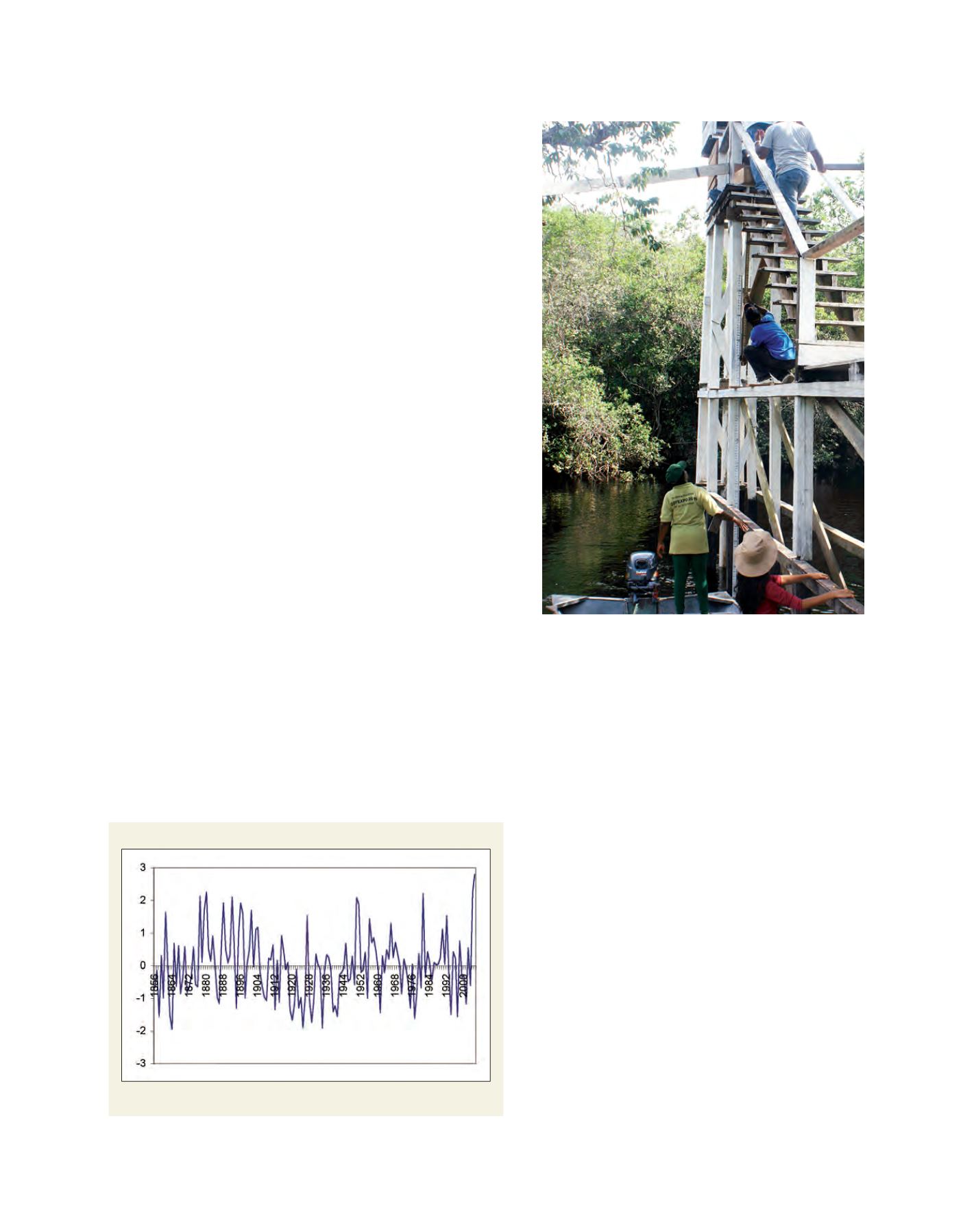
Edgecumbe SPI Jul-Dec (6 months)
Historical SPI values for Edgecumbe, St. Philip, Barbados from 1856
Source: CIMH
Measuring river levels in St. Cuthbert Mission, Guyana