


 135 / 287

[
] 136
O
bserving
, P
redicting
and
P
rojecting
C
limate
C
onditions
and archiving of the resulting data and information; contributing to the
implementation of global coastal and open-ocean observing networks
by sustaining and extending the global array of Argo ocean monitor-
ing buoys; and developing a globally coordinated information and
data system for monitoring the deep ocean and the dynamics of ocean
processes throughout the ocean water column.
The WMO is leading efforts to build a complete and stable Global
Observing System. The surface-based component is to include in
situ, airborne, land and possibly ocean measurements; high priority
will be given to ensuring a stable and, as far as possible, automated
World Weather Watch Upper Air Network and to further developing
the Aircraft Meteorological Data Relay programme. The space-based
module is to include operational geostationary and polar components.
Finally, WCRP and yet another GEOCommunity of Practice (address-
ing the cryosphere) are collaborating on ensuring that the Legacy of the
International Polar Year (IPY) 2007-08 enhances the use of Earth obser-
vations in all appropriate realms including, but not limited to, sea and
land ice, permafrost, coastal erosion, physical and chemical polar ocean
changes, marine and terrestrial ecosystem change, biodiversity monitor-
ing and impacts of increased resource exploitation andmarine transport.
The long-term goals are to ensure an appropriate legacy for IPY projects
and to advocate the continuation of relevant efforts beyond the duration
of the IPY.
A climate record for assessing variability and change
A fourth major effort is the GEO community’s work
on extending and improving the quality of past climate
records through advanced data reanalysis and recon-
struction of the atmosphere, ocean, land and sea ice
domains. The aim is to generate high-quality, temporally
homogeneous estimates of the past climate to support
current analyses of climate variability and change.
The activities under this effort include: reprocessing and
reanalysing climate data to ensure consistency in histori-
cal records; extending the record of climate variability at
the global scale in order to ensure a global coverage of
high-resolution, well-dated reconstructions of past climate
parameters in the ocean and on land; and securing key
climate data from satellite systems. These activities are led
by many of the GEOmember governments and participat-
ing organizations already mentioned.
A framework for collaboration
These four examples, all related to the field of climate,
are excellent illustrations of how governments and
organizations are working together through GEO on
a voluntary and best-efforts basis to construct GEOSS
for the benefit of scientists, managers, decision makers
and, ultimately, the global general public. By building on
existing programmes, initiating new investments to fill
gaps, and emphasizing synergies and partnerships, this
collective endeavour demonstrates the old adage about
how the whole can be greater than the sum of the parts.
To continually improve GEOSS, GEO is assessing
user needs, developing technical standards to make
data interoperable, improving information dissemina-
tion, and identifying gaps in current observing and
information systems. GEO consistently pursues new
opportunities for generating integrated data sets, infor-
mation products and analyses in near real-time, as well
as combining data from a wide variety of fields and
sources and presenting them in user-friendly formats.
It is no accident that the construction of GEOSS
has been initiated at this time. Until now, a critical
mass of instruments, technologies, databases, models
and decision-support services had not been realized.
Similarly, the sense that ‘we are all in this together’, and
that nations must collaborate on addressing our shared
global problems, has only emerged in recent years. Both
the supply side and the demand side of Earth observa-
tions have recently started to mature.
This non-binding and cooperative approach advocated by
GEOmay not be easy to understand at first, but it is the right
model for global collaboration in the 21st century. GEOgets
the incentive structure right by ensuring that contributors
to GEOSS continue to manage and receive credit for their
contributed components. At the same time, by collabo-
rating with others, these contributors leverage their own
investments in Earth observations through better access to
information, analyses and other collective resources. The
end result is a stronger capacity for effective economic and
societal decision making on an increasingly complex and
interconnected planet.
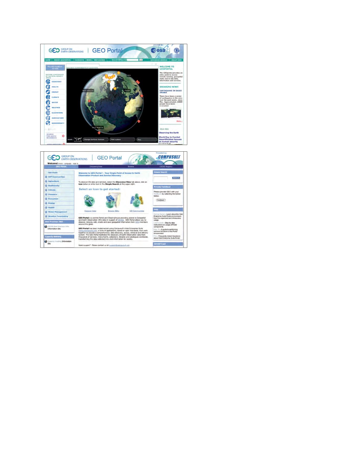
The GEOportal provides an entry point to access remote sensing, geospatial static
and in situ data, information and services
Source: www.geoportal.org
Source: www.geoportal.org