


 131 / 218

[
] 129
S
OLVING COMPLEX HUMAN
environment problems has
increasingly required that organizations employ interdis-
ciplinary strategies.
1
Organizations that have been able
to successfully integrate data and ideas from both the social
sciences and the physical sciences are of particular interest to
remote sensing data producers seeking to demonstrate the soci-
etal benefit of their work. The US Agency for International
Development’s (USAID) Famine Early Warning System
Network (FEWS NET) uses biophysical datasets to inform the
political process of humanitarian aid and response to food secu-
rity crises in the developing world.
Interdisciplinary organizations such as FEWS NET face many
challenges, among them a large and continually changing body
of stakeholders; working with and understanding diverse
concepts; finding a common language to communicate ideas
and strategies; trusting research that many teammembers haven’t
the skills to assess, and having strong leadership to ensure
mission success and ultimately continued funding. How these
challenges are met will have a significant impact on the organi-
zation’s ability to continue to secure funding and to be successful
in achieving its mission.
As a long-standing USAID-funded project, FEWS NET
provides an example of the processes and methodologies
required for a large interdisciplinary decision support system.
FEWS NET has recently been reauthorized until 2009, and since
its inception in the mid-1980s, has used state-of-the-art social
science methodologies for food security monitoring, coupled
with advanced models, satellite measurements and geographic
information system (GIS) technology for monitoring threats to
food production and biophysical hazards. FEWS NET provides
decision support to a wide range of decision makers, from heads
of international organizations to local and national decision
makers who require specific, integrative analysis for small
geographical areas. By focusing on the food security impact of
biophysical variations, FEWS NET is able to connect images of
remote sensing to their impact on the lives and livelihoods of
local residents.
Satellite remote sensing data from NASA are used in many
aspects of FEWS NET’s work. By providing spatially complete,
accurate, and timely data, NASA contributes significantly to the
ability of the humanitarian field to provide appropriate decision
support to a wide variety of decision makers. In a complex deci-
sion-making environment, remote sensing information provides
a robust foundation upon which consensus regarding the needs
and hazards facing a particular community can be built.
Although FEWS NET has a broad range of other information
sources, remote sensing information remains a critical input to
their analysis.
USAID’s Famine Early Warning System Network
The goal of FEWS NET is “to provide decision makers with
accurate, timely and actionable information to prevent hunger-
related deaths, mitigate food insecurity, and strengthen
livelihoods in Africa, Central America and the Caribbean, and
Afghanistan through providing early warning information related
to food security threats, developing information networks, and
building capacity for information generation and dissemina-
tion”.
2
FEWS NET involves an intergovernmental agreement
between USAID, the National Aeronautics and Space
Administration (NASA), the National Oceanic and Atmospheric
Administration (NOAA), the US Department of Agriculture
(USDA) and the US Geological Survey (USGS).
Although FEWS NET activities conducted in the participat-
ing organizations are important to its ability to provide data
Satellite remote sensing for early
warning of food security crises
Molly E. Brown, NASA Goddard Space Flight Center
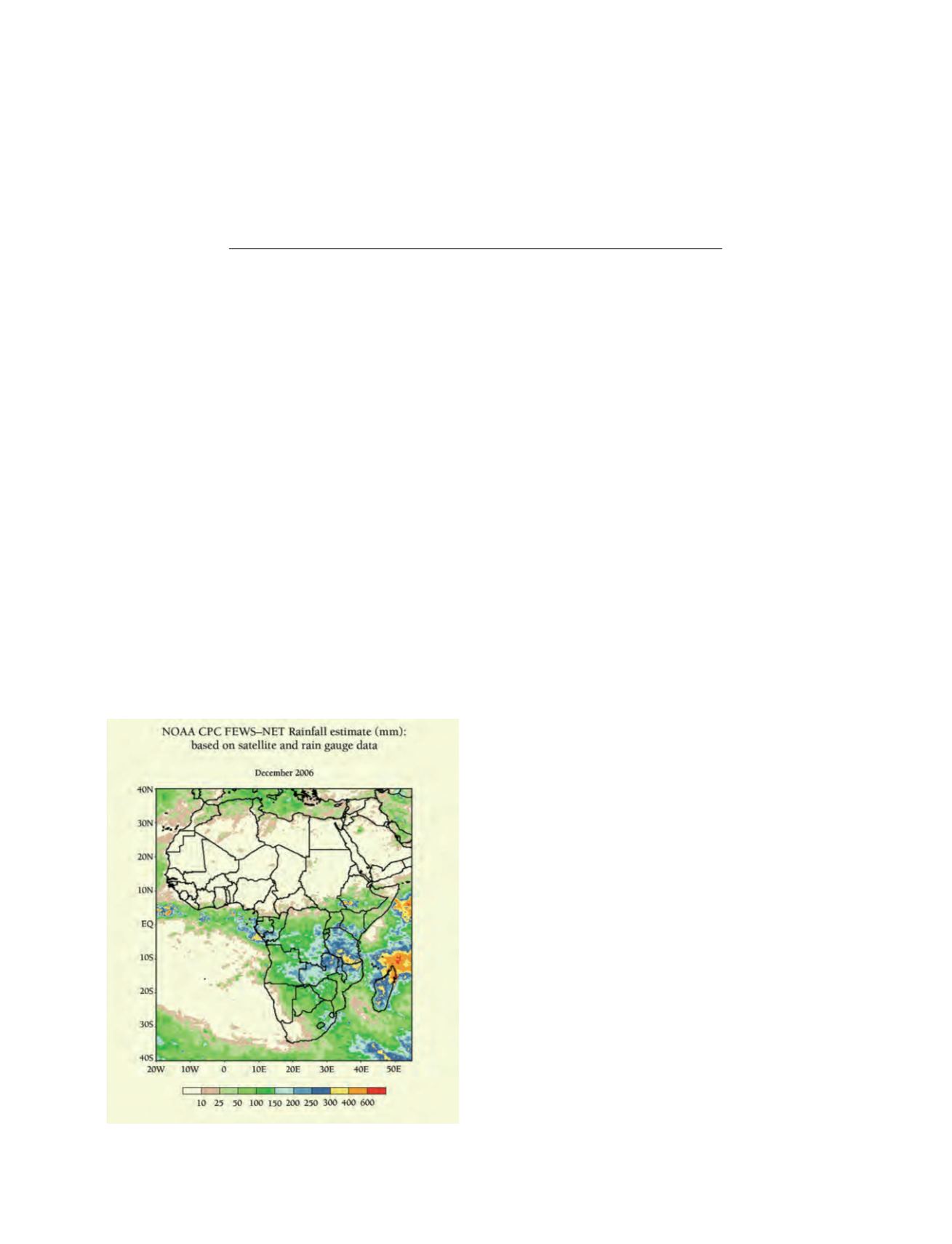
Rainfall data from the National Oceanic and Atmospheric
Administration’s Climate Prediction Center’s rainfall estimate
in mm during the month of December, 2006
Source: NASA