


 24 / 218

[
] 24
M
ANKIND CANNOT CONTROL
the weather, but with
accurate and timely information, the effects of severe
weather and natural disasters can be mitigated. Global
warming, climate change and increasingly destructive weather
events over recent years have alerted governments, scientists
and other communities to the importance of finding efficient
and cost-effective resources to help prepare for and mitigate
the effects of such events on a global scale.
Satellites have been collecting atmospheric observations for
decades, and have made a significant contribution to weather fore-
casting and the long-term monitoring of the planet’s well being.
The European Organisation for the Exploitation of
Meteorological Satellites (EUMETSAT) works to provide data,
products and services to help detect potentially dangerous
weather patterns and provide input for computer models to
produce forecasts. Even if a disaster has already struck, these
information services can support rescue missions as well as
planning for the prevention or mitigation of similar events in
the future.
EUMETSAT is a European organization with a global commit-
ment – it serves 30 states – and its data, services and products
can be received in almost every country on Earth – 24 hours a
day, every day of the year. The organisation also is a major contrib-
utor to global programmes such as the World Meteorological
Organization’s (WMO) Global Observing System (GOS).
A space-eye view of the Earth
EUMETSAT currently operates six satellites:
• Two second generation Meteosat satellites providing the
operational service from geostationary orbit
• Three first-generation geostationary satellites: Meteosat-6
and -7, which provide the Indian Ocean Service, and
Meteosat-5 which is due to be de-orbited in spring 2007.
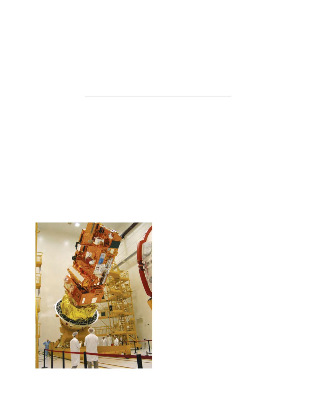
• Metop, launched in October 2006 and soon to provide the
operational service from polar orbit.
Technological advances and the increasing sophistication of
weather forecasting requirements created a demand for more
frequent, more accurate and higher resolution observations from
space. To meet this demand, EUMETSAT in 2002 launched the
first of a new series of even more advanced weather satellites
known as Meteosat Second Generation (MSG), developed in
collaboration with the European Space Agency (ESA) and the
European space industry. The second satellite in the series was
launched in December 2005 and since July 2006 the vital opera-
tional service from geostationary orbit is provided by two second
generation Meteosats – Meteosat-8 and Meteosat-9. Second
Generation Meteosats herald a new era in weather and climate
monitoring. With the most advanced imager of all satellites
currently in orbit they continuously scan Europe, Africa and parts
of the Indian and Atlantic Oceans with visibly improved image
quality at 15 minute intervals. The frequent delivery of data is
especially important in situations of severe weather. Very short
term forecasting, called Nowcasting, makes use of the rapid
sequence of high-resolution satellite imagery provided by the new
MSG satellites and helps to for example monitor the development
of dangerous storms. But even in more ‘normal’ conditions the
information on weather, climate and the environment gathered
Monitoring weather, climate and
the environment – EUMETSAT’s
operational satellite service
The European Organisation for the Exploitation of Meteorological Satellites
The Metop satellite being encapsulated in the fairing of the launch
vehicle before take-off
Photo: Copyright EUMETSAT